Recent searches
Loading...
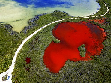
1350-6623 - Aerial view of Punta Allen Sian Ka'an Reserve, Yucatan Peninsula, Mexico. Red lagoon near Boca Paila Bridge.
In the language of the Mayan peoples who once inhabited this region, Sian Ka'an means Origin of the Sky. Located on the east coast of the Yucatán peninsula, this biosphere reserve contains tropical forests, mangroves and marshes, as well as a large marine section intersected by a barrier reef. It provides a habitat for a remarkably rich flora and a fauna comprising more than 300 species of birds, as well as a large number of the region's characteristic terrestrial vertebrates, which cohabit in the diverse environment formed by its complex hydrological system.
Along its roughly 120 kilometres of coastline, the property covers over 400,000 hectares of land ranging from sea level to only ten m.a.s.l. The property boasts diverse tropical forests, palm savannah, one of the most pristine wetlands in the region, lagoons, extensive mangrove stands, as well as sandy beaches and dunes. The 120,000 hectares of marine area protect a valuable part of the Mesoamerican Barrier Reef and seagrass beds in the shallow bays. The lush green of the forests and the many shades of blue of the lagoons and the Caribbean Sea under a wide sky offer fascinating visual impressions.
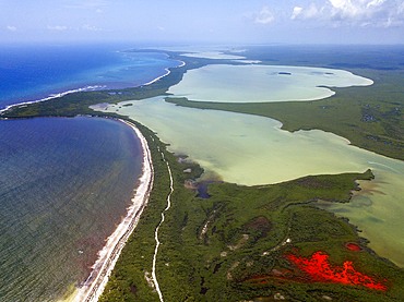
1350-6625 - Aerial view of Punta Allen Sian Ka'an Reserve, Yucatan Peninsula, Mexico. Red lagoon near Boca Paila Bridge.
In the language of the Mayan peoples who once inhabited this region, Sian Ka'an means Origin of the Sky. Located on the east coast of the Yucatán peninsula, this biosphere reserve contains tropical forests, mangroves and marshes, as well as a large marine section intersected by a barrier reef. It provides a habitat for a remarkably rich flora and a fauna comprising more than 300 species of birds, as well as a large number of the region's characteristic terrestrial vertebrates, which cohabit in the diverse environment formed by its complex hydrological system.
Along its roughly 120 kilometres of coastline, the property covers over 400,000 hectares of land ranging from sea level to only ten m.a.s.l. The property boasts diverse tropical forests, palm savannah, one of the most pristine wetlands in the region, lagoons, extensive mangrove stands, as well as sandy beaches and dunes. The 120,000 hectares of marine area protect a valuable part of the Mesoamerican Barrier Reef and seagrass beds in the shallow bays. The lush green of the forests and the many shades of blue of the lagoons and the Caribbean Sea under a wide sky offer fascinating visual impressions.
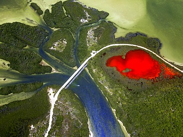
1350-6620 - Aerial view of Punta Allen Sian Ka'an Reserve, Yucatan Peninsula, Mexico. Red lagoon near Boca Paila Bridge.
In the language of the Mayan peoples who once inhabited this region, Sian Ka'an means Origin of the Sky. Located on the east coast of the Yucatán peninsula, this biosphere reserve contains tropical forests, mangroves and marshes, as well as a large marine section intersected by a barrier reef. It provides a habitat for a remarkably rich flora and a fauna comprising more than 300 species of birds, as well as a large number of the region's characteristic terrestrial vertebrates, which cohabit in the diverse environment formed by its complex hydrological system.
Along its roughly 120 kilometres of coastline, the property covers over 400,000 hectares of land ranging from sea level to only ten m.a.s.l. The property boasts diverse tropical forests, palm savannah, one of the most pristine wetlands in the region, lagoons, extensive mangrove stands, as well as sandy beaches and dunes. The 120,000 hectares of marine area protect a valuable part of the Mesoamerican Barrier Reef and seagrass beds in the shallow bays. The lush green of the forests and the many shades of blue of the lagoons and the Caribbean Sea under a wide sky offer fascinating visual impressions.
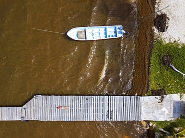
1350-6616 - Aerial view of Punta Allen Sian Ka'an Reserve, Yucatan Peninsula, Mexico.
In the language of the Mayan peoples who once inhabited this region, Sian Ka'an means Origin of the Sky. Located on the east coast of the Yucatán peninsula, this biosphere reserve contains tropical forests, mangroves and marshes, as well as a large marine section intersected by a barrier reef. It provides a habitat for a remarkably rich flora and a fauna comprising more than 300 species of birds, as well as a large number of the region's characteristic terrestrial vertebrates, which cohabit in the diverse environment formed by its complex hydrological system.
Along its roughly 120 kilometres of coastline, the property covers over 400,000 hectares of land ranging from sea level to only ten m.a.s.l. The property boasts diverse tropical forests, palm savannah, one of the most pristine wetlands in the region, lagoons, extensive mangrove stands, as well as sandy beaches and dunes. The 120,000 hectares of marine area protect a valuable part of the Mesoamerican Barrier Reef and seagrass beds in the shallow bays. The lush green of the forests and the many shades of blue of the lagoons and the Caribbean Sea under a wide sky offer fascinating visual impressions.
1350-6602 - Aerial view of Grand Palladium White Sand Resort and Spa in Riviera Maya, Yucatan Peninsula, Quintana Roo, Caribbean Coast, Mexico
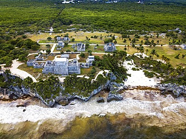
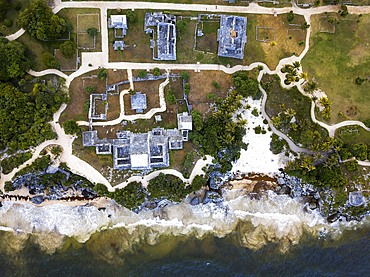
1350-6597 - Aerial views of El Castillo and the Ruins of the Mayan temple grounds at Tulum, Quintana Roo, Yucatan, Mexico. Tulum is the site of a pre-Columbian Mayan walled city which served as a major port for Coba, in the Mexican state of Quintana Roo. The ruins are situated on 12 meter 39 ft tall cliffs along the east coast of the Yucatán Peninsula on the Caribbean Sea in the state of Quintana Roo, Mexico. Tulum was one of the last cities built and inhabited by the Maya; it was at its height between the 13th and 15th centuries and managed to survive about 70 years after the Spanish began occupying Mexico. Old World diseases brought by the Spanish settlers appear to have resulted in very high fatalities, disrupting the society, and eventually causing the city to be abandoned.
1350-6599 - Aerial views of El Castillo and the Ruins of the Mayan temple grounds at Tulum, Quintana Roo, Yucatan, Mexico. Tulum is the site of a pre-Columbian Mayan walled city which served as a major port for Coba, in the Mexican state of Quintana Roo. The ruins are situated on 12 meter 39 ft tall cliffs along the east coast of the Yucatán Peninsula on the Caribbean Sea in the state of Quintana Roo, Mexico. Tulum was one of the last cities built and inhabited by the Maya; it was at its height between the 13th and 15th centuries and managed to survive about 70 years after the Spanish began occupying Mexico. Old World diseases brought by the Spanish settlers appear to have resulted in very high fatalities, disrupting the society, and eventually causing the city to be abandoned.
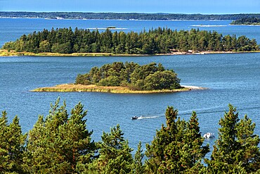
1350-6604 - Aerial view of the islands in front Mossala Island Resort Southwest Finland archipelago. The archipelago ring road or Saariston rengastie is full of things to see, do and do. The Archipelago Trail can be taken clockwise or counter clockwise, starting in the historical city of Turku, and continuing through rural archipelago villages and astonishing Baltic Sea sceneries. The Trail can be taken from the beginning of June until the end of August.
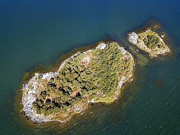
1350-6605 - Aerial view of small island in front Mossala Island Resort Southwest Finland archipielago. The archipelago ring road or Saariston rengastie is full of things to see, do and do. The Archipelago Trail can be taken clockwise or counter clockwise, starting in the historical city of Turku, and continuing through rural archipelago villages and astonishing Baltic Sea sceneries. The Trail can be taken from the beginning of June until the end of August.
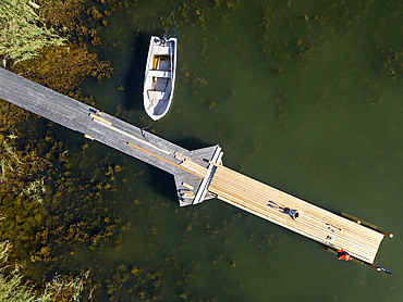
1350-6600 - Aerial view of small dock in Korpo or Korppoo island, Korpostrom coast Southwest Finland Turku archipelago. The archipelago ring road or Saariston rengastie is full of things to see, do and do. The Archipelago Trail can be taken clockwise or counter clockwise, starting in the historical city of Turku, and continuing through rural archipelago villages and astonishing Baltic Sea sceneries. The Trail can be taken from the beginning of June until the end of August.
1350-6594 - Aerial view of Kustavi small islands in Southwest Finland archipielago. The archipelago ring road or Saariston rengastie is full of things to see, do and do. The Archipelago Trail can be taken clockwise or counter clockwise, starting in the historical city of Turku, and continuing through rural archipelago villages and astonishing Baltic Sea sceneries. The Trail can be taken from the beginning of June until the end of August.
1350-6677 - Montserrat is a mountain near Barcelona, in Catalonia. It is the site of a Benedictine abbey, Santa Maria de Montserrat, which hosts the Virgin of Montserrat sanctuary.
Montserrat is a multi-peaked mountain range near Barcelona, in Catalonia, Spain. It is part of the Catalan Pre-Coastal Range. The main peaks are Sant Jeroni (1,236 m), Montgrós (1,120 m) and Miranda de les Agulles (903 m). It is well known as the site of the Benedictine abbey, Santa Maria de Montserrat, which hosts the Virgin of Montserrat sanctuary. Montserrat literally means "saw (serrated, like the common handsaw) mountain" in Catalan. It describes its peculiar aspect with multitude of rock formations which are visible from a great distance. The mountain is composed of strikingly pink conglomerate, a form of sedimentary rock. Montserrat was designated as a National Park in 1987. On this mountain we will have access to the Monastery of Montserrat which houses the virgin that gives its name to the monastery, although it is also known as La Moreneta
1350-6459 - Aerial view of marshes, the Tancada lagoon, rice fields, Eucaliptos beach and lᄡAlfaca beach; Sant Carles de la Rapita, Ebro Delta, Natural Park, Tarragona, Spain
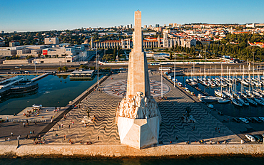
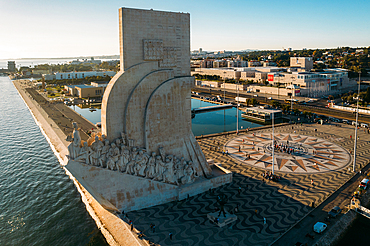
1243-388 - Aerial drone view of Padrao dos Descobrimentos (Monument of the Discoveries), a monument on the northern bank of the Tagus River estuary, Belem, Lisbon, Portugal, Europe
1243-390 - Aerial drone view of Padrao dos Descobrimentos (Monument of the Discoveries), a monument on the northern bank of the Tagus River estuary, Belem, Lisbon, Portugal, Europe
1243-389 - Aerial drone view of Belem Tower, UNESCO World Heritage Site, a 16th century fortification on the Tagus River, Belem, Lisbon, Portugal, Europe
1243-387 - Aerial drone view of Belem Tower, UNESCO World Heritage Site, a 16th century fortification on the Tagus River, Belem, Lisbon, Portugal, Europe
1243-384 - Aerial drone panoramic view of Cascais, Portuguese coastline, Portugal, Europe
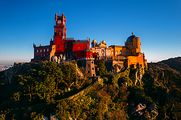
1243-386 - Aerial drone view of Pena Palace, UNESCO World Heritage Site, a romanticist castle in the Sintra mountains, Portugal, Europe
1351-208 - A drone view of Ozurgeti and the mountains of Guria, Georgia (Sakartvelo), Central Asia, Asia
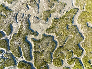
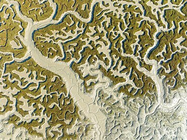
832-398233 - Network of dry channels and streams at low tide, in the marshland of the Bahia de Cadiz, aerial view, drone shot, Cadiz province, Andalusia, Spain, Europe
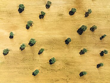
832-398229 - Holm Oak (Quercus ilex) in a field, aerial view, drone shot, Almeria province, Andalusia, Spain, Europe
832-398236 - Network of dry channels and streams at low tide, in the marshland of the Bahia de Cadiz, aerial view, drone shot, Cadiz province, Andalusia, Spain, Europe
832-398232 - Network of channels and streams at low tide, in the marshland of the Bahia de Cadiz, aerial view, drone shot, Cadiz province, Andalusia, Spain, Europe
832-398228 - Holm Oaks (Quercus ilex) in a field, aerial view, drone shot, Granada province, Andalusia, Spain, Europe
832-398237 - Network of channels and streams at low tide, in the marshland of the Bahia de Cadiz, aerial view, drone shot, Cadiz province, Andalusia, Spain, Europe
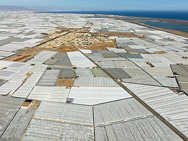
832-398226 - The town of San Agustin amidst masses of shimmering plastic greenhouses, on the right the shallow lagoon Salinas de Cerrillos, aerial view, drone shot, Almeria province, Andalusia, Spain, Europe
832-398234 - Network of dry channels and streams at low tide, in the marshland of the Bahia de Cadiz, aerial view, drone shot, Cadiz province, Andalusia, Spain, Europe
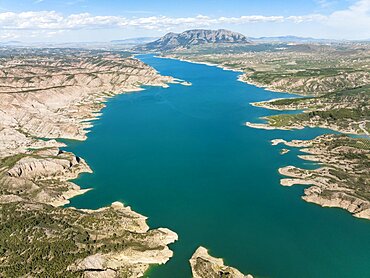
832-398227 - The Negratin reservoir, aerial view, drone shot, Granada province, Andalusia, Spain, Europe
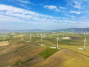
832-398231 - Windmills on a wind farm near Zahara de los Atunes, aerial view, drone shot, Cadiz province, Andalusia, Spain, Europe
832-398235 - Network of dry channels and streams at low tide, in the marshland of the Bahia de Cadiz, aerial view, drone shot, Cadiz province, Andalusia, Spain, Europe
832-398113 - Sunset over Cala Anguila-Cala Mendia from a drone, Porto Cristo, Majorca, Spain, Europe
832-398230 - Windmills on a wind farm near Zahara de los Atunes, aerial view, drone shot, Cadiz province, Andalusia, Spain, Europe
832-397820 - Drone shot, afternoon light, stairs, building, cistern, Minoan Palace of Festos, Messara Plain, Central Crete, Crete Island, Greece, Europe
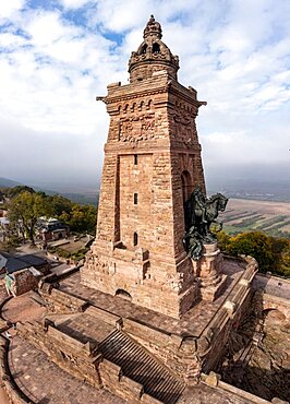
832-397622 - Drone photo, drone shot, Kyffhaeuser with Kaiser Wilhelm monument, Barbarossaden monument, close-up, Kyffhaeuserland, Thuringia, Germany, Europe
832-397571 - Isle of Portland from a drone, Weymouth, Dorset, England, United Kingdom, Europe
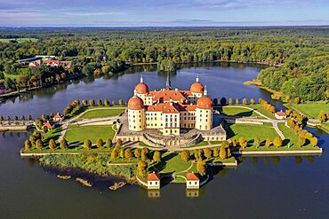
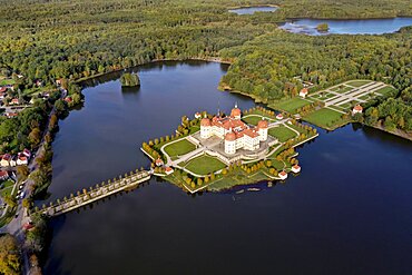
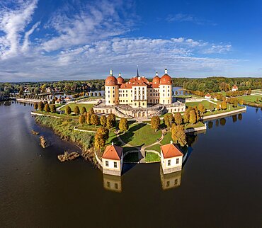
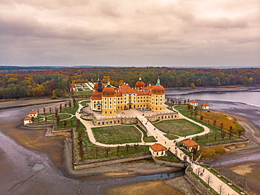
832-397629 - Drone shot, drone photo, access road over the castle pond to the hunting lodge, Baroque Moritzburg Castle with view of the woods and the garden, autumn, Saxony, Germany, Europe
832-397623 - Drone photo, drone shot, panorama, Kyffhaeuser with Kaiser Wilhelm monument, Barbarossaden monument, fog, clouds, wide angle, Kyffhaeuserland, Thuringia, Germany, Europe
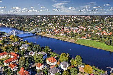
832-397624 - Drone photo, drone shot, Elbe, bridge, Blue Wonder, Elbe Florence, view of Loschwitz, sunshine, blue sky, suspension railway, Elbe castles, Elbe meadows, Elbe cycle path, Blasewitz, Dresden, Saxony, Germany, Europe
832-397398 - Drone shot, sepia colours, sailboat from above at the lake in backlight with water reflection, Mondsee, Salzkammergut, Upper Austria, Austria, Europe
832-397399 - SW shot, canoeist at the Irrsee between fog, ground fog, from above, drone shot, aerial view, Zell am moss, Salzkammergut, Upper Austria, Austria, Europe
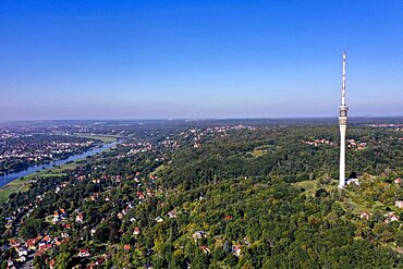
832-397626 - Drone photo, drone shot, Loschwitz district, wide view of the Elbe, blue sky, close-up of the TV tower, Dresden, Saxony, Germany, Europe
832-397627 - Drone shot, drone photo, access road over the castle pond to the hunting lodge, Baroque Moritzburg Castle with view of the woods and the garden, Saxony, Germany, Europe
832-397628 - Wide angle, drone shot, drone photo, access road over the castle pond to the hunting lodge, baroque Moritzburg Castle with view of the woods and the garden, Saxony, Germany, Europe
832-397625 - Drone photo, drone shot, Elbe, bridge, Blue Wonder, Elbe Florence, view of Loschwitz, sunshine, blue sky, Elbe castles, Elbe meadows, Elbe cycle path, Blasewitz, Dresden, Saxony, Germany, Europe
832-397314 - Drone shot, sunshades at White Beach, Sibenik, Sibenik-Knin, Dalmatia, Croatia, Europe
832-397312 - Drone shot, Podvrske peninsula, Murter island, Dalmatia, Croatia, Europe
832-397313 - Drone shot, coast along marina Amadria Yacht Marines and Camping Solaris, Sibenik, Sibenik-Knin, Dalmatia, Croatia, Europe
832-397311 - Drone shot, Podvrske peninsula, Murter town and islands, Murter island, Dalmatia, Croatia, Europe
832-397310 - Drone shot, Podvrske peninsula, Murter island, Dalmatia, Croatia, Europe
1278-304 - Drone above small island with house, green vegetation and rocky coastline in the Mediterranean at Chalkidiki peninsula, Greece, Europe
1278-305 - Drone view of small boat sailing in calm blue waters, Greece, Europe
832-397206 - Drone shot, harbour and Baska, island of Krk, Kvarner Gulf Bay, Primorje-Gorski kotar, Croatia, Europe
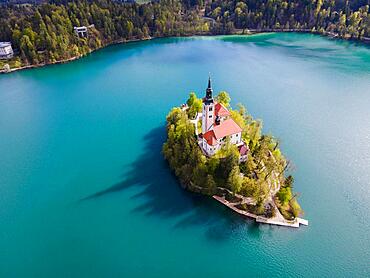
832-397162 - Drone shot, Bled Island with St. Mary's Church, Lake Bled, Lake Veldes, Blejsko jezero, Bled, Veldes, Feldes, Upper Carniola Region, Gorenjska, Slovenia, Balkans, Europe
832-397232 - Drone shot, ships in Kosirina Bay, Murter, Murter Island, Dalmatia, Croatia, Europe
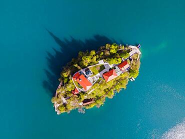
832-397163 - Drone shot, Bled Island with St. Mary's Church, Lake Bled, Lake Veldes, Blejsko jezero, Bled, Veldes, Feldes, Upper Carniola Region, Gorenjska, Slovenia, Balkans, Europe
832-397213 - Drone shot, coast near Glavotok, Krk Island, Kvarner Gulf Bay, Primorje-Gorski kotar, Croatia, Europe
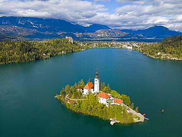
832-397160 - Drone shot, Bled Island with St. Mary's Church, Lake Bled, Lake Veldes, Blejsko jezero, Bled, Veldes, Feldes, Upper Carniola Region, Gorenjska, Slovenia, Balkans, Europe
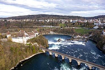
832-396930 - Drone shot, drone photo of Rhine waterfall, view of Laufen am Rheinfall castle with railway bridge, Neuhausen am Rheinfall, Canton Schaffhausen, Switzerland, Europe
832-396932 - Drone photo, drone shot, close-up, monumental building Herkules, with central view of the statue, winter, snowy, fog, Bergpark Bad Wilhelmshoehe, Kassel, Hesse, Germany, Europe
832-396929 - Drone photo, drone shot of All Saints Monastery with car park and ruins in winter, snow, serpentine, Oppenau, Black Forest, Baden-Wuerttemberg, Germany, Europe
832-396931 - Drone photo, drone shot, close-up, monumental building Herkules, with central view of the statue, winter, snowy, fog, Bergpark Bad Wilhelmshoehe, Kassel, Hesse, Germany, Europe
1278-300 - Thessaloniki, Greece day drone view of view of Rotunda Roman circular temple, part of UNESCO World Heritage Sights.
1278-298 - Mediterranean terrain Greek beach landscape drone shot with bathers at Georgioupoli Crete island with sea beds and umbrellas.
1278-299 - Aerial drone view of Spinalonga, deserted leper colony with fortifications, currently a tourist attraction, in Crete island.
1278-303 - Thessaloniki, Greece aerial drone view of White Tower landmark with residential buildings at Leoforos Nikis calm seafront.
1278-302 - Thessaloniki, Greece drone view of Heptapyrgion Byzantine fortress with towers and bastions.
1278-297 - Mediterranean Greek landscape beach drone shot above Sithonia Chalkidiki peninsula, with small islands and clear waters.
1278-301 - Thessaloniki, Greece drone view of Heptapyrgion Byzantine fortress with towers and bastions.
832-396575 - DJI Drone Mavic 2 Pro with Hasselblad camera flying against blue sky, Copy space, Graz, Austria, Europe
832-396569 - Drone shot, drone photo of the chapel Saint Michel de Pruniers in the lake Lac de Serre Poncon with view of the surrounding mountains, Departement Hautes-Alpes, France, Europe
832-396570 - Drone shot, drone photo of the chapel Saint Michel de Pruniers in the lake Lac de Serre Poncon with view of the surrounding mountains, Departement Hautes-Alpes, France, Europe
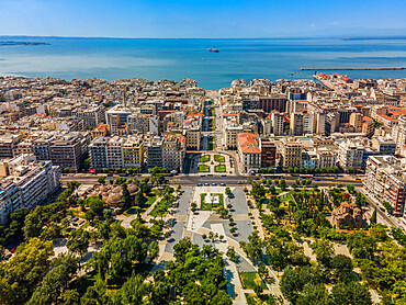
1278-294 - Drone aerial view with Northern part of Aristotelous main square at the city center visible, Thessaloniki, Greece, Europe
832-396527 - Aerial view, drone photo of Moritzburg Castle in the municipality of Moritzburg near Dresden, Saxony, Germany, Europe
832-396350 - Drone shot, white round lighthouse on tiny rocky island, sea clear, sea blue and turquoise. Andros Town, Chora, Andros Island, Cyclades, Greece, Europe
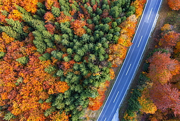
832-396366 - Drone image, autumnal forest along the main road in Weissenbachtal, Salzkammergut, Upper Austria, Austria, Europe
1278-270 - Drone view of Navarinou square with Roman ruins of the Palace of Galerius, Thessaloniki, Greece, Europe
1278-269 - Drone view of Trigonion Chain defensive Tower and fortifications at upper town of Ano Poli in Thessaloniki, Greece, Europe
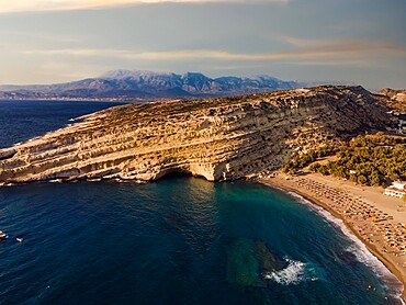
1278-262 - Drone view of Matala artificial caves on the rock by the beach at Crete, Greek Islands, Greece, Europe
1278-267 - Drone view of Spinalonga, former leper colony fortress, Crete, Greek Islands, Greece, Europe
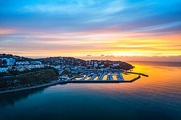
832-395821 - View over Torquay and Torquay Marina from a drone in sunrise time, Torbay, Devon, England, United Kingdom, Europe
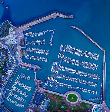
832-395822 - Top Down view over Torquay Marina and Harbour from a drone, Devon, England, United Kingdom, Europe
1346-43 - City drone aerial view at sunset with iconic Palace, Mafra, Portugal, Europe
1346-44 - Ericeira drone aerial view on the coast of Portugal with surfers on the sea at sunset, Lisbon area, Portugal, Europe
1346-41 - City drone aerial view at sunset with iconic Palace, Mafra, Portugal, Europe
1346-42 - City drone aerial view at sunset with iconic Palace, Mafra, Portugal, Europe
1350-5535 - Salt marshes in a coastal aerial view. Oriᅢᄆon, Castro Urdiales, Cantabria.
1350-5534 - Sandy sediments in low tide in a river close to the sea. Isla, Cantabria, Spain, Europe.
1350-5530 - Coastal landscape. La Ballena. Sonabia (Castro Urdiales) Cantabria, Spain, Europe.
1350-5533 - Sandy sediments in low tide in a river close to the sea. Isla, Cantabria, Spain, Europe.
1350-5531 - Coastal landscape. Sonabia (Castro Urdiales) Cantabria, Spain, Europe.
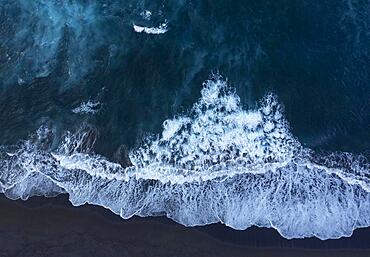
832-395395 - Drone shot, surf on the beach of Praia de Santa Barbara, Ribeira Grande, Sao Miguel Island, Azores, Portugal, Europe
832-395393 - Drone shot, surf on the beach of Praia de Santa Barbara, Ribeira Grande, Sao Miguel Island, Azores, Portugal, Europe
832-395377 - Drone shot, viewing terrace with surface texture of black and white cobblestones on Atlantic beach, Ribeira Grande, Sao Miguel Island, Azores, Portugal, Europe
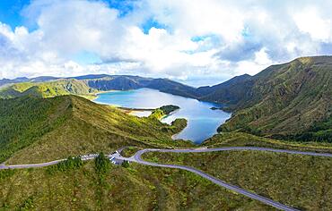
832-395443 - Drone shot, mountain road to the summit of Pico da Barrosa and view to the crater lake Lagoa do Fogo, Sao Miguel Island, Azores, Portugal, Europe
832-395441 - Drone shot, view from the Miradouro do Pico da Barrosa lookout to the crater lake Lagoa do Fogo, Sao Miguel Island, Azores, Portugal, Europe
832-395398 - Drone shot, sunset at the rocky island Ilheus dos Mosteiros, Mosteiros, Sao Miguel Island, Azores, Portugal, Europe
832-395403 - Drone shot, surf with big round stones on the beach of Rocha da Relva, Sao Miguel Island, Azores, Portugal, Europe
832-395396 - Drone shot, surf on the beach of Praia dos Mosteiros, Mosteiros, Sao Miguel Island, Azores, Portugal, Europe
832-395379 - Drone shot, Atlantic coast near Ribeira Grande, Sao Miguel Island, Azores, Portugal, Europe
