Recent searches
Loading...
1178-41580 - Mixed Race woman using touch screen navigation map in car
1178-37260 - Hispanic woman driving car and pressing touch screen
1178-36995 - Caucasian man driving car while using cell phone
1178-32880 - Mixed race woman taking cell phone photograph of roadmap
741-5946 - A GPS-collared lioness (Panthera leo), Ndutu, Ngorongoro Conservation Area, Serengeti, Tanzania, East Africa, Africa
746-88859 - Boat and Sella del Diavolo, Cagliari, Sardinia, Italy, Europe
746-88838 - Monte Corrasi, Oliena, coin-operated spotting scope, view from Monte Ortobene, Sardinia, Italy, Europe
746-88837 - Landscape, Monte Corrasi and Cedrino Valley, view from Monte Ortobene, Sardinia, Italy, Europe
746-88839 - Monte Corrasi, Oliena, view from Monte Ortobene, Sardinia, Italy, Europe
1116-39540 - Tractor tedding hay, Sudlersville, Maryland, United States of America
1116-39542 - Tractor tedding hay, Sudlersville, Maryland, United States of America
1178-23658 - Couple hiking with GPS in forest, USA, New Jersey, Mendham
1178-17534 - Man using cell phone in forest, Newtown, Connecticut
1178-23659 - Couple hiking with GPS in forest, USA, New Jersey, Mendham
1178-15580 - USA, California, Joshua Tree National Park, Female hiker on rocks, USA, California, Joshua Tree National Park
1178-15579 - USA, California, Joshua Tree National Park, Female hiker on rocks, USA, California, Joshua Tree National Park
1178-17532 - Woman using cell phone in forest, Newtown, Connecticut
1178-6669 - Senior couple in convertible car, Jupiter, Florida
832-125219 - Doctor's surgery, injection with a disposable syringe, immunisation
857-48022 - Katrin Schneider and Susann Scheller checking a GPS device while sitting on a rocky outcrop at the coast near De Kelders. South Africa.
857-48029 - Katrin Schneider and Susann Scheller checking a handheld GPS device while hiking on an ocean trail between Gansbaai and De Kelders. South Africa.
857-48028 - Katrin Schneider and Susann Scheller checking a handheld GPS device while hiking on an ocean trail between Gansbaai and De Kelders. South Africa.
857-48065 - Katrin Schneider and Susann Scheller checking a GPS and a hiking map while hiking on the Hoerikwaggo Trail from Cape Point to Table Mountain in Cape Town. South Africa.
857-48026 - Katrin Schneider and Susann Scheller checking a handheld GPS device while hiking on an ocean trail between Gansbaai and De Kelders. South Africa.
911-6394 - A differential GPS being used in real time kinematic survey, to survey the extent of the Durham canyon flooding feature, County Durham, England, United Kingdom, Europe
911-6357 - A differential GPS being used in real time kinematic survey, to survey the extent of the Durham canyon flooding feature, County Durham, England, United Kingdom, Europe
911-6358 - A differential GPS being used in real time kinematic survey, to survey the extent of the Durham canyon flooding feature, County Durham, England, United Kingdom, Europe
911-6392 - A differential GPS being used in real time kinematic survey, to survey the extent of the Durham canyon flooding feature, County Durham, England, United Kingdom, Europe
911-135 - PHD scientist Ian Bartholomew's theodolite measuring the speed of the Russell Glacier near Kangerlussuaq, Greenland, Polar Regions
911-51 - PHD scientist Ian Bartholomew's GPS equipment measuring the speed of the Russell Glacier near Kangerlussuaq Greenland, Polar Regions
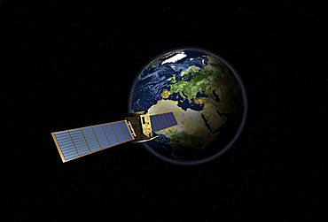
832-3033 - Satellite in front of the globe with Europe, symbolic image Galileo navigation system, overhead intelligence, data transmission
829-462 - Man with a GPS in the rainforests of Bwindi Impenetrable National Park in southern Uganda.
You reached the end of search results


