Recent searches
Loading...
860-292130 - Lac de l'Orceyrette (1927 m), from left to right Pic de Roche Noire (2707 m), Pic de Maravoise (2704 m), Crete du Grand Clausis (2631 m) and Pic du Haut Mouriare (2808 m), Villar-Saint-Pancrace, Hautes-Alpes, France
1311-720 - Pleasant Valley looking south illuminated by moonlight, Grand Canyon North Rim, Arizona, United States of America, North America
1311-719 - Pleasant Valley near sunset in the Kaibab National Forest just north of Grand Canyon North Rim, Arizona, United States of America, North America
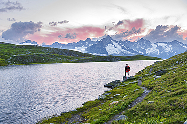
1361-250 - Hiker stands near the shore of Fenetre lake admiring the sunset over the massif of Mount Blanc, Ferret valley, Valais canton, Col du Grand-Saint-Bernard (St. Bernard mountain pass), Switzerland, Europe
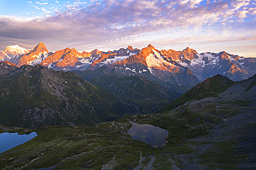
1361-246 - Aerial view of Fenetre lakes and the massif of Mount Blanc at sunrise, Ferret valley, Valais canton, Col du Grand-Saint-Bernard (St. Bernard mountain pass), Switzerland, Europe
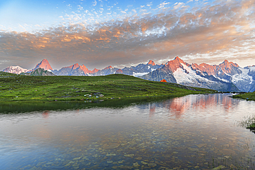
1361-245 - Sunrise view over the shore of Fenetre lake with the massif of Mount Blanc, Fenetre lake, Ferret valley, Valais canton, Col du Grand-Saint-Bernard (St. Bernard mountain pass), Switzerland, Europe
1311-675 - House Valley, with the Vermilion Cliffs in the distance, viewed from the summit of Saddle Mountain on the north edge of Grand Canyon, Grand Canyon National Park, UNESCO World Heritage Site, Arizona, United States of America, North America
1311-523 - A fisheye view of a deep chasm east of Pinal Point at Grand Canyon, Grand Canyon National Park, UNESCO World Heritage Site, Arizona, United States of America, North America
1311-515 - Fisheye view of a deep chasm near Papago Point at Grand Canyon with Zuni Point in the distance, Grand Canyon National Park, UNESCO World Heritage Site, Arizona, United States of America, North America
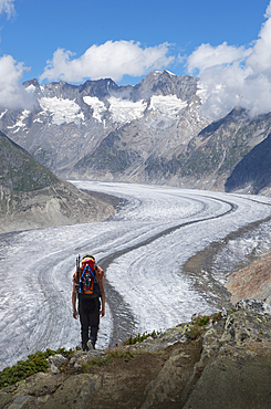
1178-40861 - Caucasian man hiking in snowy mountains
1311-376 - Grand Canyon viewed from Point Sublime on the North Rim, Grand Canyon National Park, UNESCO World Heritage Site, Arizona, United States of America, North America
1311-377 - View from the Saddle Mountain Overlook on the northeast edge of Grand Canyon North Rim and the Kaibab National Forest, Arizona, United States of America, North America
1311-375 - Storm rolling into Point Imperial at Grand Canyon North Rim, Grand Canyon National Park, UNESCO World Heritage Site, Arizona, United States of America, North America
1311-374 - Grand Canyon view north of Point Imperial with Woolsey Butte on the left and Mount Hayden on the right, Grand Canyon National Park, UNESCO World Heritage Site, Arizona, United States of America, North America
1311-373 - Point Imperial view from Ken Patrick Trail at Grand Canyon North Rim with Mount Hayden the pointed peak left of center, Arizona, United States of America, North America
1311-372 - Bright Angel Canyon viewed from Coconino Overlook along North Kaibab Trail on Grand Canyon North Rim, Arizona, United States of America, North America
1311-371 - Bright Angel Canyon viewed from Coconino Overlook along North Kaibab Trail on Grand Canyon North Rim, Arizona, United States of America, North America
1311-370 - Panorama view of Freya's Castle and Wotan's Throne from the southwest side of Cape Royal on Grand Canyon North Rim, Arizona, United States of America, North America
1311-368 - Grand Canyon North Rim from the end of the Cliff Spring Trail near Cape Royal, Arizona, United States of America, North America
1311-369 - Panorama view of Freya's Castle and Wotan's Throne from the overlook of Cape Royal on Grand Canyon North Rim, Arizona, United States of America, North America
1178-34990 - Mountain and clouds in remote landscape
1178-34954 - Rock formations in desert landscape, Monument Valley, Arizona, United States
832-388070 - Observation tower, Desert View Watchtower, Colorado Plateau, Grand Canyon National Park, Arizona, USA, North America
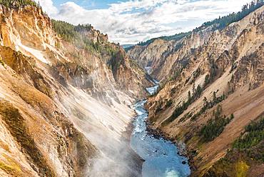
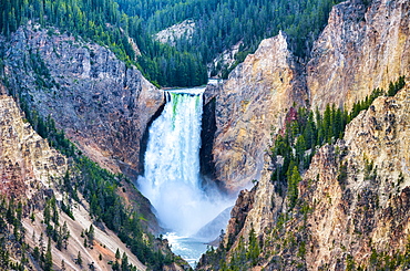
832-384320 - Yellowstone River flows through Gorge, Grand Canyon of the Yellowstone, View from North Rim, Brink of the Lower Falls, Yellowstone National Park, Wyoming, USA, North America
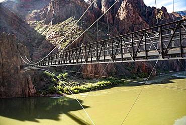
832-385420 - Suspension Bridge Kaibab Suspension Bridge over Colorado River, South Kaibab Trail, Grand Canyon National Park, Arizona, USA, North America
832-384438 - Young man jumping with outstretched arms, view from Grand Viewpoint, rugged gorges of the Green River, canyon landscape, erosion landscape, rock formations, Monument Basin, White Rim, Island in the Sky, Canyonlands National Park, Utah, USA, North America
832-384319 - Hiker at Red Rock Viewpoint, Lower Falls, Waterfall in a gorge, Grand Canyon of the Yellowstone River, View from North Rim, Yellowstone National Park, Wyoming, USA, North America
832-385400 - Canyon landscape, eroded rocky landscape of the Grand Canyon, South Rim, Grand Canyon National Park, Arizona, USA, North America
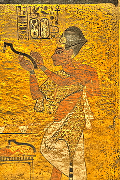
801-2919 - Grand Visier Aye, Tomb of Tutankhamun, KV62, Valley of the Kings, UNESCO World Heritage Site, Luxor, Thebes, Egypt, North Africa, Africa
746-89476 - Lower Falls of Yellowstone Grand Canyon, Wyoming.
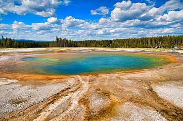
746-89459 - Grand Prismatic Spring Geyser, Yellowstone National Park.
746-89400 - Panoramic view of Monument Valley mountain and road across national park.
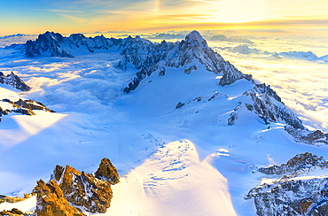
1179-3830 - Aerial view of the Grand Jorasses at sunrise, Mont Blanc massif, Courmayeur, Aosta Valley, Italy, Europe
1109-3507 - Verdon Gorge (Grand Canyon du Verdon), Alpes de Haute Provence, South of France, Europe
1109-3509 - Verdon Gorge (Grand Canyon du Verdon), Alpes de Haute Provence, South of France, Europe
1109-3508 - Verdon Gorge (Grand Canyon du Verdon), Alpes de Haute Provence, South of France, Europe
1109-3506 - Verdon Gorge (Grand Canyon du Verdon), Alpes de Haute Provence, South of France, France
1116-40955 - Colorado River In The Bottom Of The Grand Canyon, Arizona, United States Of America
1184-2030 - Erosion created the Grand Canyon of the Congo, Diosso Gorge, Pointe-Noire, Republic of the Congo, Africa
1184-2031 - Erosion created the Grand Canyon of the Congo, Diosso Gorge, Pointe-Noire, Republic of the Congo, Africa
1184-2032 - Erosion created the Grand Canyon of the Congo, Diosso Gorge, Pointe-Noire, Republic of the Congo, Africa
733-7456 - Climbers on Madonna summit 4059m, Grand Paradiso, Aosta Valley, Italian Alps, Italy, Europe
733-7455 - Climbers on Madonna summit 4059m, Grand Paradiso, Aosta Valley, Italian Alps, Italy, Europe
396-5216 - Our River near Dillingen, Grand Duchy of Luxembourg, Europe
396-5213 - Bourscheid Castle in the Valley of Sauer River, Canton of Diekirch, Grand Duchy of Luxembourg, Europe
396-5214 - Bourscheid Castle in the Valley of Sauer River, Canton of Diekirch, Grand Duchy of Luxembourg, Europe
1179-1689 - Panorama of Mont Blanc, Mont De La Saxe and Grand Jorasses under the starry sky, Graian Alps, Courmayeur, Aosta Valley, Italy, Europe
1179-934 - The mountain range is reflected in Fenetre Lakes at dusk, Ferret Valley, Saint Rhemy, Grand St Bernard, Aosta Valley, Italy, Europe
1179-933 - Starry summer sky on Fenetre Lakes and the high peaks, Ferret Valley, Saint Rhemy, Grand St Bernard, Aosta Valley, Italy, Europe
1179-935 - The snowy peaks are reflected in Fenetre Lakes at dawn, Ferret Valley, Saint Rhemy, Grand St Bernard, Aosta Valley, Italy, Europe
1179-931 - Lights of a tent around Fenetre Lakes at dusk, Ferret Valley, Saint Rhemy, Grand St Bernard, Aosta Valley, Italy, Europe
1179-936 - Mist and flowers frames The Fenetre Lakes Ferret Valley, Saint Rhemy, Grand St Bernard, Aosta Valley, Italy, Europe
1179-932 - A tent under the stars around Fenetre Lakes, Ferret Valley, Saint Rhemy, Grand St Bernard, Aosta Valley, Italy, Europe
762-764 - Moose (Alces alces), Gros Ventre valley, Grand Tetons National Park, Wyoming, United States of America, North America
762-758 - Grand Canyon of the Yellowstone River, Yellowstone National Park, UNESCO World Heritage Site, Wyoming, United States of America, North America
762-760 - Artists Point looking towards Lower Falls, Grand Canyon, Yellowstone National Park, UNESCO World Heritage Site, Wyoming, United States of America, North America
762-761 - Grand Canyon of the Yellowstone River from Brink of the Lower Falls, Yellowstone National Park, UNESCO World Heritage Site, Wyoming, United States of America, North America
1189-39 - Grand Canyon viewed from South Rim, Grand Canyon National Park, UNESCO World Heritage Site, Arizona, United States of America, North America
857-89709 - Hikers setup camp on a beach along the Colorado River near the plumeting 180-foot Deer Creek Falls in the Grand Canyon outside of Fredonia, Arizona November 2011. The 21.4-mile loop starts at the Bill Hall trailhead on the North Rim and descends 2000-feet in 2.5-miles through Coconino Sandstone to the level Esplanada then descends further into the lower canyon through a break in the 400-foot-tall Redwall to access Surprise Valley. Hikers connect Thunder River and Tapeats Creek to a route along the Colorado River and climb out Deer Creek.
857-89713 - Female hiker cooks dinner on a cliff-pinched patio above camp and the Colorado River near Deer Creek Falls in the Grand Canyon outside of Fredonia, Arizona November 2011. The 21.4-mile loop starts at the Bill Hall trailhead on the North Rim and descends 2000-feet in 2.5-miles through Coconino Sandstone to the level Esplanada then descends further into the lower canyon through a break in the 400-foot-tall Redwall to access Surprise Valley. Hikers connect Thunder River and Tapeats Creek to a route along the Colorado River and climb out Deer Creek.
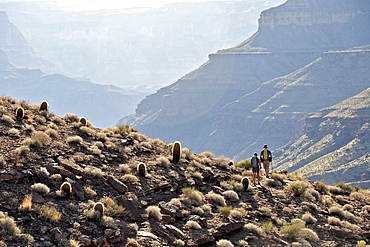
857-89701 - Hikers on the sandstone Esplanade of the Thunder River Trail below the North Rim of the Grand Canyon outside Fredonia, Arizona November 2011. The 21.4-mile loop descends 2000-feet in 2.5-miles through Coconino Sandstone from the Bill Hall trailhead to connect the Thunder River and Deer Creeks trails. Hikers descend into the lower canyon through a break in the 400-foot-tall Redwall to access Surprise Valley, Deer Creek, Tapeats Creek via Thunder River and even the Colorado River.
857-89710 - Hikers cook dinner on a cliff-pinched patio above camp and the Colorado River near Deer Creek Falls in the Grand Canyon outside of Fredonia, Arizona November 2011. The 21.4-mile loop starts at the Bill Hall trailhead on the North Rim and descends 2000-feet in 2.5-miles through Coconino Sandstone to the level Esplanada then descends further into the lower canyon through a break in the 400-foot-tall Redwall to access Surprise Valley. Hikers connect Thunder River and Tapeats Creek to a route along the Colorado River and climb out Deer Creek.
857-89708 - Hikers swim in the pool below 180-foot Deer Creek Falls in the Grand Canyon outside of Fredonia, Arizona November 2011. The 21.4-mile loop starts at the Bill Hall trailhead on the North Rim and descends 2000-feet in 2.5-miles through Coconino Sandstone to the level Esplanada then descends further into the lower canyon through a break in the 400-foot-tall Redwall to access Surprise Valley. Hikers connect Thunder River and Tapeats Creek to a route along the Colorado River and climb out Deer Creek.
857-89717 - Hikers follow a route along the Colorado River that connect Tapeats Creek and Thunder River to Deer Creek in the Grand Canyon outside of Fredonia, Arizona November 2011. The 21.4-mile loop starts at the Bill Hall trailhead on the North Rim and descends 2000-feet in 2.5-miles through Coconino Sandstone to the level Esplanada then descends further into the lower canyon through a break in the 400-foot-tall Redwall to access Surprise Valley. Hikers connect Thunder River and Tapeats Creek to a route along the Colorado River and climb out Deer Creek.
857-89712 - Male hiker filters water on a cliff-pinched patio near Deer Creek Falls in the Grand Canyon outside of Fredonia, Arizona November 2011. The 21.4-mile loop starts at the Bill Hall trailhead on the North Rim and descends 2000-feet in 2.5-miles through Coconino Sandstone to the level Esplanada then descends further into the lower canyon through a break in the 400-foot-tall Redwall to access Surprise Valley. Hikers connect Thunder River and Tapeats Creek to a route along the Colorado River and climb out Deer Creek.
857-89700 - Hikers on the sandstone Esplanade of the Thunder River Trail below the North Rim of the Grand Canyon outside Fredonia, Arizona November 2011. The 21.4-mile loop descends 2000-feet in 2.5-miles through Coconino Sandstone from the Bill Hall trailhead to connect the Thunder River and Deer Creeks trails. Hikers descend into the lower canyon through a break in the 400-foot-tall Redwall to access Surprise Valley, Deer Creek, Tapeats Creek via Thunder River and even the Colorado River.
857-89703 - Hikers past small waterfalls along Deer Creek Narrows in the Grand Canyon outside of Fredonia, Arizona November 2011. The 21.4-mile loop starts at the Bill Hall trailhead on the North Rim and descends 2000-feet in 2.5-miles through Coconino Sandstone to the level Esplanada then descends further into the lower canyon through a break in the 400-foot-tall Redwall to access Surprise Valley. Hikers connect Thunder River and Tapeats Creek to a route along the Colorado River and climb out Deer Creek.
857-89711 - Male hiker filters water on a cliff-pinched patio near Deer Creek Falls in the Grand Canyon outside of Fredonia, Arizona November 2011. The 21.4-mile loop starts at the Bill Hall trailhead on the North Rim and descends 2000-feet in 2.5-miles through Coconino Sandstone to the level Esplanada then descends further into the lower canyon through a break in the 400-foot-tall Redwall to access Surprise Valley. Hikers connect Thunder River and Tapeats Creek to a route along the Colorado River and climb out Deer Creek.
857-89702 - Hikers walk along Deer Creek Narrows in the Grand Canyon outside of Fredonia, Arizona November 2011. The 21.4-mile loop starts at the Bill Hall trailhead on the North Rim and descends 2000-feet in 2.5-miles through Coconino Sandstone to the level Esplanada then descends further into the lower canyon through a break in the 400-foot-tall Redwall to access Surprise Valley. Hikers connect Thunder River and Tapeats Creek to a route along the Colorado River and climb out Deer Creek.
857-89705 - Hikers walk along Deer Creek Narrows in the Grand Canyon outside of Fredonia, Arizona November 2011. The 21.4-mile loop starts at the Bill Hall trailhead on the North Rim and descends 2000-feet in 2.5-miles through Coconino Sandstone to the level Esplanada then descends further into the lower canyon through a break in the 400-foot-tall Redwall to access Surprise Valley. Hikers connect Thunder River and Tapeats Creek to a route along the Colorado River and climb out Deer Creek.
860-286151 - Male Ibex in the snow, Grand Paradisi Alps Italy
860-286152 - Male Ibex and young in the snow, Grand Paradisi Alps Italy
1178-8215 - USA, Arizona, Grand Canyon, Yavapi Point at sunset
1178-9210 - Colorado River from Grand View Point, Utah
816-7864 - The Teton range in the Grand Teton National Park, Wyoming, United States of America, North America
857-86011 - Hikers walk along Deer Creek Narrows in the Grand Canyon outside of Fredonia, Arizona November 2011. The 21.4-mile loop starts at the Bill Hall trailhead on the North Rim and descends 2000-feet in 2.5-miles through Coconino Sandstone to the level Esplanada then descends further into the lower canyon through a break in the 400-foot-tall Redwall to access Surprise Valley. Hikers connect Thunder River and Tapeats Creek to a route along the Colorado River and climb out Deer Creek.
857-86023 - Male hiker filters water on a cliff-pinched patio near Deer Creek Falls in the Grand Canyon outside of Fredonia, Arizona November 2011. The 21.4-mile loop starts at the Bill Hall trailhead on the North Rim and descends 2000-feet in 2.5-miles through Coconino Sandstone to the level Esplanada then descends further into the lower canyon through a break in the 400-foot-tall Redwall to access Surprise Valley. Hikers connect Thunder River and Tapeats Creek to a route along the Colorado River and climb out Deer Creek.
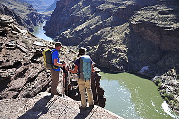
857-86016 - Hikers overlook the Colorado River as they exit the Deer Creek Narrows in the Grand Canyon outside of Fredonia, Arizona November 2011. The 21.4-mile loop starts at the Bill Hall trailhead on the North Rim and descends 2000-feet in 2.5-miles through Coconino Sandstone to the level Esplanada then descends further into the lower canyon through a break in the 400-foot-tall Redwall to access Surprise Valley. Hikers connect Thunder River and Tapeats Creek to a route along the Colorado River and climb out Deer Creek.
857-86021 - Hikers setup camp on a beach along the Colorado River near the plumeting 180-foot Deer Creek Falls in the Grand Canyon outside of Fredonia, Arizona November 2011. The 21.4-mile loop starts at the Bill Hall trailhead on the North Rim and descends 2000-feet in 2.5-miles through Coconino Sandstone to the level Esplanada then descends further into the lower canyon through a break in the 400-foot-tall Redwall to access Surprise Valley. Hikers connect Thunder River and Tapeats Creek to a route along the Colorado River and climb out Deer Creek.
857-86015 - Hikers walk along Deer Creek Narrows in the Grand Canyon outside of Fredonia, Arizona November 2011. The 21.4-mile loop starts at the Bill Hall trailhead on the North Rim and descends 2000-feet in 2.5-miles through Coconino Sandstone to the level Esplanada then descends further into the lower canyon through a break in the 400-foot-tall Redwall to access Surprise Valley. Hikers connect Thunder River and Tapeats Creek to a route along the Colorado River and climb out Deer Creek.
857-86013 - Hikers walk along Deer Creek Narrows in the Grand Canyon outside of Fredonia, Arizona November 2011. The 21.4-mile loop starts at the Bill Hall trailhead on the North Rim and descends 2000-feet in 2.5-miles through Coconino Sandstone to the level Esplanada then descends further into the lower canyon through a break in the 400-foot-tall Redwall to access Surprise Valley. Hikers connect Thunder River and Tapeats Creek to a route along the Colorado River and climb out Deer Creek.
857-86000 - Hikers on the sandstone Esplanade of the Thunder River Trail below the North Rim of the Grand Canyon outside Fredonia, Arizona November 2011. The 21.4-mile loop descends 2000-feet in 2.5-miles through Coconino Sandstone from the Bill Hall trailhead to connect the Thunder River and Deer Creeks trails. Hikers descend into the lower canyon through a break in the 400-foot-tall Redwall to access Surprise Valley, Deer Creek, Tapeats Creek via Thunder River and even the Colorado River.
857-86025 - Hikers follow a route along the Colorado River that connect Tapeats Creek and Thunder River to Deer Creek in the Grand Canyon outside of Fredonia, Arizona November 2011. The 21.4-mile loop starts at the Bill Hall trailhead on the North Rim and descends 2000-feet in 2.5-miles through Coconino Sandstone to the level Esplanada then descends further into the lower canyon through a break in the 400-foot-tall Redwall to access Surprise Valley. Hikers connect Thunder River and Tapeats Creek to a route along the Colorado River and climb out Deer Creek.
857-86007 - Hikers cook dinner along Deer Creek Narrows in the Grand Canyon outside of Fredonia, Arizona November 2011. The 21.4-mile loop starts at the Bill Hall trailhead on the North Rim and descends 2000-feet in 2.5-miles through Coconino Sandstone to the level Esplanada then descends further into the lower canyon through a break in the 400-foot-tall Redwall to access Surprise Valley. Hikers connect Thunder River and Tapeats Creek to a route along the Colorado River and climb out Deer Creek.
857-86027 - Hikers climb out of Surprise Valley to the North Rim of the Grand Canyon outside of Fredonia, Arizona November 2011. The 21.4-mile loop starts at the Bill Hall trailhead on the North Rim and descends 2000-feet in 2.5-miles through Coconino Sandstone to the level Esplanada then descends further into the lower canyon through a break in the 400-foot-tall Redwall to access Surprise Valley. Hikers connect Thunder River and Tapeats Creek to a route along the Colorado River and climb out Deer Creek.
857-86022 - Hikers setup camp on a beach along the Colorado River near the plumeting 180-foot Deer Creek Falls in the Grand Canyon outside of Fredonia, Arizona November 2011. The 21.4-mile loop starts at the Bill Hall trailhead on the North Rim and descends 2000-feet in 2.5-miles through Coconino Sandstone to the level Esplanada then descends further into the lower canyon through a break in the 400-foot-tall Redwall to access Surprise Valley. Hikers connect Thunder River and Tapeats Creek to a route along the Colorado River and climb out Deer Creek.
857-86003 - Hikers descend into Surprise Valley to access the lower canyon through a break in the 400-foot-tall Redwall on the Thunder River Trail in the Grand Canyon outside of Fredonia, Arizona November 2011. The 21.4-mile loop starts at the Bill Hall trailhead on the North Rim and descends 2000-feet in 2.5-miles through Coconino Sandstone to the level Esplanada then descends further into the lower canyon to access Thunder River, Tapeats Creek and Deer Creek.
832-375657 - Grand Canyon and Colorado River seen from Toroweap Point, Tuweep Area, North Rim, Arizona, USA
832-375656 - Grand Canyon and Colorado River seen from Toroweap Point, Tuweep Area, North Rim, Arizona, USA
832-299647 - Waterfalls in the valley of Grand Etang, La Reunion Island, France, Africa
832-360159 - Rim Trail, South Rim, Grand Canyon National Park, Arizona, USA
832-360153 - Pine (Pinus) at the Rim Trail, South Rim, Grand Canyon National Park, Arizona, USA


