
Recent searches
Loading...
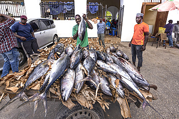
860-292481 - Sale of tuna on banana leaves in the middle of the street, Fish market in a district of Stone Town, Zanzibar, Tanzania
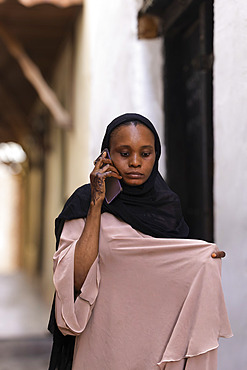
860-292478 - Traditional Muslim woman, abaya rolled up over her shoulders, Stone Town, in the capital of Zanzibar, Tanzania

860-292479 - Traditional Muslim children: girls wear abayas, boys wear kofias, traditional hats, on their way to school in the narrow streets of Stone Town, capital of Zanzibar, Tanzania.

860-292477 - Traditional Muslim girl on her way to school, wearing an abaya, Stone Town, capital of Zanzibar, Tanzania
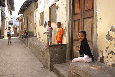
860-292475 - Children playing in narrow streets, little girls wearing headdresses, Stone Town, capital of Zanzibar, Tanzania

860-292391 - Landscape of Svalbard in Norway, also known as Spitsbergen. This territory stretches from latitude 75 to 80 degrees to the pack ice a few hundred kilometers from the North Pole. Melting ice, early global warming. Coastal scenery as you climb towards latitude 80 degrees. Trapper's hut, professional hunter's hut
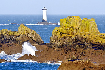
860-292383 - Pierre-de-Herpin lighthouse and Pointe du Grouin, Normandy, France
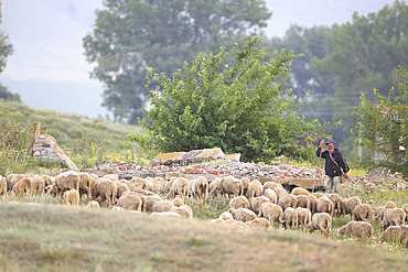

860-292339 - Landscape of Svalbard in Norway, also known as Spitsbergen. This territory stretches from latitude 75 to 80 degrees to the pack ice a few hundred kilometers from the North Pole.
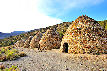
860-292325 - Charcoal kiln. Panamint mountains. Death valley national park. Built 1877. California
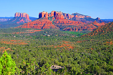
860-292278 - The city of Sedona is known for its natural red sandstone formations such as Cathedral Rock here. Arizona. USA.
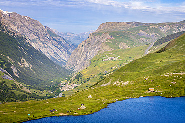
860-292258 - Lac du Pontet (1955 m) with La Grave (Les Plus Beaux Villages de France) in the background and Les Terrasses hamlet (1767 m), upper Romanche valley, Villar-d'Arene, Hautes-Alpes, France
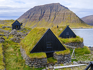
860-292231 - The open air museum Osvoer. Bolungarvik at fjord Isafjardardjup. The Westfjords (Vestfirdir) in Iceland during autumn. Europe, Northern Europe, Iceland
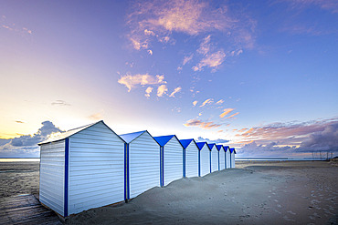
860-292168 - Beach cabins, Boulogne sur mer, Pas-de-Calais Cote d'Opale, France
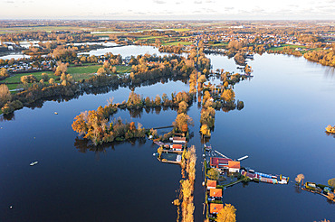
860-292166 - Lake d'Ardres overflows following intense rainfall, Pas-de-Calais, France, November 2023
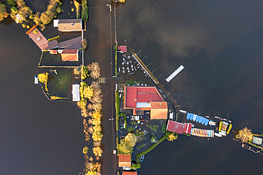
860-292165 - Lake d'Ardres overflows following intense rainfall, Pas-de-Calais, France, November 2023
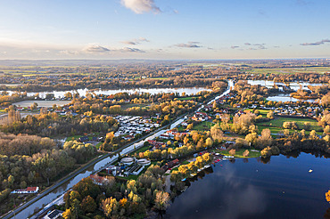
860-292164 - Lake d'Ardres overflows following intense rainfall, Pas-de-Calais, France, November 2023
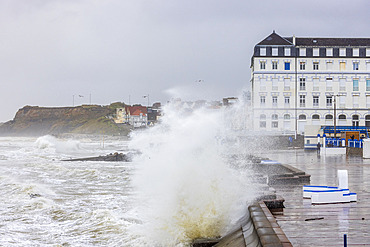
860-292161 - Wimereux during Storm Ciaran, Opal Coast, Pas-de-Calais, France

860-292160 - Wimereux during Storm Ciaran, Opal Coast, Pas-de-Calais, France
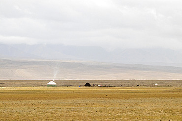
860-292140 - Yurt in the Ak-sai valley, At-bashi, Naryn, Kyrgyzstan
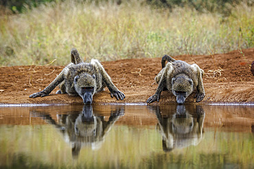
860-292135 - Two Chacma baboon (Papio ursinus) drinking front view in waterhole in Kruger National park, South Africa
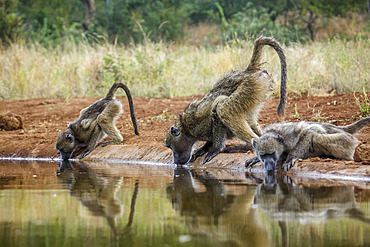
860-292134 - Three Chacma baboon (Papio ursinus) drinking in waterhole in Kruger National park, South Africa
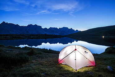
860-292131 - Bivouac on the shore of Lake Laramon (2359 m), Queyrellin ridge (2866 m) in the background, upper Claree valley, Nevache, Hautes-Alpes, France
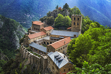
860-292129 - Saint-Martin du Canigou Abbey in the Eastern Pyrenees. Cady valley, above Prades. France

860-292121 - Morning mist over lavender fields, Puimoisson, Valensole plateau, Alpes-de-Haute-Provence, France

860-292117 - Storm Mathis in March 2023 at Phare du Four, Finistere, Brittany, France
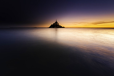
860-292115 - High tides, Mont-Saint-Michel, Manche, Normandy, France
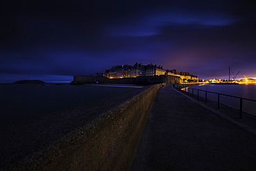
860-292114 - La Digue du Mole des Noires at dawn, Bastion Saint-Philippe, Saint-Malo, Ille-et-Vilaine, Brittany, France
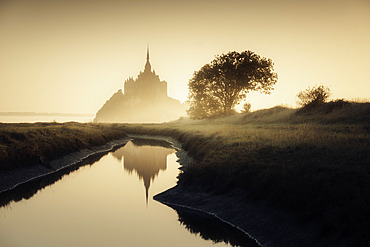
860-292113 - Mont-Saint-Michel in autumn, Manche, Normandy, France

860-292047 - Monumental tomb at Cap Corse. Piccioni family mausoleum in Pino. This magnificent tomb contains the ashes of Valentine Eiffel, daughter of engineer Gustave Eiffel and wife of diplomat Camille Piccioni. Monumental tombs are part of traditional Corsican architecture and are often spectacular and ostentatious. They generally date from the 19th century.
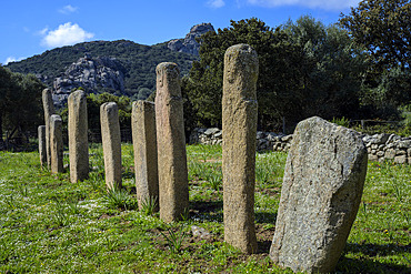
860-292046 - Alignment of statue-menhirs at I Stantari. Cauria megalithic site, located in the commune of Sartene in southern Corsica. The site was occupied from the Early Neolithic to the end of the Bronze Age. Some ten statue-menhirs can be seen in two alignments, on which reliefs (swords, belts, loincloths, faces, arms and hands) can be distinguished.
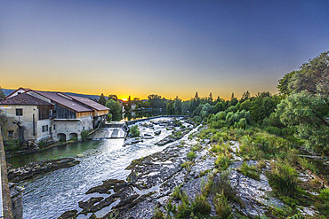
860-292042 - River Ain, Pont de Poitte, Jura, France
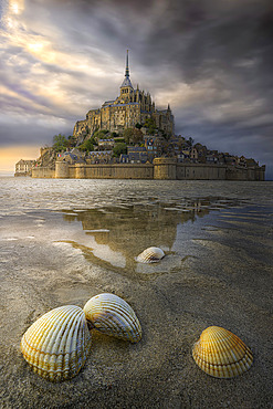
860-292024 - Shells on the sand at low tide in front of Mont Saint-Michel, Normandy, France

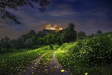
860-292020 - A multitude of fireflies in front of Torrechiara Castle, Parma, Italy
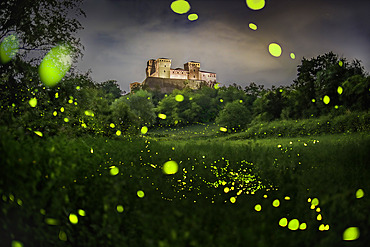
860-292019 - Fireflies in front of Torrechiara Castle, Parma, Italy
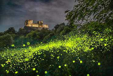
860-292017 - A multitude of fireflies in front of Torrechiara Castle, Parma, Italy
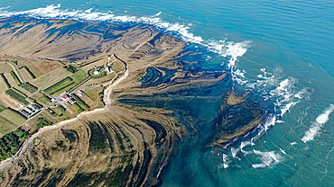
860-291976 - Chassiron lighthouse at the northern tip of Ile d'Oleron, Charente-Maritime, France

860-291974 - Northwest coastline of Ile d'Oleron with Ile de Re in the background, Charente-Maritime, France

860-291911 - The cathedral and the storm. Thunderstorm over Voves seen from Chartres on the night of 2 to 3 September 2022, Eure-et-Loir, France
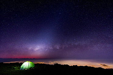
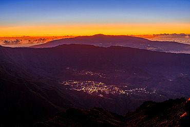
860-291883 - Piton de la Fournaise and Cilaos from the Grand Benare, Reunion Island, France


860-291755 - Roland Garros Airport, Sainte Marie , Reunion Island, France

860-291740 - Chateau-Chalon, 'Most beautiful village in France', AOC vineyard, capital of Vin Jaune, Jura, France

860-291741 - Chateau-Chalon, 'Most beautiful village in France', AOC vineyard, capital of Vin Jaune, Jura, France

860-291738 - Chateau-Chalon, 'Most beautiful village in France', AOC vineyard, capital of Vin Jaune, Jura, France

860-291739 - Chateau-Chalon, 'Most beautiful village in France', AOC vineyard, capital of Vin Jaune, Jura, France

860-291737 - Chateau-Chalon, 'Most beautiful village in France', capital of Vin Jaune, Jura, France

860-291736 - Storm over Chateau-Chalon, 'Most beautiful village in France', capital of Vin Jaune, Jura, France

860-291735 - Chateau-Chalon, 'Most beautiful village in France', AOC vineyard, capital of Vin Jaune, Jura, France

860-291732 - Village of Baume-les-Messieurs, 'Most beautiful village in France', Jura, France

860-291730 - Arbois and its AOC vineyards, Arbois, Jura, France

860-291731 - Abbey and village of Baume-les-Messieurs, 'Most beautiful village in France', Jura, France

860-291728 - Arbois and its AOC vineyards, Arbois, Jura, France

860-291729 - Arbois and its AOC vineyards, Arbois, Jura, France


860-291714 - Farm in the Hautes Combes, in the background : the Jura Mountains, Jura, France

860-291712 - Farm in the Hautes Combes, les Molunes, in the background: the cret de Chalam, Jura, France


860-291675 - Yurt, Ger, Mongolian camp, Steppe area, East Mongolia, Mongolia

860-291657 - Hen Harrier (Circus cyaneus) female in flight on the plain of Caen, Calvados, Normandy, France

860-291655 - Mont-Saint-Michel from a polder and its winding channel, Manche, Normandy, France
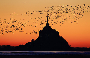
860-291629 - Brent Geese (Branta bernicla) reaching the bay of Mont-Saint-Michel to spend the night, Manche, Normandy, France.
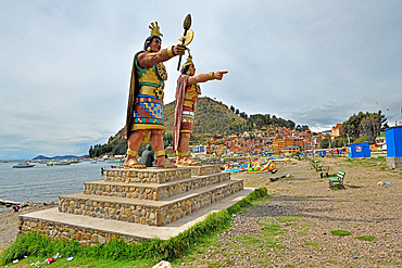
860-291566 - Statues of Manco Cápac, the first Inca ruler and his sister and wife Mama Ocllo, Copacabana Beach on Lake Titicaca, Bolivia

860-291497 - Svalbard Global Seed Vault, Saatgut Tresor. Longyearbyen, die Hauptstadt von Svalbard auf der Insel Spitzbergen im Spitzbergen Archipel. Arktis, Europa, Skandinavien, Norwegen, Spitzbergen

860-291492 - Camp with tents on the ice sheet. The brown sediment on the ice is created by the rapid melting of the ice. Landscape of the Greenland ice sheet near Kangerlussuaq. America, North America, Greenland, danish territory

860-291463 - Hemp field for CBD (cannabidiol) production 15 days before the harvest of the hemp heads, Montagny, France.

860-291459 - Stable of a CBD (cannabidiol) producer or cannabiculturist who also has cows and who dries the hemp flowers in the stable. The cows are outside at the time of the drying of the cannabis buds, Montagny, France.
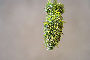
860-291458 - Stable of a CBD (cannabidiol) producer or cannabiculturist who also has cows and who dries the hemp flowers in the stable. The cows are outside at the time of the drying of the cannabis buds, Montagny, France.

860-291457 - Stable of a CBD (cannabidiol) producer or cannabiculturist who also has cows and who dries the hemp flowers in the stable. The cows are outside at the time of the drying of the cannabis buds, Montagny, France.


860-291030 - Tourists on the staircase going to the summit of the Lion's rock, former capitale of king Kasyapa from 477 to 495. Sirigiya. Sri-Lanka.

860-291191 - White marble cross where American soldiers are buried, first American military cemetery of World War II, Colleville-sur-Mer, Calvados, Normandy, France
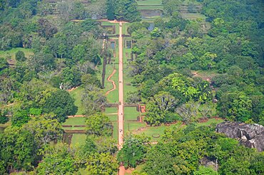
860-291031 - The gardens of the capital (477-495) of king Kasyapa viewed from the top of the Lion's rock. Sirigiya. Sri-Lanka.
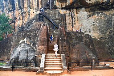
860-291029 - Tourists on the lion's staircase going to the summit of the Lion's rock, former capitale of king Kasyapa from 477 to 495. Sirigiya. Sri-Lanka.

860-291270 - Hayma camp at night, Merzouga, Morocco, Sahara desert

860-291162 - Red fox (Vulpes vulpes) coming out his den in Hay barn, England

860-291211 - Barn owl (Tyto alba) perhed on a barn door with a prey, England
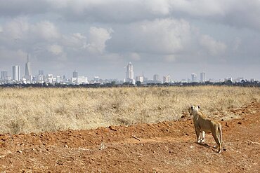
860-291360 - Lioness (Panthera leo) watching Nairobi Skyline, Nairobi National Park, Kenya

860-290963 - Mentawai boys and chikens, Siberut, Mentawai, Indonesia
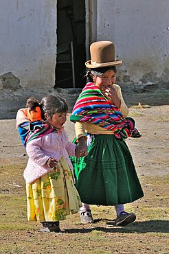
860-291023 - Aymara children near Lake Titicaca, Bolivia
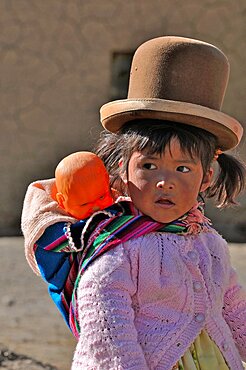
860-291024 - Aymara child near Lake Titicaca, Bolivia

860-290983 - Woman Mentawai putting the meat in a bamboo to preserve her Siberut, Indoneisa

860-290961 - Mentawai boys eating, Siberut, Mentawai, Indonesia

860-290965 - Mentawai children, Siberut, Mentawai, Indonesia
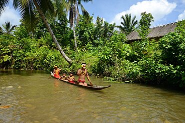
860-290957 - Mentawai familly on dugout, Siberut, Indonesia

860-290962 - Mentawai boys and chikens, Siberut, Mentawai, Indonesia

860-290966 - Mentawai children, Siberut, Mentawai, Indonesia

860-290982 - Woman Mentawai putting the meat in a bamboo to preserve her Siberut, Indoneisa
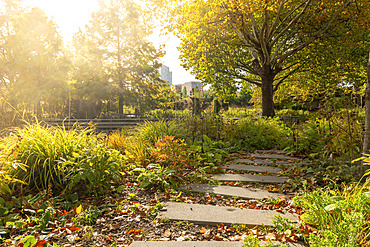
860-290506 - The Garden of the Giants in autumn, Lille, Hauts de France, France

860-290617 - Secretary bird walking in dry land in Kgalagadi transfrontier park, South Africa; specie Sagittarius serpentarius family of Sagittariidae

860-290620 - Red fox (Vulpes vulpes) smelling a bin, England

860-290574 - Large photovoltaic installation in a natural environment above Les Mees, Plateau de Valensole, Alpes de Haute Provence, France

860-290643 - Two reindeer in front of a chum, surroundings of Uoyan, Buryatia, Russia
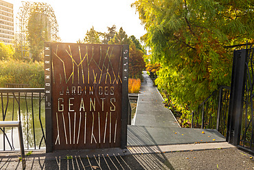
860-290507 - The Garden of the Giants in autumn, Lille, Hauts de France, France

860-290896 - Northern Lights over settlement Kuummiit (formerly spelled Kummiut). Ammassalik area in East Greenland. North America, Greenland, Danish Territorrry

860-290575 - Large photovoltaic installation in a natural environment above Les Mees, Plateau de Valensole, Alpes de Haute Provence, France