Recent searches
Loading...
1373-220 - View of Nallıhan's Colorful Mountains from Davutoğlan, a neighborhood in the municipality and district of Nallıhan, Ankara Province, Turkey. Situated 157 km from Ankara, the capital of Turkey.
1373-221 - View of Nallıhan's Colorful Mountains from Davutoğlan, a neighborhood in the municipality and district of Nallıhan, Ankara Province, Turkey. Situated 157 km from Ankara, the capital of Turkey.
1373-219 - View of Nallıhan's Colorful Mountains from Davutoğlan, a neighborhood in the municipality and district of Nallıhan, Ankara Province, Turkey. Situated 157 km from Ankara, the capital of Turkey.
1373-218 - View of Nallıhan's Colorful Mountains from Davutoğlan, a neighborhood in the municipality and district of Nallıhan, Ankara Province, Turkey. Situated 157 km from Ankara, the capital of Turkey.
1373-217 - View of Nallıhan's Colorful Mountains from Davutoğlan, a neighborhood in the municipality and district of Nallıhan, Ankara Province, Turkey. Situated 157 km from Ankara, the capital of Turkey.
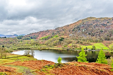
1358-291 - Rydal Water, 2 km long and over 15 metres deep, Lake District National Park, UNESCO World Heritage Site, Cumbria, England, United Kingdom, Europe
1358-290 - Rydal Water, 2 km long and over 15 metres deep, Lake District National Park, UNESCO World Heritage Site, Cumbria, England, United Kingdom, Europe
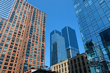
1373-50 - Cityscape from the High Line, a 2.33 km elevated linear park, greenway, and rail trail in New York City, built on a former Central Railroad spur on the west side of Manhattan, inspired by the Coulee verte project in Paris, 1993, New York City, United States of America, North America
1373-48 - Cityscape from the High Line, a 2.33 km elevated linear park, greenway, and rail trail in New York City, built on a former Central Railroad spur on the west side of Manhattan, inspired by the Coulee verte project in Paris, 1993, New York City, United States of America, North America
1373-49 - Cityscape from the High Line, a 2.33 km elevated linear park, greenway, and rail trail in built on a former Central Railroad spur on the west side of Manhattan, New York City, United States of America, North America
1373-45 - Cityscape from the High Line, a 2.33 km elevated linear park, greenway, and rail trail built on a former Central Railroad spur on the west side of Manhattan, New York City, United States of America, North America
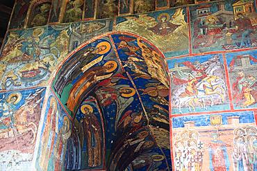
832-399463 - Frescoes on the exterior wall, Humorului, Romania, Unesco World Heritage Site Monastery Church of Adormirea Maicii Domnului at Humor Monastery, a Romanian Orthodox womans monastery and located about 5 km north of the town of Gura Humorului in Romania, Europe
1242-499 - Playa Zicatela, the legendary Mexican surfing beach, stretching for over 3 km, Oaxaca, Mexico, North America
860-291192 - Senequet lighthouse on the rock of the same name 3.8 km off Gouville-sur-Mer, Cotentin, Normandy, France
832-394961 - Signpost, Distance to Africa 15 km, Kite kites on the horizon, Tarifa, Cadiz, Andalucia, Spain, Europe
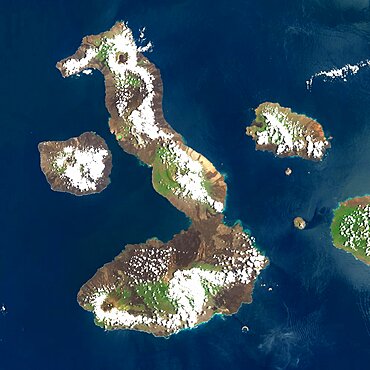
1348-4557 - Galapagos Volcanoes, Ecuador, True Colour Satellite Image. Galapagos Archipelago, Ecuador, true colour satellite image. Galapagos Archipelago is situated 1000 km West of the Ecuadorian coast. The largest and most volcanically active island in the archipelago is Isabela (6 volcanoes). On the left of image, the island of Fernandina (one volcano). Image taken on 16 March 2001 using LANDSAT data. Print size 30 x 30 cm.
1348-4537 - Siljan Meteor Impact Crater, Sweden, True Colour Satellite Image. True colour satellite image of Siljan impact structure, Sweden (diameter : 55 km). Image using LANDSAT data.
1348-4540 - Kara-Kul Meteor Impact Crater, Tajikistan, True Colour Satellite Image. True colour satellite image of Kara-Kul impact structure, Tajikistan (age : 25 million years ; diameter : 52 km). Image taken on 27 September 1992 using LANDSAT data.
1348-4539 - Lonar Meteor Impact Crater, India, True Colour Satellite Image. True colour satellite image of Lonar impact structure, India (diameter : 1,83 km). Image taken on 4 November 1992 using LANDSAT data.
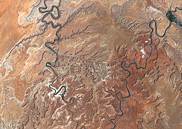
1348-4533 - Upheaval Dome Meteor Impact Crater, Utah, Usa, True Colour Satellite Image. True colour satellite image of Upheaval Dome impact structure, Utah, US (age : 65 million years ; diameter : 5 km). Image taken on 17 June 1989 using LANDSAT data.
1348-3441 - Satellite image of Abu Dhabi, United Arab Emirates, taken on February 2, 1985 by the satellite Landsat 5. The territory covered is 78 km x 55 km.
1348-3447 - Satellite image of Abu Dhabi, United Arab Emirates, taken on June 26, 2014 by the satellite Landsat 8. The territory covered is 78 km x 55 km.
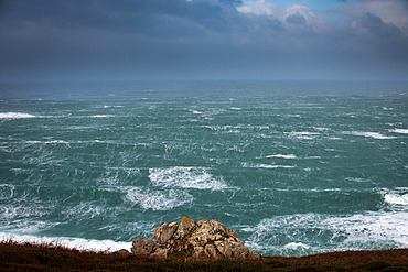
860-290282 - Storm Bella in Beuzec-Cap-Sizun, in the Bay of Douarnenez, on December 28, 2020. Wind of 140 km/h. Brittany, France
860-290283 - Storm Bella in Beuzec-Cap-Sizun, in the Bay of Douarnenez, on December 28, 2020. Wind of 140 km/h. Brittany, France
1350-3824 - Namtso lake or Nam tso lake in Tibet China. Nam Tso Lake is the second largest lake in Tibet, and one of the most famous places on the "Roof of the World". The lake itself is located at an altitude of 4,718 m, and has an area of 1,920 km². This lake is the largest of the lakes in the Tibet Autonomous Region, although it is not the largest on the Qinghai Tibet Plateau, a title that belongs to Lake Qinghai, more than twice the area of Namtso, which is more than 1,000 km, in the northeast, in Qinghai province.
832-389291 - Festival of eagle hunters in Olgii Province, about 20 km from the provincial capital, where different methods of hunting are demonstrated and evaluated, as well as equestrian games and riding new mounts, Kisil Char, Olgii, Mongolia, Asia
149-5061 - A triangular lunette at the Castillo del Morro, a fortess at the entrance to the Bay of Santiago, UNESCO World Heritage Site, 10 km southwest of Santiago de Cuba, Cuba, West Indies, Central America
149-5281 - The custom built resort of Charaki on a bay 40 km south of Rhodes Town, Rhodes, Dodecanese, Greek Islands, Greece, Europe
1228-147 - The Pocklington Canal runs for 9.5 miles (15.3 km) in the East Riding of Yorkshire, England, United Kingdom, Europe
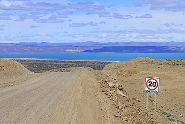
832-380514 - Gravel road Ruta 40 with speed limit 20 Km/h, behind Lago Cardiel and Andes, near Perito Moreno, province Santa Cruz, Patagonia, Argentina, South America
857-95283 - The Golden Gate Bridge is a suspension bridge spanning the Golden Gate, the one-mile-wide (1.6 km) strait connecting San Francisco Bay and the Pacific Ocean. The structure links the American city of San Francisco, California the northern tip of the San Francisco Peninsula to Marin County, carrying both U.S. Route 101 and California State Route 1 across the strait. The bridge is one of the most internationally recognized symbols of San Francisco, California, and the United States. It has been declared one of the Wonders of the Modern World by the American Society of Civil Engineers.
857-95284 - The Golden Gate Bridge is a suspension bridge spanning the Golden Gate, the one-mile-wide (1.6 km) strait connecting San Francisco Bay and the Pacific Ocean. The structure links the American city of San Francisco, California the northern tip of the San Francisco Peninsula to Marin County, carrying both U.S. Route 101 and California State Route 1 across the strait. The bridge is one of the most internationally recognized symbols of San Francisco, California, and the United States. It has been declared one of the Wonders of the Modern World by the American Society of Civil Engineers.
450-4311 - Aerial view from one of the world's longest (6 km) aerial tramways, Tatev, Armenia, Central Asia, Asia
857-94717 - Nimoa Island - here the island mission will impress. The five-sided church features murals of island life and all mission buildings are surrounded by well maintained paths and gardens filled with flowering plants. Edged by jungle-covered mountains, postcard beaches and crystal clear waters - an island paradise indeed! The Louisiade Archipelago is a string of ten larger volcanic islands frequently fringed by coral reefs, and 90 smaller coral islands located 200 km southeast of New Guinea, stretching over more than 160 km and spread over an ocean area of 26,000 km? between the Solomon Sea to the north and the Coral Sea to the south. The aggregate land area of the islands is about 1,790 km? (690 square miles), with Vanatinai (formerly Sudest or Tagula as named by European claimants on Western maps) being the largest. Sideia Island and Basilaki Island lie closest to New Guinea, while Misima, Vanatinai, and Rossel islands lie further east. The archipelago is divided into the Local Level Government (LLG) areas Loui!
857-94720 - Nimoa Island - here the island mission will impress. The five-sided church features murals of island life and all mission buildings are surrounded by well maintained paths and gardens filled with flowering plants. Edged by jungle-covered mountains, postcard beaches and crystal clear waters - an island paradise indeed! The Louisiade Archipelago is a string of ten larger volcanic islands frequently fringed by coral reefs, and 90 smaller coral islands located 200 km southeast of New Guinea, stretching over more than 160 km and spread over an ocean area of 26,000 km? between the Solomon Sea to the north and the Coral Sea to the south. The aggregate land area of the islands is about 1,790 km? (690 square miles), with Vanatinai (formerly Sudest or Tagula as named by European claimants on Western maps) being the largest. Sideia Island and Basilaki Island lie closest to New Guinea, while Misima, Vanatinai, and Rossel islands lie further east. The archipelago is divided into the Local Level Government (LLG) areas Louisiade Rural (western part, with Misima), and Yaleyamba (western part, with Rossell and Tagula islands. The LLG areas are part of Samarai-Murua District district of Milne Bay. The seat of the Louisiade Rural LLG is Bwagaoia on Misima Island, the population center of the archipelago.
857-94718 - Nimoa Island - here the island mission will impress. The five-sided church features murals of island life and all mission buildings are surrounded by well maintained paths and gardens filled with flowering plants. Edged by jungle-covered mountains, postcard beaches and crystal clear waters - an island paradise indeed! The Louisiade Archipelago is a string of ten larger volcanic islands frequently fringed by coral reefs, and 90 smaller coral islands located 200 km southeast of New Guinea, stretching over more than 160 km and spread over an ocean area of 26,000 km? between the Solomon Sea to the north and the Coral Sea to the south. The aggregate land area of the islands is about 1,790 km? (690 square miles), with Vanatinai (formerly Sudest or Tagula as named by European claimants on Western maps) being the largest. Sideia Island and Basilaki Island lie closest to New Guinea, while Misima, Vanatinai, and Rossel islands lie further east. The archipelago is divided into the Local Level Government (LLG) areas Louisiade Rural (western part, with Misima), and Yaleyamba (western part, with Rossell and Tagula islands. The LLG areas are part of Samarai-Murua District district of Milne Bay. The seat of the Louisiade Rural LLG is Bwagaoia on Misima Island, the population center of the archipelago.
857-94722 - Children playing with a outrigger canoe in the village of Hessessai Bay at PanaTinai (Panatinane)island in the Louisiade Archipelago in Milne Bay Province, Papua New Guinea. The island has an area of 78 km2. The Louisiade Archipelago is a string of ten larger volcanic islands frequently fringed by coral reefs, and 90 smaller coral islands located 200 km southeast of New Guinea, stretching over more than 160 km and spread over an ocean area of 26,000 km? between the Solomon Sea to the north and the Coral Sea to the south. The aggregate land area of the islands is about 1,790 km? (690 square miles), with Vanatinai (formerly Sudest or Tagula as named by European claimants on Western maps) being the largest. Sideia Island and Basilaki Island lie closest to New Guinea, while Misima, Vanatinai, and Rossel islands lie further east. The archipelago is divided into the Local Level Government (LLG) areas Louisiade Rural (western part, with Misima), and Yaleyamba (western part, with Rossell and Tagula islands. The LLG areas are part of Samarai-Murua District district of Milne Bay. The seat of the Louisiade Rural LLG is Bwagaoia on Misima Island, the population center of the archipelago.PanaTinai (Panatinane) is an island in the Louisiade Archipelago in Milne Bay Province, Papua New Guinea.
857-94715 - Nimoa Island - here the island mission will impress. The five-sided church features murals of island life and all mission buildings are surrounded by well maintained paths and gardens filled with flowering plants. Edged by jungle-covered mountains, postcard beaches and crystal clear waters - an island paradise indeed! The Louisiade Archipelago is a string of ten larger volcanic islands frequently fringed by coral reefs, and 90 smaller coral islands located 200 km southeast of New Guinea, stretching over more than 160 km and spread over an ocean area of 26,000 km? between the Solomon Sea to the north and the Coral Sea to the south. The aggregate land area of the islands is about 1,790 km? (690 square miles), with Vanatinai (formerly Sudest or Tagula as named by European claimants on Western maps) being the largest. Sideia Island and Basilaki Island lie closest to New Guinea, while Misima, Vanatinai, and Rossel islands lie further east.
857-94719 - Nimoa Island - here the island mission will impress. The five-sided church features murals of island life and all mission buildings are surrounded by well maintained paths and gardens filled with flowering plants. Edged by jungle-covered mountains, postcard beaches and crystal clear waters - an island paradise indeed! The Louisiade Archipelago is a string of ten larger volcanic islands frequently fringed by coral reefs, and 90 smaller coral islands located 200 km southeast of New Guinea, stretching over more than 160 km and spread over an ocean area of 26,000 km? between the Solomon Sea to the north and the Coral Sea to the south. The aggregate land area of the islands is about 1,790 km? (690 square miles), with Vanatinai (formerly Sudest or Tagula as named by European claimants on Western maps) being the largest. Sideia Island and Basilaki Island lie closest to New Guinea, while Misima, Vanatinai, and Rossel islands lie further east. The archipelago is divided into the Local Level Government (LLG) areas Louisiade Rural (western part, with Misima), and Yaleyamba (western part, with Rossell and Tagula islands. The LLG areas are part of Samarai-Murua District district of Milne Bay. The seat of the Louisiade Rural LLG is Bwagaoia on Misima Island, the population center of the archipelago.
857-94721 - Nimoa Island - here the island mission will impress. The five-sided church features murals of island life and all mission buildings are surrounded by well maintained paths and gardens filled with flowering plants. Edged by jungle-covered mountains, postcard beaches and crystal clear waters - an island paradise indeed! The Louisiade Archipelago is a string of ten larger volcanic islands frequently fringed by coral reefs, and 90 smaller coral islands located 200 km southeast of New Guinea, stretching over more than 160 km and spread over an ocean area of 26,000 km? between the Solomon Sea to the north and the Coral Sea to the south. The aggregate land area of the islands is about 1,790 km? (690 square miles), with Vanatinai (formerly Sudest or Tagula as named by European claimants on Western maps) being the largest. Sideia Island and Basilaki Island lie closest to New Guinea, while Misima, Vanatinai, and Rossel islands lie further east. The archipelago is divided into the Local Level Government (LLG) areas Loui!
857-94716 - Nimoa Island - here the island mission will impress. The five-sided church features murals of island life and all mission buildings are surrounded by well maintained paths and gardens filled with flowering plants. Edged by jungle-covered mountains, postcard beaches and crystal clear waters - an island paradise indeed! The Louisiade Archipelago is a string of ten larger volcanic islands frequently fringed by coral reefs, and 90 smaller coral islands located 200 km southeast of New Guinea, stretching over more than 160 km and spread over an ocean area of 26,000 km? between the Solomon Sea to the north and the Coral Sea to the south. The aggregate land area of the islands is about 1,790 km? (690 square miles), with Vanatinai (formerly Sudest or Tagula as named by European claimants on Western maps) being the largest. Sideia Island and Basilaki Island lie closest to New Guinea, while Misima, Vanatinai, and Rossel islands lie further east. The archipelago is divided into the Local Level Government (LLG) areas Loui!
857-94714 - The Louisiade Archipelago is a string of ten larger volcanic islands frequently fringed by coral reefs, and 90 smaller coral islands located 200 km southeast of New Guinea, stretching over more than 160 km and spread over an ocean area of 26,000 km? between the Solomon Sea to the north and the Coral Sea to the south. The aggregate land area of the islands is about 1,790 km? (690 square miles), with Vanatinai (formerly Sudest or Tagula as named by European claimants on Western maps) being the largest. Sideia Island and Basilaki Island lie closest to New Guinea, while Misima, Vanatinai, and Rossel islands lie further east. The archipelago is divided into the Local Level Government (LLG) areas Louisiade Rural (western part, with Misima), and Yaleyamba (western part, with Rossell and Tagula islands. The LLG areas are part of Samarai-Murua District district of Milne Bay. The seat of the Louisiade Rural LLG is Bwagaoia on Misima Island, the population center of the archipelago.
857-94712 - The Louisiade Archipelago is a string of ten larger volcanic islands frequently fringed by coral reefs, and 90 smaller coral islands located 200 km southeast of New Guinea, stretching over more than 160 km and spread over an ocean area of 26,000 km? between the Solomon Sea to the north and the Coral Sea to the south. The aggregate land area of the islands is about 1,790 km? (690 square miles), with Vanatinai (formerly Sudest or Tagula as named by European claimants on Western maps) being the largest.Sideia Island and Basilaki Island lie closest to New Guinea, while Misima, Vanatinai, and Rossel islands lie further east. The archipelago is divided into the Local Level Government (LLG) areas Louisiade Rural (western part, with Misima), and Yaleyamba (western part, with Rossell and Tagula islands. The LLG areas are part of Samarai-Murua District district of Milne Bay. The seat of the Louisiade Rural LLG is Bwagaoia on Misima Island, the population center of the archipelago.
1265-41 - Panorama of Piatra Secuiului over Rimetea village in the Transcaului Mountains in western Transylvania, 25 km west of Turda, Romania, Europe
1265-40 - Panorama of Piatra Secuiului over Rimetea village in the Transcaului Mountains in western Transylvania, 25 km west of Turda, Romania, Europe
746-88344 - Iron Gate, Portile de Fier, gorge of river danube through the southern carpathian Mountains, a national park on the serbian and romanian side of the river. A dam downstream of the gorge holds also the same name Iron Gate and has created an artifical lake of about 130 km length, reaching nearly upstream to Beograd. The castle of Trikule is now submerged in the artificial lake, Europe, Eastern Europe, Romania
1263-26 - The 5-star hotel resort of Aman Sveti Stefan set on a small islet on the Adriatic coast, 6 km from Budva, Montenegro, Europe
1225-779 - Pangong lake in Ladakh at a height of about 4350m (14270ft), 134 km (83 miles) long and extends from India to Tibet, Ladakh, India, Asia
1225-371 - Cueva de las Manos (Cave of Hands), UNESCO World Heritage Site, a cave or series of caves located in the province of Santa Cruz, 163 km south of the town of Perito Moreno, Patagonia, Argentina, South America
1225-373 - Cueva de las Manos (Cave of Hands), UNESCO World Heritage Site, a cave or series of caves located in the province of Santa Cruz, 163 km south of the town of Perito Moreno, Patagonia, Argentina, South America
1225-369 - Cueva de las Manos (Cave of Hands), UNESCO World Heritage Site, a cave or series of caves located in the province of Santa Cruz, 163 km south of the town of Perito Moreno, Patagonia, Argentina, South America
1225-375 - Cueva de las Manos (Cave of Hands), UNESCO World Heritage Site, a cave or series of caves located in the province of Santa Cruz, 163 km south of the town of Perito Moreno, Patagonia, Argentina, South America
857-92995 - Cotopaxi is a volcano of Ecuador. Located in Canton Latacunga in Cotopaxi Province. With an elevation of 5.897msnm is the second most height of the country (being preceded by the Chimborazo) and one of the highest active volcanoes in the world (the highest active volcano is the Ojos del Salado on the border between Chile and Argentina) . It is located 33 kilometers northeast of the city of Latacunga, 50 km south of the state.
857-92942 - Cotopaxi is a volcano of Ecuador. Located in Canton Latacunga in Cotopaxi Province. With an elevation of 5.897msnm is the second most height of the country (being preceded by the Chimborazo) and one of the highest active volcanoes in the world (the highest active volcano is the Ojos del Salado on the border between Chile and Argentina) . It is located 33 kilometers northeast of the city of Latacunga, 50 km south of the state.
1113-101653 - U Bein bridge, 1, 2 km long wooden bridge, Amarapura near Mandalay, Myanmar, Burma
805-917 - People crossing U Bein's Bridge, supported by 984 teak posts over 1.2 km distance across Thaumthaman Lake, Mandalay, Myanmar (Burma), Asia
1113-101236 - Two monks on the U Bein bridge, 1, 2 km long wooden bridge, Amarapura near Mandalay, Myanmar, Burma
1179-254 - Colorful portrait of the little train that passes by Batasia Loop, a historical spiral station 5 km from Darjeeling, India, Asia
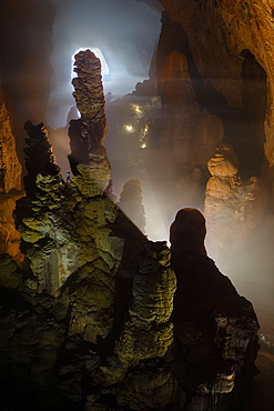
857-86805 - A caver is dwarfed by massive stalagmites in Hang Son Doong. Light can be seen coming in in the distance through the frist doline which is over 3 km away. Hang Son Doong is located in Phong Nha Ke Bang National Park, Vietnam.
858-10 - The Saint Martin’s Island, locally known as Narkel Jinjira. It is the only coral island and one of the most famous tourist spots of Bangladesh. The 13 sq km island is a tropical treasure, situated 17 km away from Teknak and located in the northeast of the Bay of Bengal. Bangladesh
797-12085 - Germany, Berlin, The East Side Gallery, a 1.3 km long section of the Berlin Wall, Wall paintings and signs advertising Souvenirs and Tourist Shop.
797-12066 - Germany, Berlin, The East Side Gallery, a 1.3 km long section of the Berlin Wall, mural with the word Berlin prominently displayed.
797-12089 - Germany, Berlin, The East Side Gallery, a 1.3 km long section of the Berlin Wall, Mural by Jolly Kunjappu called 'Dancing to Freedom'.
797-12065 - Germany, Berlin, The East Side Gallery, a 1.3 km long section of the Berlin Wall, mural with the word Berlin prominently displayed.
797-12071 - Germany, Berlin, The East Side Gallery, a 1.3 km long section of the Berlin Wall, Mural known as ‘It happened in November’ by Kani Alavi.
797-12088 - Germany, Berlin, The East Side Gallery, a 1.3 km long section of the Berlin Wall, 'The Wall Jumper' by Gabriel Heimler.
797-12068 - Germany, Berlin, The East Side Gallery, a 1.3 km long section of the Berlin Wall, Mural known as Save our Earth by Artist Indiano.
797-12079 - Germany, Berlin, The East Side Gallery, a 1.3 km long section of the Berlin Wall, Mural called Homage to the Young Generation by Thierry Noir.
797-12075 - Germany, Berlin, The East Side Gallery, a 1.3 km long section of the Berlin Wall, Birgit Kinder's mural known as 'Test the Best' .
797-12074 - Germany, Berlin, The East Side Gallery, a 1.3 km long section of the Berlin Wall, Birgit Kinder's mural known as 'Test the Best'.
797-12069 - Germany, Berlin, The East Side Gallery, a 1.3 km long section of the Berlin Wall, Mural known as Save our Earth by Artist Indiano.
797-12080 - Germany, Berlin, The East Side Gallery, a 1.3 km long section of the Berlin Wall, A mural by Georg Lutz depicts former Soviet leader Mikhail Gorbachev driving.
797-12072 - Germany, Berlin, The East Side Gallery, a 1.3 km long section of the Berlin Wall, Mural known as ‘It happened in November’ by Kani Alavi.
797-12087 - Germany, Berlin, The East Side Gallery, a 1.3 km long section of the Berlin Wall.
797-12083 - Germany, Berlin, The East Side Gallery, a 1.3 km long section of the Berlin Wall, Another colourful section.
797-12073 - Germany, Berlin, The East Side Gallery, a 1.3 km long section of the Berlin Wall, Mural known as ‘It happened in November’ by Kani Alavi.
797-12076 - Germany, Berlin, The East Side Gallery, a 1.3 km long section of the Berlin Wall, Mural called 'My God help me survive this deadly love' Soviet Premier Brezhnev kisses East German Chancellor Honecker.
797-12070 - Germany, Berlin, The East Side Gallery, a 1.3 km long section of the Berlin Wall, Mural known as ‘It happened in November’ by Kani Alavi.
797-12077 - Germany, Berlin, The East Side Gallery, a 1.3 km long section of the Berlin Wall, Mural called My God help me survive this deadly love, Soviet Premier Brezhnev kisses East German Chancellor Honecker.
797-12067 - Germany, Berlin, The East Side Gallery, a 1.3 km long section of the Berlin Wall, Mural known as 'Save our Earth' by Artist Indiano.
797-12090 - Germany, Berlin, The East Side Gallery, a 1.3 km long section of the Berlin Wall.
797-12078 - Germany, Berlin, The East Side Gallery, a 1.3 km long section of the Berlin Wall, Mural called Homage to the Young Generation by Thierry Noir.
832-349684 - Markt Schwaben, GER, 26. June 2006 - A car passes a sign which marks the begin of a speed limited zone in Markt Schwaben Bavaria Germany.
832-325903 - RIEGL LR90-235/P laser speed trap indicating 47km/h in a 30 km/h zone in Odenthal-Voiswinkel, North Rhine-Westphalia, Germany
832-318167 - DEU, Germany, Essen: Traffic speed control in a speeding zone of 30 km/h near a school, with a laser measure gun. Daily police life. Officer from a city police station.
832-283851 - Geothermal power plant which uses the hot water coming from drill holes 2 km deep near the volcano Krafla Iceland
832-283850 - Geothermal power plant which uses the hot water coming from drill holes 2 km deep near the volcano Krafla Iceland
832-283140 - Smoke coming from Mt. Augustine Volcano (Ring of Fire) at sunset, picture taken from ca 140 km away, Kenai Peninsula, Alaska, USA
1113-94920 - Old going concern convent Rizong, founded in 1833, situated 3450m above sea level, 76 km west of Leh, Ladakh, Jammu and Kashmir, India
1113-94905 - Monk looking out of a painted window, inner shrine at convent Rizong, founded in 1833, situated 3450m above sea level, 76 km west of Leh, Ladakh, Jammu and Kashmir, India
832-246709 - Gondola, Teleferico, highest and longest aerial tramway of the world, at altitude of 4765 m, length of 12.5 km, Merida, Venezuela, South America
832-213366 - Indian women fetching water in the desert about 50 km away from Jaisalmer, Rajasthan, India
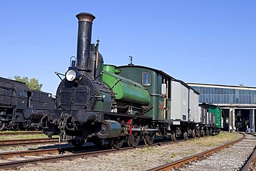
832-187906 - Licaon steam locomotive, the oldest operational locomotive in the world, built in 1851 in Austria, maximum speed 40 km/h, Railway Museum Strasshof, Austria, Europe
832-128182 - Kriziu kalnas, The Hill of Crosses, a site of pilgrimage, 12 km north of the city of Siauliai, Lithuania, Northern Europe
832-128193 - Kriziu kalnas, The Hill of Crosses, a site of pilgrimage, 12 km north of the city of Siauliai, Lithuania, Northern Europe
832-128284 - Kriziu kalnas, The Hill of Crosses, a site of pilgrimage, 12 km north of the city of Siauliai, Lithuania, Northern Europe
832-128190 - Kriziu kalnas, The Hill of Crosses, a site of pilgrimage, 12 km north of the city of Siauliai, Lithuania, Northern Europe
832-128191 - Kriziu kalnas, The Hill of Crosses, a site of pilgrimage, 12 km north of the city of Siauliai, Lithuania, Northern Europe
832-128490 - View from the Aletsch Panorama Trail down to the 23, 1 km long Aletsch Glacier, Canton of Valais, Switzerland, Europe
832-128184 - Kriziu kalnas, The Hill of Crosses, a site of pilgrimage, 12 km north of the city of Siauliai, Lithuania, Northern Europe


