Recent searches
Loading...
1131-2113 - AI generated image of a stylized beautifully multicolored Madagascar sunset butterfly in natural leafy environment, Ecuador
1131-2105 - AI generated image of two tomato frogs on leaves, Madagascar, Africa
1131-2106 - AI generated image of two tomato frogs on leaves, Madagascar, Africa
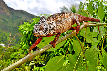
860-292262 - Oustalet's Chameleon (Furcifer oustaleti) on a branch, Madagascar
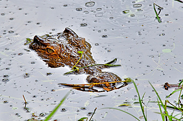
860-292261 - Nile Crocodile (Crocodylus niloticus) in water, Madagascar
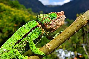
860-292260 - Globe-horned Chameleon (Chamaeleo globifer) on a branch, C. Madagascar
759-11119 - Pollini Cichlid, Paratilapia polleni, Madagascar
860-291671 - Parson's chameleon (Calumma parsonii)
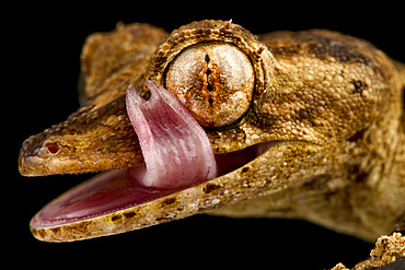
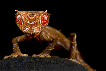
860-291668 - Lined leaf-tailed gecko (Uroplatus lineatus)
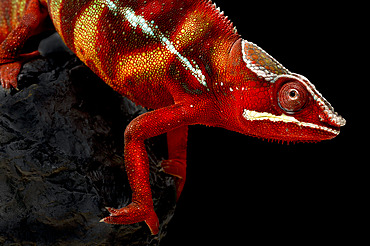
860-291549 - Panther chameleon (Furcifer pardalis) male.
860-291548 - Panther chameleon (Furcifer pardalis) male.
1358-123 - The beach at Nosy Komba island, North West Madagascar, Indian Ocean, Africa
1358-122 - Beach at Nosy Komba island, North West Madagascar, Indian Ocean, Africa
1358-121 - Panther chameleon (Furcifer pardalis) at Nosy Komba island, North West Madagascar, Indian Ocean, Africa
1358-119 - Beach at Nosy Komba island, North West Madagascar, Indian Ocean, Africa
1358-92 - Boat on the beach at Nosy Komba island, North West Madagascar, Indian Ocean, Africa
860-291312 - Henkel?s leaf-tailed gecko (Uroplatus henkeli), on black background
860-291179 - Baobabs (Adansonia grandidieri) at sunrise near the water with reflection. Morondava. Madagascar..
1358-74 - Giant Madagascar Day Gecko (Phelsuma grandis) hanging from a banana tree, Nosy Be, North West Madagascar, Indian Ocean, Africa
1358-71 - Beach umbrellas and deck chairs by the sea at Nosy Be island, Nosy Komba, North West Madagascar, Indian Ocean, Africa
1358-70 - Wooden coastal sailing boats anchored at Nosy Be island, North West Madagascar, Indian Ocean, Africa
1358-61 - Traditional wooden sailing vessel at sea off the North West coast of Madagascar, Indian Ocean, Africa
1111-225 - Landscape of Isalo National Park, Madagascar, Africa
1111-215 - Zebu cattle herders, Isalo, Madagascar, Africa
1111-217 - Ring tailed lemur, Isalo National Park, Isalo, Madagascar, Africa
1111-219 - Portrait of woman carrying water, with her face painted to protect the skin from the sun, Isalo, Madagascar, Africa
1111-226 - Villagers panning for diamonds, Ilakaka, Madagascar, Africa
1111-216 - Ring tailed lemur, Isalo National Park, Isalo, Madagascar, Africa
1111-218 - Ring tailed lemur, Isalo National Park, Isalo, Madagascar, Africa
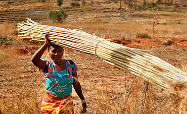
1111-221 - Portrait of local villager collecting Bamboo, Isalo, Madagascar, Africa
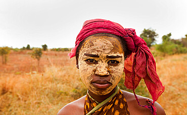
1111-227 - Portrait of young woman wearing dry mud, used to preserve the skin and protect from the sun, Isalo, Madagascar, Africa
1111-222 - Portrait of local villager collecting Bamboo, Isalo, Madagascar, Africa
1111-223 - Landscape of Isalo National Park, Isalo, Madagascar, Africa
1111-228 - Villagers panning for diamonds, Ilakaka, Madagascar, Africa
1111-220 - Local villagers collecting Bamboo, Isalo, Madagascar, Africa
1111-224 - Common brown lemur, Isalo, Madagascar, Africa
1111-210 - Parson's Chameleon, Female Panther Chameleon reptile, Peyreras Reserve, Andasibe, Madagascar, Africa
1111-208 - Black and white ruffed lemur, Lemur Island. Madagascar, Africa
1111-212 - Hillside houses, Antananarivo, Madagascar, Africa
1111-201 - Baobab trees, Reniala Reserve, Ifaty, Madagascar, Africa
1111-206 - Grey bamboo lemur, Lemur Island, Madagascar, Africa
1111-204 - Common brown lemur (Eulemur fulvus) at Lemur Park, Madagascar, Africa
1111-209 - Parson's Chameleon, Female Panther Chameleon reptile, Peyreras Reserve, Andasibe, Madagascar, Africa
1111-214 - Village of Turning of the Bones Ceremony, which occurs every five to seven years throughout Madagascar, Ambositra, Madagascar, Africa
1111-202 - Vezo tribe rely entirely on the Mozambique Channel for their subsistence, Madagascar, Indian Ocean, Africa
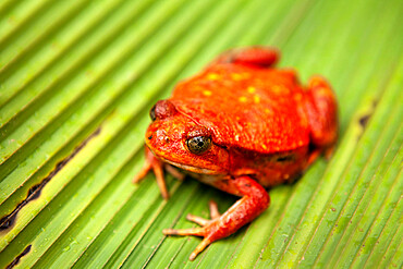
1111-213 - Orange frog, Peyreras Reserve, Andasibe, Madagascar, Africa
1111-205 - Grey bamboo lemur, Lemur Island, Madagascar, Africa
1111-211 - Grey chameleon, Peyreras Reserve, Andasibe, Madagascar, Africa
1111-207 - Grey bamboo lemur, Lemur Island, Madagascar, Africa
1113-107665 - sharp-edged karst landscape, Tsingy de Bemaraha National Park, Madagascar, Mahajanga Province, Africa, UNESCO World Heritage Site
1113-107668 - Guide watches as woman crosses rope bridge, karst landscape in Tsingy de Bemaraha National Park, Madagascar, Mahajanga Province, Africa, UNESCO World Heritage Site
1113-107663 - Rova Antananarivo (former Royal Palace), Madagascar, Africa
1113-107660 - Church at Rova Antananarivo (former Royal Palace), Madagascar, Africa
1113-107667 - Woman anxiously crossing rope bridge, karst landscape in Tsingy de Bemaraha National Park, Madagascar, Mahajanga Province, Africa, UNESCO World Heritage Site
1113-107670 - Boat trip through the Canal des Pamgalanes, Madagascar, Africa
1113-107662 - Cathedral of the Immaculate Conception, Antananarivo capital, Madagascar, Africa
1113-107661 - Stone sculpture at Rova Antananarivo (former Royal Palace), Madagascar, Africa
1113-107659 - Ruins of the Rova Antananarivo (former Royal Palace), Madagascar, Africa
1113-107669 - Boat trip through the Canal des Pamgalanes, Madagascar, Africa
1113-107664 - National Park Center, Tsingy de Bemaraha National Park, Madagascar, Mahajanga Province, Africa, UNESCO World Heritage Site
1113-107666 - Man getting out of boat on Manambolo River, Tsingy de Bemaraha National Park, Bekopaka, Madagascar, Mahajanga Province, Africa, UNESCO World Heritage Site
1358-37 - Outrigger boat seen through vegetation on the beach at Nosy Komba, North West Madagascar.
1358-29 - Boat anchored off the beach at Nosy Komba island, North West Madagascar.
1358-28 - Boat seen through lush vegetation at Nosy Komba Island in the North West of Madagascar.
1358-27 - Boat on the beach seen through lush vegetation at Nosy Komba island, in the North West of Madagascar.
860-290717 - Malamakibo daygecko (Phelsuma malamakibo)
860-290718 - Gunther's leaf-tailed gecko (Uroplatus guentheri)
860-290715 - Spearpoint leaf-tailed gecko (Uroplatus ebenaui)
1348-2802 - Brick workers near Ranomafana, Haute Matsiatra Region, Madagascar
1348-4483 - Cyclone Gafilo, Indian Ocean, In 2004, True Colour Satellite Image. Tropical Cyclone Gafilo over the Indian Ocean, Northwest of Madagascar, on 6 March 2004. True-colour satellite image using MODIS data.
1348-2785 - Making aluminum near Ambatolampy in the Central Highlands of Madagascar
1348-2814 - Brick workers near Ranomafana, Haute Matsiatra Region, Madagascar
1348-2813 - Brick workers near Ranomafana, Haute Matsiatra Region, Madagascar
1348-2788 - Making crafts from Zebu horn, Antisrabe, Madagascar Central Highlands
1348-2787 - Portrait of brick makers near Ranomafana, Madagascar Central Highlands
1348-2791 - Weaving with silk, Ambalavao, Madagascar Central Highlands
1348-4611 - Madagascar, True Colour Satellite Image. Madagascar, true colour satellite image. This image was compiled from data acquired by LANDSAT 5 & 7 satellites.
1348-3366 - Satellite view of Southern Africa. It shows the African Great Lakes region. This image was compiled from data acquired by Landsat 7 & 8 satellites.
1348-4579 - Betsiboka River, Madagascar, True Colour Satellite Image. Betsiboka river, the major river of Madagascar, goes into the Mozambique canal, close to the city of Mahajanga.
1348-2811 - Brick workers near Ranomafana, Haute Matsiatra Region, Madagascar
1348-2799 - Brick workers near Ranomafana, Haute Matsiatra Region, Madagascar
1348-2803 - Brick workers near Ranomafana, Haute Matsiatra Region, Madagascar
1348-2808 - Brick workers near Ranomafana, Haute Matsiatra Region, Madagascar
1348-2784 - Making aluminum near Ambatolampy in the Central Highlands of Madagascar
1348-2810 - Brick workers near Ranomafana, Haute Matsiatra Region, Madagascar
1348-4514 - Mayotte, Africa, True Colour Satellite Image. Satellite view of Mayotte, an overseas collectivity of France, in the northern Mozambique Channel in the Indian Ocean. This image was compiled from data acquired by LANDSAT 5 & 7 satellites.
1348-2790 - Andohasana Monday Pig Market, Madagascar Central Highlands
1348-2793 - Weaving with silk, Ambalavao, Madagascar Central Highlands
1348-2816 - Brick workers near Ranomafana, Haute Matsiatra Region, Madagascar
1348-2815 - Brick workers near Ranomafana, Haute Matsiatra Region, Madagascar
1348-2804 - Brick workers near Ranomafana, Haute Matsiatra Region, Madagascar
1348-2805 - Brick workers near Ranomafana, Haute Matsiatra Region, Madagascar
1348-2812 - Brick workers near Ranomafana, Haute Matsiatra Region, Madagascar
1348-2789 - Making aluminum near Ambatolampy in the Central Highlands of Madagascar
1348-2806 - Brick workers near Ranomafana, Haute Matsiatra Region, Madagascar
1348-2786 - Making aluminum near Ambatolampy in the Central Highlands of Madagascar
1348-2807 - Brick workers near Ranomafana, Haute Matsiatra Region, Madagascar
1348-2809 - Brick workers near Ranomafana, Haute Matsiatra Region, Madagascar
1348-2792 - Weaving with silk, Ambalavao, Madagascar Central Highlands


