Recent searches
Loading...
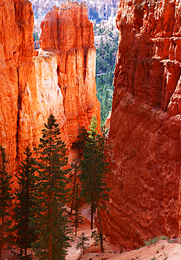
1365-175 - Navajo Loop trail descending from Sunrise Point, Bryce Canyon, Utah, United States of America, North America
1311-491 - The Village of Oak Creek on the south side of Sedona viewed from the Airport Loop Trail, Arizona, United States of America, North America
1218-1478 - Woman hiking along The Petrified Forest Loop Trail inside Theodore Roosevelt National Park, North Dakota, United States of America, North America
1218-1480 - Beautiful sight on The Petrified Forest Loop Trail inside Theodore Roosevelt National Park, North Dakota, United States of America, North America
1218-1479 - Beautiful sight on The Petrified Forest Loop Trail inside Theodore Roosevelt National Park, North Dakota, United States of America, North America
1218-1477 - Man enjoying the view along The Petrified Forest Loop Trail inside Theodore Roosevelt National Park, North Dakota, United States of America, North America
1310-224 - Colourful rock formation in the Queen's Garden beside the Navajo Loop Trail, Bryce Canyon National Park, Utah, United States of America, North America
1310-220 - High cliffs towering above the Navajo Loop Trail below Sunset Point, Bryce Canyon National Park, Utah, United States of America, North America
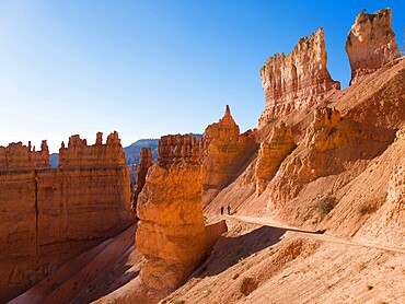
1310-221 - Two hikers heading down the Navajo Loop Trail below Sunset Point, Bryce Canyon National Park, Utah, United States of America, North America
832-384052 - Rock formation Thors Hammer, morning light, snow-covered bizarre rock landscape with Hoodoos in winter, Navajo Loop Trail, Bryce Canyon National Park, Utah, USA, North America
832-384048 - Rock formation Thors Hammer, morning light, bizarre snowy rock landscape with Hoodoos in winter, Navajo Loop Trail, Bryce Canyon National Park, Utah, USA, North America
832-384053 - Morning light, snow-covered bizarre rocky landscape with Hoodoos in winter, Navajo Loop Trail, Bryce Canyon National Park, Utah, USA, North America
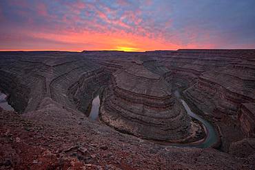
832-384679 - Goosenecks at sunset, river loop, meander of the San Juan River, Goosenecks State Park, Utah, America, USA, North America
1218-1113 - Woman in Desert Loop Trail in Carlsbad Caverns National Park, New Mexico, United States of America, North America
844-20738 - View of Loop train at station, Downtown Chicago, Illinois, United States of America, North America
844-20732 - View of Loop train and skyscrapers, Downtown Chicago, Illinois, United States of America, North America
844-20715 - View of Loop Train on North Wabash Avenue, Chicago, Illinois, United States of America, North America
844-20713 - View of Loop Train on North Wabash Avenue, Chicago, Illinois, United States of America, North America
844-20714 - View of Loop Train on North Wabash Avenue, Chicago, Illinois, United States of America, North America
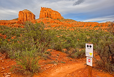
1311-61 - Cathedral Rock at the intersection of upper Baldwin Loop and HiLine Trails with sign warning that the HiLine Trail is for experts only, Sedona, Arizona, United States of America, North America
1311-52 - High angle view of Boulder Creek, the Watson Lake Loop Trail crosses this creek, Prescott, Arizona, United States of America, North America
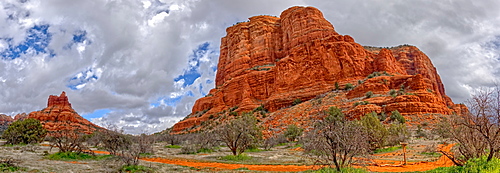
1311-50 - Panorama South view of Courthouse Butte and the Judges Bench from Courthouse Butte Loop Trail in Sedona, Arizona, United States of America, North America
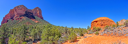
1311-33 - Panorama of Bell Rock and Courthouse Butte, viewed from Big Park Loop Trail, Sedona, Arizona, United States of America, North America
1284-44 - Two Chicago CTA L trains near Adams and Wabash station in The Loop, Chicago, Illinois, United States of America, North America
1284-46 - Oriental Theatre, Loop Theater District, Chicago, Illinois, United States of America, North America
1112-3519 - View of hoodoo formations from the Navajo Loop Trail in Bryce Canyon National Park, Utah, United States of America, North America
1112-3523 - View of hoodoo formations from the Navajo Loop Trail in Bryce Canyon National Park, Utah, United States of America, North America
1112-3522 - View of hoodoo formations from the Navajo Loop Trail in Bryce Canyon National Park, Utah, United States of America, North America
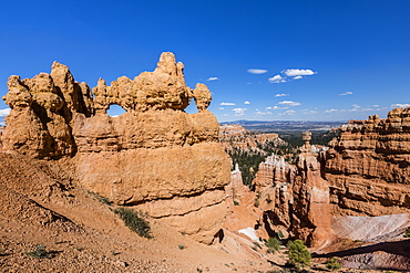
1112-3521 - View of Thor's Hammer from the Navajo Loop Trail in Bryce Canyon National Park, Utah, United States of America, North America
1112-3520 - View of Thor's Hammer from the Navajo Loop Trail in Bryce Canyon National Park, Utah, United States of America, North America
1112-3524 - View of The Amphitheater from the Navajo Loop Trail in Bryce Canyon National Park, Utah, United States of America, North America
1226-396 - CTA train on the Loop track which runs above ground in downtown Chicago, Illinois, United States of America, North America
799-3230 - Carson Peak, reflected in the mist shrouded waters of Silver Lake on the June Lake Loop, Eastern Sierras, California, United States of America, North America
857-89709 - Hikers setup camp on a beach along the Colorado River near the plumeting 180-foot Deer Creek Falls in the Grand Canyon outside of Fredonia, Arizona November 2011. The 21.4-mile loop starts at the Bill Hall trailhead on the North Rim and descends 2000-feet in 2.5-miles through Coconino Sandstone to the level Esplanada then descends further into the lower canyon through a break in the 400-foot-tall Redwall to access Surprise Valley. Hikers connect Thunder River and Tapeats Creek to a route along the Colorado River and climb out Deer Creek.
857-89713 - Female hiker cooks dinner on a cliff-pinched patio above camp and the Colorado River near Deer Creek Falls in the Grand Canyon outside of Fredonia, Arizona November 2011. The 21.4-mile loop starts at the Bill Hall trailhead on the North Rim and descends 2000-feet in 2.5-miles through Coconino Sandstone to the level Esplanada then descends further into the lower canyon through a break in the 400-foot-tall Redwall to access Surprise Valley. Hikers connect Thunder River and Tapeats Creek to a route along the Colorado River and climb out Deer Creek.
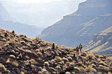
857-89701 - Hikers on the sandstone Esplanade of the Thunder River Trail below the North Rim of the Grand Canyon outside Fredonia, Arizona November 2011. The 21.4-mile loop descends 2000-feet in 2.5-miles through Coconino Sandstone from the Bill Hall trailhead to connect the Thunder River and Deer Creeks trails. Hikers descend into the lower canyon through a break in the 400-foot-tall Redwall to access Surprise Valley, Deer Creek, Tapeats Creek via Thunder River and even the Colorado River.
857-89710 - Hikers cook dinner on a cliff-pinched patio above camp and the Colorado River near Deer Creek Falls in the Grand Canyon outside of Fredonia, Arizona November 2011. The 21.4-mile loop starts at the Bill Hall trailhead on the North Rim and descends 2000-feet in 2.5-miles through Coconino Sandstone to the level Esplanada then descends further into the lower canyon through a break in the 400-foot-tall Redwall to access Surprise Valley. Hikers connect Thunder River and Tapeats Creek to a route along the Colorado River and climb out Deer Creek.
857-89708 - Hikers swim in the pool below 180-foot Deer Creek Falls in the Grand Canyon outside of Fredonia, Arizona November 2011. The 21.4-mile loop starts at the Bill Hall trailhead on the North Rim and descends 2000-feet in 2.5-miles through Coconino Sandstone to the level Esplanada then descends further into the lower canyon through a break in the 400-foot-tall Redwall to access Surprise Valley. Hikers connect Thunder River and Tapeats Creek to a route along the Colorado River and climb out Deer Creek.
857-89717 - Hikers follow a route along the Colorado River that connect Tapeats Creek and Thunder River to Deer Creek in the Grand Canyon outside of Fredonia, Arizona November 2011. The 21.4-mile loop starts at the Bill Hall trailhead on the North Rim and descends 2000-feet in 2.5-miles through Coconino Sandstone to the level Esplanada then descends further into the lower canyon through a break in the 400-foot-tall Redwall to access Surprise Valley. Hikers connect Thunder River and Tapeats Creek to a route along the Colorado River and climb out Deer Creek.
857-89712 - Male hiker filters water on a cliff-pinched patio near Deer Creek Falls in the Grand Canyon outside of Fredonia, Arizona November 2011. The 21.4-mile loop starts at the Bill Hall trailhead on the North Rim and descends 2000-feet in 2.5-miles through Coconino Sandstone to the level Esplanada then descends further into the lower canyon through a break in the 400-foot-tall Redwall to access Surprise Valley. Hikers connect Thunder River and Tapeats Creek to a route along the Colorado River and climb out Deer Creek.
857-89700 - Hikers on the sandstone Esplanade of the Thunder River Trail below the North Rim of the Grand Canyon outside Fredonia, Arizona November 2011. The 21.4-mile loop descends 2000-feet in 2.5-miles through Coconino Sandstone from the Bill Hall trailhead to connect the Thunder River and Deer Creeks trails. Hikers descend into the lower canyon through a break in the 400-foot-tall Redwall to access Surprise Valley, Deer Creek, Tapeats Creek via Thunder River and even the Colorado River.
857-89703 - Hikers past small waterfalls along Deer Creek Narrows in the Grand Canyon outside of Fredonia, Arizona November 2011. The 21.4-mile loop starts at the Bill Hall trailhead on the North Rim and descends 2000-feet in 2.5-miles through Coconino Sandstone to the level Esplanada then descends further into the lower canyon through a break in the 400-foot-tall Redwall to access Surprise Valley. Hikers connect Thunder River and Tapeats Creek to a route along the Colorado River and climb out Deer Creek.
857-89711 - Male hiker filters water on a cliff-pinched patio near Deer Creek Falls in the Grand Canyon outside of Fredonia, Arizona November 2011. The 21.4-mile loop starts at the Bill Hall trailhead on the North Rim and descends 2000-feet in 2.5-miles through Coconino Sandstone to the level Esplanada then descends further into the lower canyon through a break in the 400-foot-tall Redwall to access Surprise Valley. Hikers connect Thunder River and Tapeats Creek to a route along the Colorado River and climb out Deer Creek.
857-89702 - Hikers walk along Deer Creek Narrows in the Grand Canyon outside of Fredonia, Arizona November 2011. The 21.4-mile loop starts at the Bill Hall trailhead on the North Rim and descends 2000-feet in 2.5-miles through Coconino Sandstone to the level Esplanada then descends further into the lower canyon through a break in the 400-foot-tall Redwall to access Surprise Valley. Hikers connect Thunder River and Tapeats Creek to a route along the Colorado River and climb out Deer Creek.
857-89705 - Hikers walk along Deer Creek Narrows in the Grand Canyon outside of Fredonia, Arizona November 2011. The 21.4-mile loop starts at the Bill Hall trailhead on the North Rim and descends 2000-feet in 2.5-miles through Coconino Sandstone to the level Esplanada then descends further into the lower canyon through a break in the 400-foot-tall Redwall to access Surprise Valley. Hikers connect Thunder River and Tapeats Creek to a route along the Colorado River and climb out Deer Creek.
799-2876 - Carson Peak reflected in Silver Lake at dawn, June Lake Loop, California, United States of America, North America
1178-7771 - USA, Illinois, North Loop in Chicago panorama
857-86011 - Hikers walk along Deer Creek Narrows in the Grand Canyon outside of Fredonia, Arizona November 2011. The 21.4-mile loop starts at the Bill Hall trailhead on the North Rim and descends 2000-feet in 2.5-miles through Coconino Sandstone to the level Esplanada then descends further into the lower canyon through a break in the 400-foot-tall Redwall to access Surprise Valley. Hikers connect Thunder River and Tapeats Creek to a route along the Colorado River and climb out Deer Creek.
857-86023 - Male hiker filters water on a cliff-pinched patio near Deer Creek Falls in the Grand Canyon outside of Fredonia, Arizona November 2011. The 21.4-mile loop starts at the Bill Hall trailhead on the North Rim and descends 2000-feet in 2.5-miles through Coconino Sandstone to the level Esplanada then descends further into the lower canyon through a break in the 400-foot-tall Redwall to access Surprise Valley. Hikers connect Thunder River and Tapeats Creek to a route along the Colorado River and climb out Deer Creek.
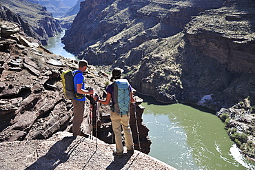
857-86016 - Hikers overlook the Colorado River as they exit the Deer Creek Narrows in the Grand Canyon outside of Fredonia, Arizona November 2011. The 21.4-mile loop starts at the Bill Hall trailhead on the North Rim and descends 2000-feet in 2.5-miles through Coconino Sandstone to the level Esplanada then descends further into the lower canyon through a break in the 400-foot-tall Redwall to access Surprise Valley. Hikers connect Thunder River and Tapeats Creek to a route along the Colorado River and climb out Deer Creek.
857-86021 - Hikers setup camp on a beach along the Colorado River near the plumeting 180-foot Deer Creek Falls in the Grand Canyon outside of Fredonia, Arizona November 2011. The 21.4-mile loop starts at the Bill Hall trailhead on the North Rim and descends 2000-feet in 2.5-miles through Coconino Sandstone to the level Esplanada then descends further into the lower canyon through a break in the 400-foot-tall Redwall to access Surprise Valley. Hikers connect Thunder River and Tapeats Creek to a route along the Colorado River and climb out Deer Creek.
857-86015 - Hikers walk along Deer Creek Narrows in the Grand Canyon outside of Fredonia, Arizona November 2011. The 21.4-mile loop starts at the Bill Hall trailhead on the North Rim and descends 2000-feet in 2.5-miles through Coconino Sandstone to the level Esplanada then descends further into the lower canyon through a break in the 400-foot-tall Redwall to access Surprise Valley. Hikers connect Thunder River and Tapeats Creek to a route along the Colorado River and climb out Deer Creek.
857-86013 - Hikers walk along Deer Creek Narrows in the Grand Canyon outside of Fredonia, Arizona November 2011. The 21.4-mile loop starts at the Bill Hall trailhead on the North Rim and descends 2000-feet in 2.5-miles through Coconino Sandstone to the level Esplanada then descends further into the lower canyon through a break in the 400-foot-tall Redwall to access Surprise Valley. Hikers connect Thunder River and Tapeats Creek to a route along the Colorado River and climb out Deer Creek.
857-86000 - Hikers on the sandstone Esplanade of the Thunder River Trail below the North Rim of the Grand Canyon outside Fredonia, Arizona November 2011. The 21.4-mile loop descends 2000-feet in 2.5-miles through Coconino Sandstone from the Bill Hall trailhead to connect the Thunder River and Deer Creeks trails. Hikers descend into the lower canyon through a break in the 400-foot-tall Redwall to access Surprise Valley, Deer Creek, Tapeats Creek via Thunder River and even the Colorado River.
1167-596 - Thor's Hammer from the Navajo Loop Trail on a partially cloudy day, Bryce Canyon National Park, Utah, United States of America, North America
857-86025 - Hikers follow a route along the Colorado River that connect Tapeats Creek and Thunder River to Deer Creek in the Grand Canyon outside of Fredonia, Arizona November 2011. The 21.4-mile loop starts at the Bill Hall trailhead on the North Rim and descends 2000-feet in 2.5-miles through Coconino Sandstone to the level Esplanada then descends further into the lower canyon through a break in the 400-foot-tall Redwall to access Surprise Valley. Hikers connect Thunder River and Tapeats Creek to a route along the Colorado River and climb out Deer Creek.
857-86007 - Hikers cook dinner along Deer Creek Narrows in the Grand Canyon outside of Fredonia, Arizona November 2011. The 21.4-mile loop starts at the Bill Hall trailhead on the North Rim and descends 2000-feet in 2.5-miles through Coconino Sandstone to the level Esplanada then descends further into the lower canyon through a break in the 400-foot-tall Redwall to access Surprise Valley. Hikers connect Thunder River and Tapeats Creek to a route along the Colorado River and climb out Deer Creek.
857-86027 - Hikers climb out of Surprise Valley to the North Rim of the Grand Canyon outside of Fredonia, Arizona November 2011. The 21.4-mile loop starts at the Bill Hall trailhead on the North Rim and descends 2000-feet in 2.5-miles through Coconino Sandstone to the level Esplanada then descends further into the lower canyon through a break in the 400-foot-tall Redwall to access Surprise Valley. Hikers connect Thunder River and Tapeats Creek to a route along the Colorado River and climb out Deer Creek.
857-86022 - Hikers setup camp on a beach along the Colorado River near the plumeting 180-foot Deer Creek Falls in the Grand Canyon outside of Fredonia, Arizona November 2011. The 21.4-mile loop starts at the Bill Hall trailhead on the North Rim and descends 2000-feet in 2.5-miles through Coconino Sandstone to the level Esplanada then descends further into the lower canyon through a break in the 400-foot-tall Redwall to access Surprise Valley. Hikers connect Thunder River and Tapeats Creek to a route along the Colorado River and climb out Deer Creek.
857-86003 - Hikers descend into Surprise Valley to access the lower canyon through a break in the 400-foot-tall Redwall on the Thunder River Trail in the Grand Canyon outside of Fredonia, Arizona November 2011. The 21.4-mile loop starts at the Bill Hall trailhead on the North Rim and descends 2000-feet in 2.5-miles through Coconino Sandstone to the level Esplanada then descends further into the lower canyon to access Thunder River, Tapeats Creek and Deer Creek.
832-375961 - Two boats navigating the Horseshoe Bend river bend, Colorado River, Gooseneck near Page, Arizona, USA, North America
832-374691 - Landmark "Tiger & Turtle - Magic Mountain" by Heike Mutter and Ulrich Genth, walkable sculpture in the shape of a roller coaster, on the Halde Heinrich-Hildebrand-Höhe heap, Angerpark, Duisburg, North Rhine-Westphalia, Germany, Europe, PublicGround
832-367562 - Aerial view, loop of the Rhine River, Oberkassel, Duesseldorf, Rhineland region, North Rhine-Westphalia, Germany, Europe
1167-208 - Hiker on Navajo Loop Trail with hoodoos and pine trees lit by early morning sun in winter, Bryce Canyon National Park, Utah, United States of America, North America
1167-198 - Hoodoos strongly lit by early morning sun with heavy cloud, Peekaboo Loop Trail in winter, Bryce Canyon National Park, Utah, United States of America, North America
1167-197 - Hoodoos and snow with layers of cloud, from Peekaboo Loop Trail in winter, Bryce Canyon National Park, Utah, United States of America, North America
1167-199 - Hoodoos strongly lit by early morning sun with heavy cloud, Peekaboo Loop Trail in winter, Bryce Canyon National Park, Utah, United States of America, North America
1167-200 - Peekaboo Loop Trail sign with snow and rocks lit by early morning winter sun, Bryce Canyon National Park, Utah, United States of America, North America
1167-195 - Snow clearing equipment at a tunnel through sunlit red rock in winter, Peekaboo Loop Trail, Bryce Canyon National Park, Utah, United States of America, North America
1167-194 - Peekaboo Loop Trail switchbacks wind through hoodoos lit by early morning sun in winter, Bryce Canyon National Park, Utah, United States of America, North America
1167-196 - Distant view with cloud layers from elevated position on Peekaboo Loop Trail in winter, Bryce Canyon National Park, Utah, United States of America, North America
1167-193 - Wall of Windows from base in early morning sun, snow and pine trees, Peekaboo Loop Trail, Bryce Canyon National Park, Utah, United States of America, North America
1167-192 - Hiker in front of Wall of Windows lit by early morning sun, icy Peekaboo Loop Trail, Bryce Canyon National Park, Utah, United States of America, North America
1167-170 - Wall of Windows lit by early morning sun, silhouetted rock, Peekaboo Loop Trail, Bryce Canyon National Park, Utah, United States of America, North America
1167-171 - Snowy cliffs from Peekaboo Loop Trail, Bryce Canyon National Park, Utah, United States of America, North America
1167-166 - Hoodoos lit by early morning sun in winter, Peekaboo Loop Trail, Bryce Canyon National Park, Utah, United States of America, North America
1167-168 - Snowy cliffs from Peekaboo Loop Trail, Bryce Canyon National Park, Utah, United States of America, North America
1167-172 - Icy Peekaboo Loop Trail with hoodoos, trees and snow in the early morning, Bryce Canyon National Park, Utah, United States of America, North America
1167-167 - Hiker takes a break on the Peekaboo Loop Trail in winter, with snowy red rocks and cliffs, Bryce Canyon National Park, Utah, United States of America, North America
1167-165 - Large hoodoo lit by early morning sun, with snow and pine trees, Peekaboo Loop Trail, Bryce Canyon National Park, Utah, United States of America, North America
799-2532 - Frosty autumn morning on June Lake Loop in the Eastern Sierra Mountains, California, United States of America, North America
832-245405 - Aerial photo, Lenne river, Werdohl, Maerkischer Kreis, Sauerland, North Rhine-Westphalia, Germany, Europe
832-243980 - Aerial photograph, motorway loop, Autobahn ramp A45, B1 Ruhr Highway exit, Bochum-Stahlhausen, Wattenscheider Strasse, Bochum, Ruhr Area, North Rhine-Westphalia, Germany, Europe
832-186421 - Cranger Kirmes fair, the biggest fair in the Ruhr area, at the Rhine-Herne Canal, Herne, North Rhine-Westphalia, Germany, Europe
832-186425 - Cranger Kirmes fair, the biggest fair in the Ruhr area, at the Rhine-Herne Canal, Herne, North Rhine-Westphalia, Germany, Europe
832-186422 - Cranger Kirmes fair, the biggest fair in the Ruhr area, at the Rhine-Herne Canal, Herne, North Rhine-Westphalia, Germany, Europe
832-186423 - Cranger Kirmes fair, the biggest fair in the Ruhr area, at the Rhine-Herne Canal, Herne, North Rhine-Westphalia, Germany, Europe
832-186424 - Cranger Kirmes fair, the biggest fair in the Ruhr area, at the Rhine-Herne Canal, Herne, North Rhine-Westphalia, Germany, Europe
832-156531 - Aerial photo, Lippe River, Lippe meander and meadows, Luenen city limits, Bergkamen, Ruhr area, North Rhine-Westphalia, Germany, Europe
832-138360 - Aerial view, floodplains of the Lippe river, meandering Lippe river, river bends, renaturation, Life-Project of the state government of NRW, Hamm, Ruhrgebiet area, North Rhine-Westfalia, Germany, Europe
832-138247 - Aerial view, Lohmann company, loop of the Ruhr river, Herbede, Ruhr river, Ruhrtal valley, Witten, Ruhrgebiet area, North Rhine-Westphalia, Germany, Europe
832-123916 - Oxbow Bend, Snake River bend, in front of the Teton Range with Mount Moran, Grand Teton National Park, Wyoming, United States of America, USA
832-123833 - Promenade, Chicago River Walk, 35 East Wacker Drive, formerly North American Life Insurance Building, Unitrin Building, Loop, Chicago, Illinois, United States of America, USA
832-123836 - View from the Chicago River towards Boeing World Headquarters, Loop, Chicago, Illinois, United States of America, USA
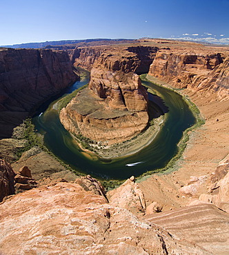
832-124257 - Horseshoe Bend, a horseshoe-shaped meander of the Colorado River, Arizona, USA, America
832-123917 - Oxbow Bend, Snake River bend, in front of the Teton Range with Mount Moran, Grand Teton National Park, Wyoming, United States of America, USA
832-123862 - State Central Bank, Federal Reserve Bank of Chicago, also known as Chicago Fed, Financial District, Chicago Loop, Chicago, Illinois, United States of America, USA, North America
832-123827 - View from the Chicago River towards the Reid Murdoch Center, Loop, Chicago, Illinois, United States of America, USA
832-118964 - Aerial view, Otto-Brenner-Strasse estate, loop road, Hasslinghausen, Sprockhoevel, Ruhrgebiet region, North Rhine-Westphalia, Germany, Europe
832-123887 - Night shot, Bataan Corregidor Memorial Bridge, River Loop, skyline, Marina City Twin Towers, 330 North Wabash, former IBM Building, John Hancock Center, Trump International Tower, Wrigley Building, Chicago University, Chicago, Illinois, United States of A
