Recent searches
Loading...
1372-334 - Mountain meadow with a lake on a high plateau. View over a high mountains with towering summits of the swiss alps on the horizon.
1372-316 - Vast arid volcanic landscape on high plateau of Tongariro National Park. New Zealand. Light before sunrise
1131-2085 - Mountain village on the Karester Yalas plateau, Trabzon, Turkey, Asia Minor, Asia
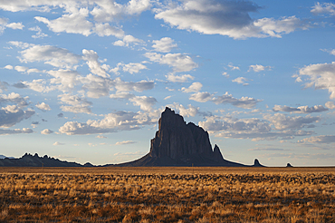
1178-44408 - Usa, New Mexico, Shiprock, Clouds over desert landscape with Shiprock
860-292147 - Peatland on the Varanger plateau in Norway in spring
860-292146 - Peatland on the Varanger plateau in Norway in spring
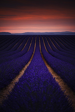
860-292121 - Morning mist over lavender fields, Puimoisson, Valensole plateau, Alpes-de-Haute-Provence, France
860-292119 - Lavender field on the Plateau de Valensole, Alpes-de-Haute-Provence, France
860-292120 - Lavender field on the Plateau de Valensole, Alpes-de-Haute-Provence, France
860-292109 - Lavender field on the Plateau de Valensole, Alpes-de-Haute-Provence, France
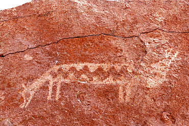
860-291990 - Pre-Hispanic petroglyphs. Stopover for caravans linking the altiplano to the Pacific coast. Hierbas Buenas, Atacama Desert, Chile.
832-403542 - View from Grosser Hundstod to Watzmann, Steinernes Meer, Berchtesgaden Alps, Upper Bavaria, Bavaria, Germany, Europe
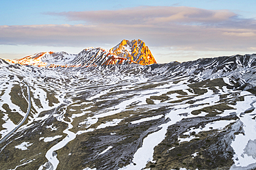
1361-275 - Aerial view of Campo Imperatore plateau during spring thaw at dawn, Gran Sasso and Monti della Laga National Park, L'Aquila province, Abruzzo, Italy, Europe
832-402947 - Mountain hiker, Hoher Ifen, 2230m, and Gottesacker plateau, Allgaeu Alps, border Bavaria, Germany, Vorarlberg, Europe
832-402946 - Hahnenkoepfle, 2085m, Gottesacker plateau, Kleinwalsertal, Vorarlberg, Austria, behind it the Allgaeu Alps, Bavaria, Germany, Europe
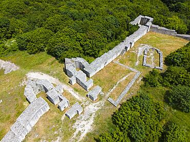
832-402781 - Aerial view, fortress, rock plateau Madara, Madara, Shumen, Shumla, Unesco World Heritage, Bulgaria, Europe
832-401527 - Landscape in the High Fens Nature Park in the Eifel, Belgium, Europe
1112-7666 - The Great Sphinx of Giza, a limestone statue of a reclining sphinx, UNESCO World Heritage Site, Giza Plateau, West Bank of the Nile, Cairo, Egypt, North Africa, Africa
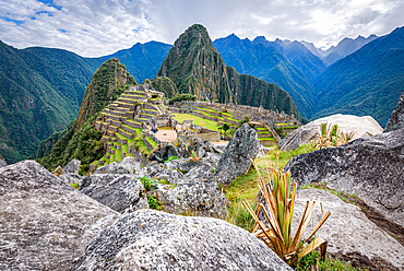
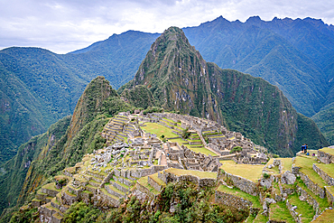
1174-11468 - The path to Machu Picchu, the high mountain capital of the Inca tribe, a 15th century citadel site, buildings and view of the plateau and Andes mountains.
1174-11467 - The path to Machu Picchu, the high mountain capital of the Inca tribe, a 15th century citadel site, buildings and view of the plateau and Andes mountains.
1174-11466 - The path to Machu Picchu, the high mountain capital of the Inca tribe, a 15th century citadel site, buildings and view of the plateau and Andes mountains.
1353-532 - Norwegian Pine Tree high on the Finnmark Plateau in snow backlit by the sun at sunset in winter, Finnmark Plateau, Arctic Circle, Norway, Scandinavia, Europe
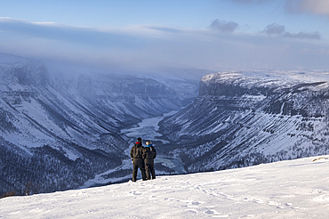
1353-529 - Alta Canyon and the Alta River from the Finnmark Plateau in winter, Finnmark Plateau, near Alta, Arctic Cirle, Norway, Scandinavia, Europe
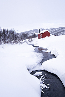
1353-525 - Traditional Sami Cabin (Hytte) in winter, near Lake Eoalbmejavri, Finnmark Plateau, Troms og Finnmark, Norway, Scandinavia, Europe
1353-523 - Cross Country Ski Trekker pulling a sled in winter over the remote Finnmark Plateau, near Alta, Finnmark Plateau, Troms og Finnmark, Norway, Scandinavia, Europe
1353-522 - Traditional Sami Cabin (Hytte) in winter, near Lake Eoalbmejavri, Finnmark Plateau, Troms og Finnmark, Norway, Scandinavia, Europe
1353-520 - Alta Canyon and the Alta River from the Finnmark Plateau in winter, Finnmark Plateau, near Alta, Arctic Circle, Norway, Scandinavia, Europe
1353-519 - Husky Dog Sledding at sunset on the Finnmark Plateau, near Alta, Arctic Circle, Norway, Scandinavia, Europe
1353-517 - Alta Canyon and the Alta River from the Finnmark Plateau in winter, Finnmark Plateau, near Alta, Arctic Circle, Norway, Scandinavia, Europe
1353-516 - Alta Canyon and the Alta River from the Finnmark Plateau in winter, Finnmark Plateau, near Alta, Arctic Circle, Norway, Scandinavia, Europe
1353-514 - Snowmobiles outside a traditional Sami Cabin (Hytte) in winter, near Lake Eoalbmejavri, Finnmark Plateau, Troms og Finnmark, Arctic Circle, Norway, Scandinavia, Europe
1353-513 - Couple in Snowsuits looking out over the Alta Canyon and Alta River from the Finnmark Plateau in winter, Finnmark Plateau, near Alta, Norway, Arctic Circle, Scandinavia, Europe
860-291732 - Village of Baume-les-Messieurs, 'Most beautiful village in France', Jura, France
860-291731 - Abbey and village of Baume-les-Messieurs, 'Most beautiful village in France', Jura, France
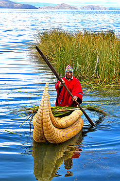
860-291596 - Aymara bringing back the totora (Schoenoplectus californicus subsp. tatora) that he has just cut. Lake Titicaca, Bolivia
860-291595 - Aymara harvesting totora (Schoenoplectus californicus subsp. tatora) with a knife attached to a stick. Lake Titicaca, Bolivia
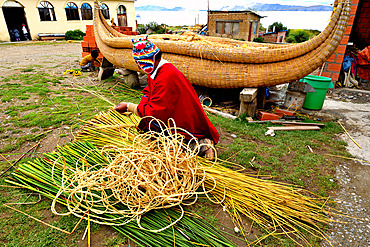
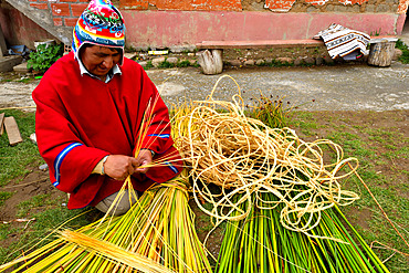
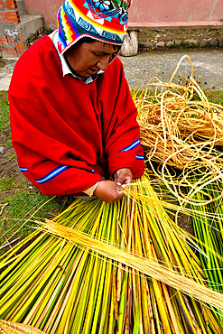
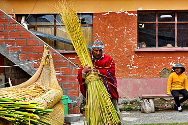
860-291593 - Aymara working the totora (Schoenoplectus californicus subsp. tatora), Lake Titicaca, Bolivia
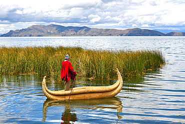
860-291594 - Aymara on their Totora boat (Schoenoplectus californicus subsp. tatora). Lake Titicaca, Bolivia
860-291592 - Aymara working the totora (Schoenoplectus californicus subsp. tatora), Lake Titicaca, Bolivia
860-291591 - Aymara working the totora (Schoenoplectus californicus subsp. tatora), Lake Titicaca, Bolivia
860-291590 - Aymara working the totora (Schoenoplectus californicus subsp. tatora), Lake Titicaca, Bolivia
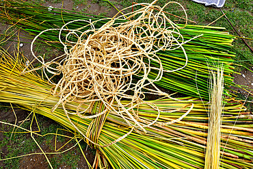
860-291589 - Totora (Schoenoplectus californicus subsp. tatora) used by the Aymaras, Lake Titicaca, Bolivia
860-291588 - Aymara working the Totora (Schoenoplectus californicus subsp. tatora), Lake Titicaca, Bolivia
860-291575 - First industrial solar power plant in South America in Calama: Calama Solar 3 is the first industrial plant of its kind to be built in South America. Province of Loa, Antofagasta region. Chile.
860-291574 - El Cebollar cobalt mine. Antofogasta Region N. Chile
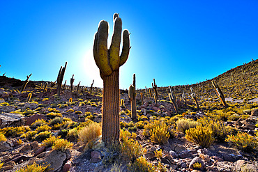
860-291569 - Atacama columnar cactus (Echinopsis atacamensis subsp. pasacanaor or Trichocereus pasacana), Isla del Pescado, Salar d'Uyuni, Altiplano, Bolivia.
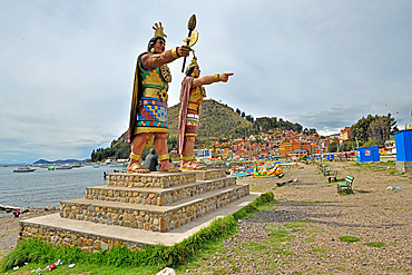
860-291566 - Statues of Manco Cápac, the first Inca ruler and his sister and wife Mama Ocllo, Copacabana Beach on Lake Titicaca, Bolivia
832-400550 - View of rocky plateau with snow and glacier at sunrise, on the Hochkoenig, Uebergossene Alm, view of the Steinernes Meer, Berchtesgaden Alps, Salzburger Land, Austria, Europe
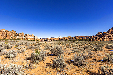
1178-44126 - United States, Utah, Zion National Park, Sandstone rock formation
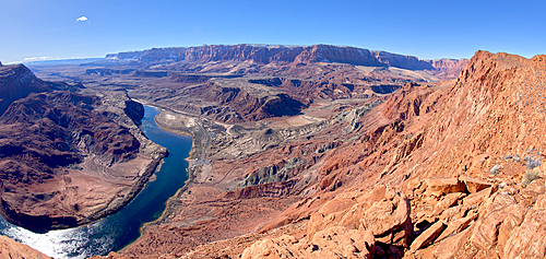
1311-622 - Panorama view from above Sand Hill Spring at Vermilion Cliffs National Monument, with snow covered land in the distance of the Kaibab Plateau, location of the Grand Canyon, Arizona, United States of America, North America
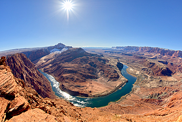
1311-608 - The Vermilion Cliffs adjacent to Glen Canyon Recreation Area viewed from the plateau at the end of Spencer Trail in Marble Canyon with Lee's Ferry on the lower left with the Colorado River, Arizona, United States of America, North America
1311-607 - The bend in the Colorado River at Lee's Ferry in Glen Canyon Recreation Area viewed from the plateau at the end of Spencer Trail at Marble Canyon in winter, Arizona, United States of America, North America
1365-50 - El Tatio Geyser, Atacama Desert Plateau, Chile, South America
1365-36 - El Tatio Geyser Field, Atacama Desert Plateau, Chile, South America
1365-35 - El Tatio Geyser Field, Atacama Desert Plateau, Chile, South America
1365-34 - El Tatio Geyser Field, Atacama Desert Plateau, Chile, South America
1365-33 - Mud, El Tatio Geyser Field, Atacama Desert Plateau, Chile, South America
1365-32 - El Tatio Geyser Field, Atacama Desert Plateau, Chile, South America
1365-31 - El Tatio Geyser Field, Atacama Desert Plateau, Chile, South America
1365-30 - Mud, El Tatio Geyser Field, Atacama Desert Plateau, Chile, South America
1365-29 - El Tatio Geyser Field, Atacama Desert Plateau, Chile, South America
1365-28 - El Tatio Geyser Field, Atacama Desert Plateau, Chile, South America
1365-27 - El Tatio Geyser Field, Atacama Desert Plateau, Chile, South America
1365-26 - Atacama Desert Plateau, Chile, South America
1365-25 - Atacama Desert Plateau, Chile, South America
1365-24 - Atacama Desert Plateau, Chile, South America
1365-23 - Atacama Desert Plateau, Chile, South America
1365-22 - Atacama Desert Plateau, Chile, South America
1365-21 - Atacama Desert Plateau, Chile, South America
1365-20 - Atacama Desert Plateau, Chile, South America
1365-19 - El Tatio Geyser Field, Atacama Desert Plateau, Chile, South America
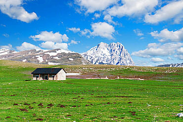
1361-35 - Isolated house among meadows on the Campo Imperatore plateau, Gran Sasso National Park, Apennines, Abruzzo, Italy, Europe
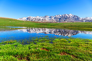
1361-34 - Spring thaw with lake reflection on the Campo Imperatore Plateau, Gran Sasso National Park, Apennines, Abruzzo, Italy, Europe
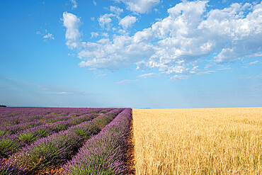
1336-628 - Purple lavender field and a wheat field symmetric under a blue sky, Plateau de Valensole, Provence, France, Europe
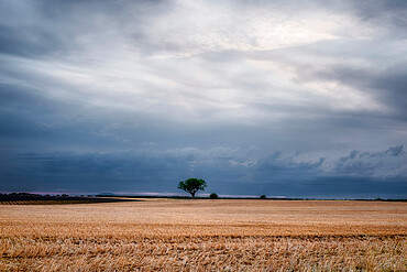
1336-620 - Lonely tree at the end of a harvested crop field with a cloudy sky, Plateau de Valensole, Provence, France, Europe
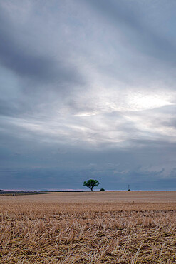
1336-626 - Lonely tree at the end of a harvested crop field with a cloudy sky, Plateau de Valensole, Provence, France, Europe
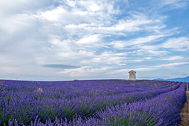
1336-627 - Small tower in a lavender field under a blue cloudy sky, Plateau de Valensole, Provence, France, Europe
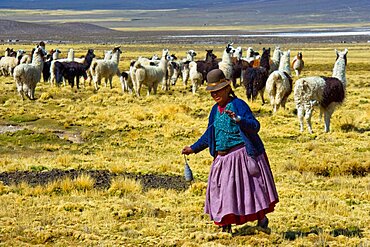
860-290939 - Aymara shepherdess spining the wool of Lama Sajama Bolivia
860-291017 - " Cardon grande" (Echinopsis atacamensis), Atacama. Alt. 3800 m., Chili.
860-290933 - Puna Flamingos Laguna colorada Bolivia
860-291018 - " Cardon grande" (Echinopsis atacamensis), Atacama. Alt. 3800 m., Chili.
1336-592 - Two trees at the end of a lavender field at dusk, Plateau de Valensole, Provence, France, Europe
1336-595 - Lavender lines in a field, Plateau de Valensole, Provence, France, Europe
1336-591 - Lavender lines in a field, Plateau de Valensole, Provence, France, Europe
1336-593 - Countryside twisting dirt road and lavender lines, Plateau de Valensole, Provence, France, Europe
1336-590 - Two trees at the end of a lavender field at sunrise, Plateau de Valensole, Provence, France, Europe
1336-594 - Harvested lavender curvy lines in a field, Plateau de Valensole, Provence, France, Europe
1336-588 - Sinuous lavender lines in a field, Plateau de Valensole, Provence, France, Europe
1336-581 - Two trees at the end of a lavender field at dusk, Plateau de Valensole, Provence, France, Europe
1336-586 - A tree at the end of a lavender field at sunset, Plateau de Valensole, Provence, France, Europe
1336-582 - Lavender flowers close up with the golden light of sunset, Plateau de Valensole, Provence, France, Europe
1336-589 - Sinuous lavender lines in a field, Plateau de Valensole, Provence, France, Europe
1336-587 - A small tree at the end of a lavender line in a field at sunset with clouds in the sky, Plateau de Valensole, Provence, France, Europe
1336-580 - Lavender field lines, Plateau de Valensole, Provence, France, Europe
1336-565 - Lavender lines, lavender field, Plateau de Valensole, Provence, France, Europe
1336-564 - Lavender lines, Plateau de Valensole, Provence, France, Europe


