Recent searches
Loading...
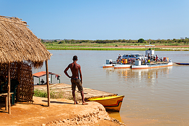
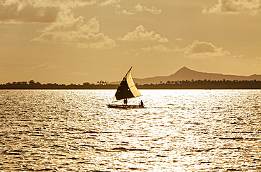
1113-105677 - Ferry across the Tsiribihina River at Belo, West Madagascar, Madagascar, Africa
1113-106418 - Ethiopia; Southern Nations Region; Mago National Park; lower Omo River; two girls from the Mursi people;
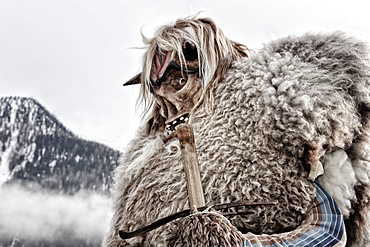
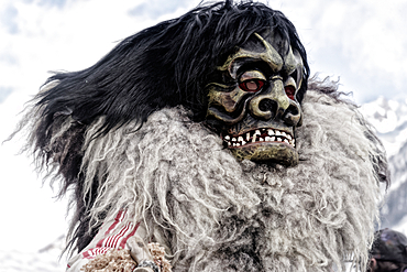
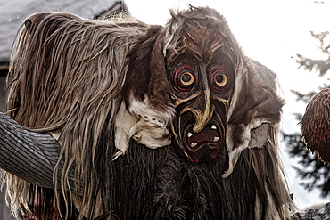
1113-106153 - Carnival parade of the Tschäggättä in Wiler, Lötschental, Valais, Switzerland.
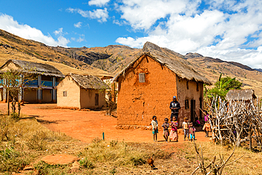
1113-105659 - Malagasy children in front of typical house, Tsaranoro Valley, highlands, southern Madagascar, Africa
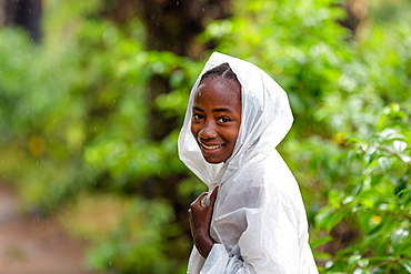
1113-105674 - Young woman, girl with raincoat in the rain, southern Madagascar, Africa
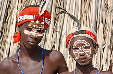
1113-106431 - Ethiopia; Southern Nations Region; southern Ethiopian highlands; two boys of the Arbore people; with with headdress and face painting; Arbore tribal area between Turmi and the village of Arbore
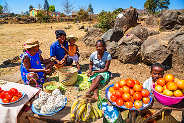
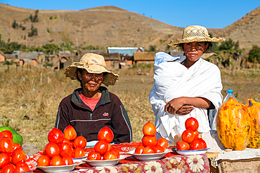
1113-105646 - Women with vegetable stand in the central highlands near Ampefy, Madagascar, Africa
1113-106420 - Ethiopia; Southern Nations Region; southern Ethiopian highlands; Mago National Park; lower Omo River; Mursi woman with lip plate and headdress
1113-106140 - Carnival parade of the Tschäggättä in Wiler, Lötschental, Valais, Switzerland.
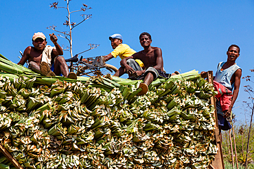
1113-105666 - Sisal harvest, sisal agaves, Agave sisalana, Berenty Reserve, Southern Madagascar, Africa
1113-106155 - Carnival parade of the Tschäggättä in Wiler, Lötschental, Valais, Switzerland.
1113-106146 - Carnival parade of the Tschäggättä in Wiler, Lötschental, Valais, Switzerland.
1113-105647 - People in village near Ampefy, Merina tribe, central highlands, Madagascar, Africa
1113-105663 - Madagascar carries firewood, near Tulear, Madagascar, Africa
1113-106151 - Carnival parade of the Tschäggättä in Wiler, Lötschental, Valais, Switzerland.
1113-105655 - Woman offers vegetables for sale, Sendrisoa, Ambalavao Region, Central Highlands, Madagascar, Africa
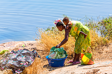
1113-105664 - Woman with baby washing clothes by the river, Southern Madagascar, Africa
1113-105471 - Market on Tanna, Vanuatu, South Pacific, Oceania
1113-105648 - Houses on Lake Itasy, Lac Itasy, Merina tribe, highlands west of Antananarivo, Madagascar, Africa
1113-105638 - Wedding party in the highlands of Madagascar, Africa
1113-106170 - The city of potters: Bhaktapur, Kathmandu Valley, Nepal, Asia.
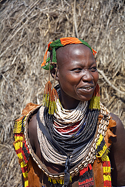
1113-106428 - Ethiopia; Southern Nations Region; southern Ethiopian highlands; Kolcho village on the Omo River; Karo woman with headdress and face-paint;
1113-106141 - Carnival parade of the Tschäggättä in Wiler, Lötschental, Valais, Switzerland.
1113-105645 - Family by the evening fire, near Ampefy, Merina tribe, highlands, Madagascar, Africa
1113-106049 - A Balinese cook, sitting in a ramshackle kitchen in a hut, smoking and laughing. Bali, Indonesia.
1113-106156 - Carnival parade of the Tschäggättä in Wiler, Lötschental, Valais, Switzerland.
1113-106419 - Ethiopia; Southern Nations Region; Mago National Park; lower Omo River; Mursi woman with lip plate and earrings;
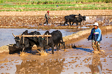
1113-105649 - Farmer plows rice field with zebus west of Antananarivo, highlands, Madagascar, Africa
1113-105467 - Market on Tanna, Vanuatu, South Pacific, Oceania
1113-105654 - Rice terraces at Ambalavao, highlands, Madagascar, Africa
1113-106425 - Ethiopia; Southern Nations Region; Kolcho village; on the Omo River; Omo Valley; Woman from the ethnic group of the Karo; dressed in a typical leather apron; Head and neck jewelry made from multicolored pearl necklaces
1113-106289 - Detail of a woman who embroiders in Trinidad, Cuba
1113-105559 - View of the Venetian gondolas and a gondolier on St. Mark's Square, in the background the island of San Giorgio, Venice, Veneto, Italy, Europe
1113-106158 - Carnival parade of the Tschäggättä in Wiler, Lötschental, Valais, Switzerland.
1113-105656 - Woman offers vegetables for sale, Sendrisoa, Ambalavao Region, Central Highlands, Madagascar, Africa
1113-105665 - Sales booth for souvenirs on the road to Fort Dauphin, Southern Madagascar, Africa
1113-105644 - Children come from fetching water, at Ampefy, Merina tribe, highlands, Madagascar, Africa
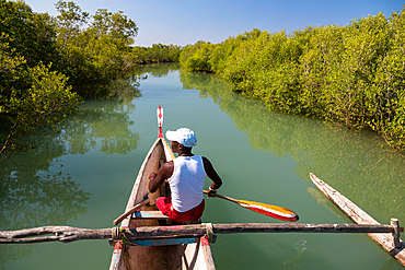
1113-105683 - Boat tour in the mangroves near Morondava, Madagascar, Africa
1113-106154 - Carnival parade of the Tschäggättä in Wiler, Lötschental, Valais, Switzerland.
1113-105685 - Butcher and Greengrocer, Antananarivo, Madagascar, Africa
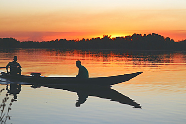
1113-105686 - Gambia; Central River Region; Afterglow on the Gambia River near Kuntaur; two men sit in a boat near the shore
1113-105678 - Colorful market in Bekopaka, West Madagascar, Madagascar, Africa
1113-105637 - Woman looks out of the window, village in the highlands of Madagascar, Africa
1113-105675 - Madagascar in the rain in the fishing village of Evatra, Southern Madagascar, Africa
1113-105469 - Carrots on market in Tanna, Vanuatu, South Pacific, Oceania
1113-105639 - Vegetable stand in the central highlands near Ampefy, Madagascar, Africa
1113-105662 - Zebu carts near Tulear, Madagascar, Africa
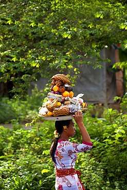
1113-106078 - A young Balinese woman, balancing offerings on her head. Bali, Indonesia.
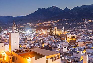
1350-1283 - Medina, UNESCO World Heritage Site,Tetouan, Morocco
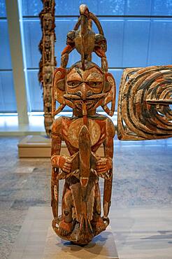
1350-2073 - New Ireland Malagan funerary statue in at the Metropolitan Museum of Art museum, New York, USA. New Ireland is part of the Bismarck Archipelago, situated north of New Guinea, and has an estimated population of 100,000. The Dutch first encountered the island in 1616, and today New Ireland is a province of Papua New Guinea. Nineteen different languages are spoken on the island, and it is divided by a chain of mountains into three distinct regions: northern, central, and southeastern. The art of New Ireland traditionally centered on mortuary ceremonies and feasts to honor the dead. In northern New Ireland, the name given to these elaborate ceremonies is malagan, which is also the term used for the carved and painted sculptures associated with the ceremonies.
1350-1281 - In the foreground the medina, and in background the Ville Nouvell or new city, Tetouan. Morocco
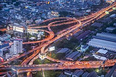
1350-1446 - Junction, Sirat Expy expressway at Chalerm Maha Nakhon Expy expressway, Bangkok, Thailand
1350-1282 - In the foreground the medina, and in background the Ville Nouvell or new city, Tetouan. Morocco
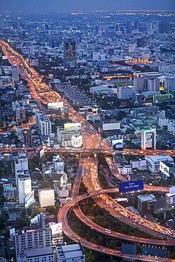
1350-1443 - Skyline and Chao phraya River at night, downtown, Bangkok, Thailand
1350-1442 - Bangkok, night, Skyline, Downtown, Thailand
1350-1445 - Chalerm Maha Nakhon Expy expressway, Bangkok, Thailand
1350-1447 - Junction, Sirat Expy expressway at Chalerm Maha Nakhon Expy expressway, Bangkok, Thailand
1350-1444 - Skyline at night, downtown, Bangkok, Thailand
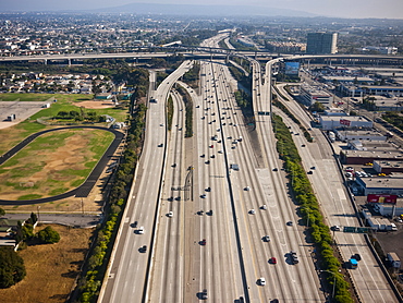
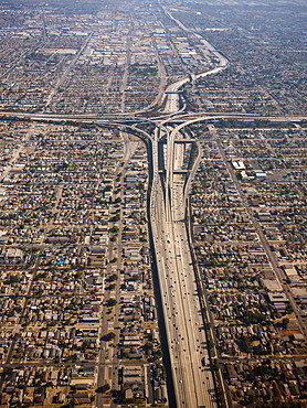
1116-49112 - Cityscape showing dense urban areas and roadways with smog in the air, Los Angeles, California, United States of America
1116-49111 - Aerial view of cityscape showing dense urban areas and roadways, Los Angeles, California, United States of America
1116-42772 - Agriculture - An insect trap placed in a Thompson Seedless grape vineyard in Spring. Its function is an early-warning system to detect adult insect emergence and flight of certain moths including the European Grapevine Moth (Lobesia botrana) and the Omniv
1116-42766 - Agriculture - An insect trap placed in a Thompson Seedless grape vineyard in Spring. Its function is an early-warning system to detect adult insect emergence and flight of certain moths including the European Grapevine Moth (Lobesia botrana) and the Omniv
1174-5643 - Colonial City of Guanajuato, Guanajuato, Mexico
832-381878 - Residents of the village of Iwasoudanei checking the quality of the dried rhizomes of organically cultivated Irises (Iris germanica), which are stored on the roof of the mud house of Hassan Bouship, the chief of the village of Iwasoudane, for natural cosmetics in Europe, Ait Inzel Gebel Region, Atlas Mountains, Morocco, Africa
832-381877 - Mohammed El Malaoui checking the quality of the dried rhizomes of organically cultivated Irises (Iris germanica), which are stored on the roof of the mud house of Hassan Bouship, the chief of the village of Iwasoudane, for natural cosmetics in Europe, Ait Inzel Gebel Region, Atlas Mountains, Morocco, Africa
832-381875 - An elderly resident of the village of Iwasoudane harvesting the rhizomes of organically grown Irises (Iris germanica) for natural cosmetics in Europe, Ait Inzel Gebel Region, Atlas Mountains, Morocco, Africa
832-381876 - A group of male residents of the village of Iwasoudane cutting the green off the rhizomes of organically grown Irises (Iris germanica) for natural cosmetics in Europe, Ait Inzel Gebel Region, Atlas Mountains, Morocco, Africa
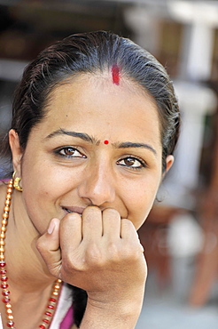
832-381076 - Nepalese woman, portrait, Pokhara, Nepal, Asia
857-94720 - Nimoa Island - here the island mission will impress. The five-sided church features murals of island life and all mission buildings are surrounded by well maintained paths and gardens filled with flowering plants. Edged by jungle-covered mountains, postcard beaches and crystal clear waters - an island paradise indeed! The Louisiade Archipelago is a string of ten larger volcanic islands frequently fringed by coral reefs, and 90 smaller coral islands located 200 km southeast of New Guinea, stretching over more than 160 km and spread over an ocean area of 26,000 km? between the Solomon Sea to the north and the Coral Sea to the south. The aggregate land area of the islands is about 1,790 km? (690 square miles), with Vanatinai (formerly Sudest or Tagula as named by European claimants on Western maps) being the largest. Sideia Island and Basilaki Island lie closest to New Guinea, while Misima, Vanatinai, and Rossel islands lie further east. The archipelago is divided into the Local Level Government (LLG) areas Louisiade Rural (western part, with Misima), and Yaleyamba (western part, with Rossell and Tagula islands. The LLG areas are part of Samarai-Murua District district of Milne Bay. The seat of the Louisiade Rural LLG is Bwagaoia on Misima Island, the population center of the archipelago.
857-94718 - Nimoa Island - here the island mission will impress. The five-sided church features murals of island life and all mission buildings are surrounded by well maintained paths and gardens filled with flowering plants. Edged by jungle-covered mountains, postcard beaches and crystal clear waters - an island paradise indeed! The Louisiade Archipelago is a string of ten larger volcanic islands frequently fringed by coral reefs, and 90 smaller coral islands located 200 km southeast of New Guinea, stretching over more than 160 km and spread over an ocean area of 26,000 km? between the Solomon Sea to the north and the Coral Sea to the south. The aggregate land area of the islands is about 1,790 km? (690 square miles), with Vanatinai (formerly Sudest or Tagula as named by European claimants on Western maps) being the largest. Sideia Island and Basilaki Island lie closest to New Guinea, while Misima, Vanatinai, and Rossel islands lie further east. The archipelago is divided into the Local Level Government (LLG) areas Louisiade Rural (western part, with Misima), and Yaleyamba (western part, with Rossell and Tagula islands. The LLG areas are part of Samarai-Murua District district of Milne Bay. The seat of the Louisiade Rural LLG is Bwagaoia on Misima Island, the population center of the archipelago.
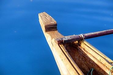
857-94722 - Children playing with a outrigger canoe in the village of Hessessai Bay at PanaTinai (Panatinane)island in the Louisiade Archipelago in Milne Bay Province, Papua New Guinea. The island has an area of 78 km2. The Louisiade Archipelago is a string of ten larger volcanic islands frequently fringed by coral reefs, and 90 smaller coral islands located 200 km southeast of New Guinea, stretching over more than 160 km and spread over an ocean area of 26,000 km? between the Solomon Sea to the north and the Coral Sea to the south. The aggregate land area of the islands is about 1,790 km? (690 square miles), with Vanatinai (formerly Sudest or Tagula as named by European claimants on Western maps) being the largest. Sideia Island and Basilaki Island lie closest to New Guinea, while Misima, Vanatinai, and Rossel islands lie further east. The archipelago is divided into the Local Level Government (LLG) areas Louisiade Rural (western part, with Misima), and Yaleyamba (western part, with Rossell and Tagula islands. The LLG areas are part of Samarai-Murua District district of Milne Bay. The seat of the Louisiade Rural LLG is Bwagaoia on Misima Island, the population center of the archipelago.PanaTinai (Panatinane) is an island in the Louisiade Archipelago in Milne Bay Province, Papua New Guinea.
857-94719 - Nimoa Island - here the island mission will impress. The five-sided church features murals of island life and all mission buildings are surrounded by well maintained paths and gardens filled with flowering plants. Edged by jungle-covered mountains, postcard beaches and crystal clear waters - an island paradise indeed! The Louisiade Archipelago is a string of ten larger volcanic islands frequently fringed by coral reefs, and 90 smaller coral islands located 200 km southeast of New Guinea, stretching over more than 160 km and spread over an ocean area of 26,000 km? between the Solomon Sea to the north and the Coral Sea to the south. The aggregate land area of the islands is about 1,790 km? (690 square miles), with Vanatinai (formerly Sudest or Tagula as named by European claimants on Western maps) being the largest. Sideia Island and Basilaki Island lie closest to New Guinea, while Misima, Vanatinai, and Rossel islands lie further east. The archipelago is divided into the Local Level Government (LLG) areas Louisiade Rural (western part, with Misima), and Yaleyamba (western part, with Rossell and Tagula islands. The LLG areas are part of Samarai-Murua District district of Milne Bay. The seat of the Louisiade Rural LLG is Bwagaoia on Misima Island, the population center of the archipelago.
857-94714 - The Louisiade Archipelago is a string of ten larger volcanic islands frequently fringed by coral reefs, and 90 smaller coral islands located 200 km southeast of New Guinea, stretching over more than 160 km and spread over an ocean area of 26,000 km? between the Solomon Sea to the north and the Coral Sea to the south. The aggregate land area of the islands is about 1,790 km? (690 square miles), with Vanatinai (formerly Sudest or Tagula as named by European claimants on Western maps) being the largest. Sideia Island and Basilaki Island lie closest to New Guinea, while Misima, Vanatinai, and Rossel islands lie further east. The archipelago is divided into the Local Level Government (LLG) areas Louisiade Rural (western part, with Misima), and Yaleyamba (western part, with Rossell and Tagula islands. The LLG areas are part of Samarai-Murua District district of Milne Bay. The seat of the Louisiade Rural LLG is Bwagaoia on Misima Island, the population center of the archipelago.
857-94712 - The Louisiade Archipelago is a string of ten larger volcanic islands frequently fringed by coral reefs, and 90 smaller coral islands located 200 km southeast of New Guinea, stretching over more than 160 km and spread over an ocean area of 26,000 km? between the Solomon Sea to the north and the Coral Sea to the south. The aggregate land area of the islands is about 1,790 km? (690 square miles), with Vanatinai (formerly Sudest or Tagula as named by European claimants on Western maps) being the largest.Sideia Island and Basilaki Island lie closest to New Guinea, while Misima, Vanatinai, and Rossel islands lie further east. The archipelago is divided into the Local Level Government (LLG) areas Louisiade Rural (western part, with Misima), and Yaleyamba (western part, with Rossell and Tagula islands. The LLG areas are part of Samarai-Murua District district of Milne Bay. The seat of the Louisiade Rural LLG is Bwagaoia on Misima Island, the population center of the archipelago.
746-88289 - Scalpay, Outer Hebrides, a small island close to the Isle of Harris. Only the construction of a bridge to Harris saved the population of Scalpay. Without the bridge, the island would habe been abandoned, an example of successfull rural regional development in Scotland. Europe, Scotland, July
911-10923 - Malawi is one of the poorest countries in the world, it has been heavily deforested. The deforestation has been to clear land for an expanding population to have access to land to grow subsistence crops and also to make charcoal, which is the main cooking fuel in Malawi. This shot shows men working barefoot and moving massive tree trunks by hand in a logging camp on the Zomba Plateau.
911-10924 - Malawi is one of the poorest countries in the world, it has been heavily deforested. The deforestation has been to clear land for an expanding population to have access to land to grow subsistence crops and also to make charcoal, which is the main cooking fuel in Malawi. This shot shows a logging camp on the Zomba Plateau.
911-10928 - A farmstead on the zomba plateau which has been heavily deforested to provide a rapidly increasing population with land.
1175-446 - Market place with justice fountain at Place de la Palud, Lausanne, Switzerland
1175-76 - Golden Artwork at Entrance to Bottcherstrasse, Bremen, Germany
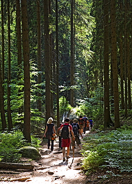
1175-62 - Rear view of tourist hiking at Malerweg, Saxony Switzerland Forest, Germany
1175-314 - Man walking outside mosque of Muhammad Ali in Citadel, Cairo, Egypt
1175-26 - View of cafe beside Chiesa di San Michele in Foro in Lucca, Tuscany, Italy
1175-477 - Close-up of woman holding rosary at Cagliari's Sant 'Efisio, Sardinia, Italy
1175-849 - Facade of the New City Hall at City Hall Square, Freiburg, Germany, blurred motion
1175-510 - Men at outside bookstore in Hay-on-Wye village, Powys, Wales, UK
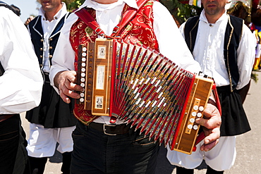
1175-479 - Musicians playing music at Sant'Efisio procession, Pula village, Sardinia, Italy
1175-481 - Person holding cross at Sant'Efisio procession, Pula village, Sardinia, Italy
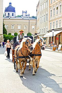
1175-239 - Man sitting on horse carriage, Salzburg, Austria
1175-136 - People at town hall market square, Bremen, Germany
1175-324 - People climbing staircase at Baden-Baden, Festspielhaus, Germany
1175-514 - Cars and people on street with ferries wheel in background at Luna park, Beirut, Lebanon
1175-850 - Facade of the New City Hall at City Hall Square, Freiburg, Germany, blurred motion
