Recent searches
Loading...
1112-6884 - Fall color change amongst the trees and shrubs on the Rock Creek Trail in Denali National Park, Alaska, United States of America, North America
1112-6886 - Fall color change amongst the trees and shrubs on the Rock Creek Trail in Denali National Park, Alaska, United States of America, North America
1311-491 - The Village of Oak Creek on the south side of Sedona viewed from the Airport Loop Trail, Arizona, United States of America, North America
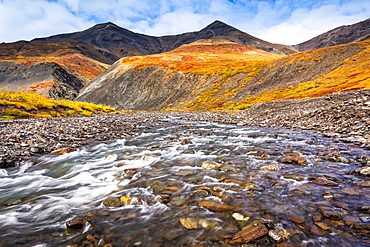
1116-50682 - Kuyuktuvuk Creek and Brooks Mountains in fall colours. Gates of the Arctic National Park and Preserve, Arctic Alaska in autumn; Alaska, United States of America
1116-50717 - Overlooking Campbell Creek Valley and Anchorage, Chugach State Park, South-central Alaska in summertime; Anchorage, Alaska, United States of America
1350-2968 - Lupine and Pike Rock from Pike Creek Trail, on Steens Mountain above the Alvord Desert in eastern Oregon.
1112-5068 - View of the Deadhorse Creek Trail, Mount Rainier National Park, Washington State, United States of America, North America
1112-5066 - Adult hoary marmot (Marmota caligata), on the Deadhorse Creek Trail, Mount Rainier National Park, Washington State, United States of America, North America
1116-48997 - A hand tram over Winner Creek near Girdwood, Kenai National Forest, South-central Alaska, Girdwood, Alaska, United States of America
1116-48995 - A hand tram over Winner Creek near Girdwood, Kenai National Forest, South-central Alaska, Girdwood, Alaska, United States of America
1116-48996 - A hand tram over Winner Creek near Girdwood, Kenai National Forest, South-central Alaska, Girdwood, Alaska, United States of America
1311-207 - View of San Francisco Peaks from a cliff at the end of the Telephone Trail north of Sedona with Oak Creek Canyon on the left, Arizona, United States of America, North America
1116-43412 - Family Crossing Bear Creek On Hiking Trail Leading To The Ice Cave At Bixby State Preserve, Near Edgewood, Iowa, United States Of America
1116-43411 - Family Crossing Bear Creek On Hiking Trail Leading To The Ice Cave At Bixby State Preserve, Near Edgewood, Iowa, United States Of America
1311-52 - High angle view of Boulder Creek, the Watson Lake Loop Trail crosses this creek, Prescott, Arizona, United States of America, North America
1112-4203 - View from the Chuck Creek Trail in Tatshenshini-Alsek Park, UNESCO World Heritage Site, British Columbia, Canada, North America
1112-3539 - Navajo sandstone in Lower Calf Creek Falls Trail, Grand Staircase-Escalante National Monument, Utah, United States of America, North America
1112-3536 - Navajo sandstone in Lower Calf Creek Falls Trail, Grand Staircase-Escalante National Monument, Utah, United States of America, North America
1112-3534 - Native Pueblo rock art, Lower Calf Creek Falls Trail, Grand Staircase-Escalante National Monument, Utah, United States of America, North America
857-93697 - The Eagle Creek Alternative Trail, to the Pacific Crest Trail along the Columbia River Gorge
1241-1 - Mountain creek flowing through dense forest woods near the Appalachian Trail, North Carolina, United States of America, North America
857-89701 - Hikers on the sandstone Esplanade of the Thunder River Trail below the North Rim of the Grand Canyon outside Fredonia, Arizona November 2011. The 21.4-mile loop descends 2000-feet in 2.5-miles through Coconino Sandstone from the Bill Hall trailhead to connect the Thunder River and Deer Creeks trails. Hikers descend into the lower canyon through a break in the 400-foot-tall Redwall to access Surprise Valley, Deer Creek, Tapeats Creek via Thunder River and even the Colorado River.
857-89700 - Hikers on the sandstone Esplanade of the Thunder River Trail below the North Rim of the Grand Canyon outside Fredonia, Arizona November 2011. The 21.4-mile loop descends 2000-feet in 2.5-miles through Coconino Sandstone from the Bill Hall trailhead to connect the Thunder River and Deer Creeks trails. Hikers descend into the lower canyon through a break in the 400-foot-tall Redwall to access Surprise Valley, Deer Creek, Tapeats Creek via Thunder River and even the Colorado River.
857-86000 - Hikers on the sandstone Esplanade of the Thunder River Trail below the North Rim of the Grand Canyon outside Fredonia, Arizona November 2011. The 21.4-mile loop descends 2000-feet in 2.5-miles through Coconino Sandstone from the Bill Hall trailhead to connect the Thunder River and Deer Creeks trails. Hikers descend into the lower canyon through a break in the 400-foot-tall Redwall to access Surprise Valley, Deer Creek, Tapeats Creek via Thunder River and even the Colorado River.
857-86003 - Hikers descend into Surprise Valley to access the lower canyon through a break in the 400-foot-tall Redwall on the Thunder River Trail in the Grand Canyon outside of Fredonia, Arizona November 2011. The 21.4-mile loop starts at the Bill Hall trailhead on the North Rim and descends 2000-feet in 2.5-miles through Coconino Sandstone to the level Esplanada then descends further into the lower canyon to access Thunder River, Tapeats Creek and Deer Creek.
832-377395 - Young woman jumping across a creek, hiking, backpacking, hiker with backpack, historic Chilkoot Trail, Chilkoot Pass, near Crater Lake, alpine tundra, Yukon Territory, British Columbia, B. C., Canada
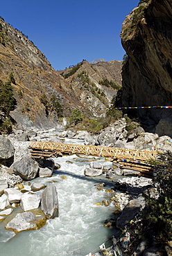
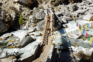
832-358387 - Bridge over Dudh Koshi river, Sagarmatha National Park, Khumbu, Nepal
832-358386 - Bridge over Dudh Koshi river, Sagarmatha National Park, Khumbu, Nepal
832-153639 - Midnight sun in the Fjaell Mountains with a stream along the Kungsleden, The King's Trail, Lapland, Sweden, Europe
832-66490 - Stream in the Wolfsklamm gorge, Stans, Karwendel Mountains, Tyrol, Austria, Europe
1116-29609 - Washington, Olympic National Park, Stream waters falling over rocks along Soleduck Falls Trail.
1116-7769 - Washington, United States Of America; Wildflowers Along A Trail In Mt. Rainier National Park
1116-8253 - A Hiker On A Trail To Mccord Creek Falls In Columbia River Gorge National Scenic Area; Oregon, USA
1116-8252 - Trail To Mccord Creek Falls In Columbia River Gorge National Scenic Area; Oregon, USA
You reached the end of search results


