Recent searches
Loading...
832-382414 - Sailing boat in the bay, Cala Pi, Majorca, Balearic Islands, Spain, Europe
832-382613 - Excursion boat, sailing ship at the pier at sunset, Manavgat, Antalya, Turkey, Asia
832-381506 - Bay Cala Mondragó with sailing yachts, beach Caló d'en Garrot, natural park of Mondragó, Mallorca, Majorca, Balearic Islands, Mediterranean Sea, Spain, Europe
832-381792 - Sailing ship with red sails in a small bay near Los Gigantes, Santiago del Teide, Tenerife, Canary Islands, Spain, Europe
832-381991 - Neustädter Segelverein e.V. sailing club, Bay of Lübeck, Neustadt in Holstein, Schleswig-Holstein, Germany, Europe
832-381990 - Neustädter Segelverein e.V. sailing club, right, Marina Neustadt Holstein, left, Marina An der Wiek, Bay of Lübeck, Neustadt in Holstein, Schleswig-Holstein, Germany, Europe
832-381505 - Sailing yachts in the Cala Mondragó bay, beach of Caló d'en Garrot, natural park of Mondragó, Mallorca, Majorca, Balearic Islands, Mediterranean Sea, Spain, Europe
832-381219 - Palombaggia beach with turquoise blue sea and sailing ship, Porto Vecchio, Corse-du-Sud department, Corsica, France, Europe
832-379990 - Harbour, blue hour, Alghero, Sassari, Province of Sardinia, Italy, Europe
832-380373 - Sailing boats, Puerto de Pollensa, Port de Pollenca, Majorca, Balearic Islands, Mediterranean Sea, Spain, Europe
832-380441 - Catamaran in turquoise lagoon, Raiatea, South Pacific, French Polynesia, Oceania
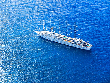
832-380165 - Luxury sailing ship Club Med 2 in front of English Harbour, West Indies, Caribbean, Antigua and Barbuda, Central America
857-95154 - Distant view of catamaran sailing in sea, Bourg de Saintes, Isles des Saintes, Guadeloupe
857-95159 - Low section view with feet of woman sunbathing on sailboat sailing in sea
857-95153 - Scenic view from catamaran sailing in Bourg de Saintes, Isles des Saintes, Guadeloupe
857-95155 - View of sailboats in sea, Bourg de Saintes, Isles des Saintes, Guadeloupe
857-95106 - A single sail boat sails past Light House Park in West Vancouver, British Columbia on a beautiful late summer day. The mountains of Vancouver Island can be seen in the distance. Vancouver, British Columbia, Canada
1113-103017 - Cross on the Jakob island, Staffelsee, with sailing boat, near Murnau, Blue Land, district Garmisch-Partenkirchen, Bavarian alpine foreland, Upper Bavaria, Bavaria, Germany, Europe
1113-102728 - Five year old boy sitting around the campfire, adventure, sailing boat, dream beach between Strandmarken und Dueodde, sandy beach, summer, Baltic sea, Bornholm, Strandmarken, Denmark, Europe, MR
1113-102729 - Familiy with children sitting around the campfire, adventure, sailing boat, dream beach between Strandmarken und Dueodde, sandy beach, summer, Baltic sea, Bornholm, Strandmarken, Denmark, Europe, MR
1113-102654 - Kayak tour and sailing boat in the lagoon, Parque Natural da Ria Formosa, Faro, Algarve, Portugal
1116-40128 - Sailing in the Great Bear Rainforest, Hartley Bay, British Columbia, Canada
1116-40129 - Man looking through a pair of binoculars with his sailboat in the distance, Great Bear Rainforest, Hartley Bay, British Columbia, Canada
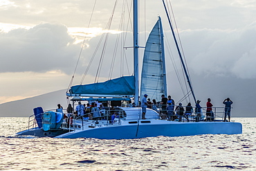
1116-40050 - Tourists whale watching from sailboat, Lahaina, Maui, Hawaii, United States of America
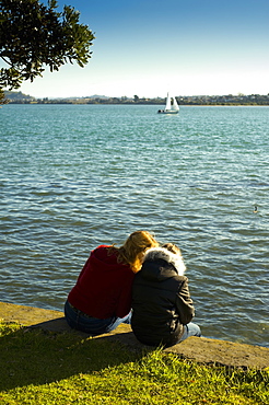
1116-41272 - Two Girls Sitting On A Retaining Wall At The Water's Edge, Auckland, New Zealand
1116-39811 - Sailing from the Ala Wai boat harbor past Waikiki and Diamond Head, Honolulu, Oahu, Hawaii, United States of America
1116-39812 - Sailing towards the Ala Wai boat harbor past Waikiki and Diamond Head, Honolulu, Oahu, Hawaii, United States of America
1116-39630 - City of Toronto skyline from Trillium Park, Toronto, Ontario, Canada
1116-40320 - Sailboat On A Misty Morning, Killala, County Mayo, Ireland
1116-39813 - Sailing from the Ala Wai boat harbor, Waikiki, Honolulu, Oahu, Hawaii, United States of America
1116-39631 - City of Toronto skyline from Trillium Park, Toronto, Ontario, Canada
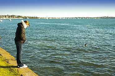
1116-41271 - A Woman Standing On The Retaining Wall At The Water's Edge, Auckland, New Zealand
1116-40127 - Sailing in the Great Bear Rainforest, Hartley Bay, British Columbia, Canada
1116-40131 - A Humpback whale (Megaptera novaeangliae) surfaces near the sailboat in the Great Bear Rainforest and a man photographs the whale, Hartley Bay, British Columbia, Canada
1109-3459 - Sailing boats at Windermere at sunrise, Lake District National Park, UNESCO World Heritage Site, Cumbria, England, United Kingdom, Europe
1269-243 - Sailboat on the lake in front Mandello del Lario, Province of Lecco, Lake Como, Italian Lakes, Lombardy, Italy, Europe
1269-252 - Sailboat on the lake in front Mandello del Lario, Province of Lecco, Lake Como, Italian Lakes, Lombardy, Italy, Europe
1245-1179 - Charles Bridge and Vltava River, Prague, UNESCO World Heritage Site, Bohemia Region, Czech Republic, Europe
1109-3416 - Gulet sailing ship cruise in a bay at Phaselis near Kemer, Antalya Province, Mediterranean Coast, Turkey, Asia Minor, Eurasia
1109-3443 - Gulet sailing boat in Kekova Bay, Antalya Province, Lycia, Anatolia, Mediterranean Sea, Turkey, Asia Minor, Eurasia
1109-3448 - Gulet sailing boat cruise, Antalya Province, Lycia, Anatolia, Mediterranean, Turkey, Asia Minor, Eurasia
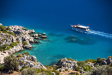
1109-3451 - Gulet sailing boat with Taurus Mountains behind, Kemer, Antalya Province, Lycia, Anatolia, Mediterranean Sea, Turkey, Asia Minor, Eurasia
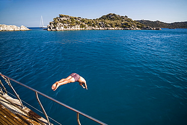
1109-3433 - Diving off a Gulet sailing boat cruise in Gokkaya Bay, Antalya Province, Lycia, Anatolia, Mediterranean, Turkey, Asia Minor, Eurasia
1109-3446 - Simena Castle and Gulet sailing boat seen from Kekova Bay, Antalya Province, Lycia, Anatolia, Mediterranean Sea, Turkey, Asia Minor, Eurasia
1109-3430 - Diving off a Gulet sailing boat cruise in Gokkaya Bay, Antalya Province, Lycia, Anatolia, Mediterranean, Turkey, Asia Minor, Eurasia
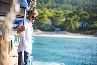
1109-3452 - Tourist on Gulet sailing boat cruise, Kemer, Antalya Province, Lycia, Anatolia, Mediterranean Sea, Turkey, Asia Minor, Eurasia
1109-3444 - Gulet sailing boat in Kekova Bay, Antalya Province, Lycia, Anatolia, Mediterranean Sea, Turkey, Asia Minor, Eurasia
1272-151 - Sailing boats seen from La Coupee, Sark Island, Channel Islands, United Kingdom, Europe
1272-155 - Sailing boat heading out of St. Peter Port Harbour at sunrise, Guernsey, Channel Islands, United Kingdom, Europe
802-514 - Bristol Harbourside, City of Bristol, England, United Kingdom, Europe
1109-3378 - Sailing boats in Poros Island port, Saronic Island, Aegean Coast, Greek Islands, Greece, Europe
1109-3386 - Sailing boats in Poros Island port at sunset, Saronic Island, Aegean Coast, Greek Islands, Greece, Europe
1109-3381 - Sailing boats in Poros Island port, Saronic Island, Aegean Coast, Greek Islands, Greece, Europe
1109-3376 - Sailing boats at sunset on Agistri Island, Saronic Islands, Greek Islands, Greece, Europe
1109-3383 - Sailing boats at sunset, Ermioni, Peloponnese, Greece, Europe
1109-3384 - Sailing boats in Poros Island port, Saronic Island, Aegean Coast, Greek Islands, Greece, Europe
1109-3385 - Sailing boats in Poros Island port, Saronic Island, Aegean Coast, Greek Islands, Greece, Europe
1167-1885 - Sailing on Lake Llanquihue, snow-capped Orsono volcano, from Puerto Varas, Lakes District, Chile, South America
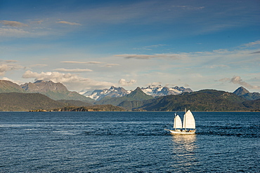
796-2370 - Scenery, Homer, Harding Icefield, Kachemak Bay, Kenai Fjords National Park, Alaska, United States of America, North America
733-7639 - Dhow sailing boat on Indian Ocean at sunset, Stone Town, Zanzibar Island, Tanzania, East Africa, Africa
733-7636 - Dhow sailing boat on Indian Ocean at sunset, Stone Town, Zanzibar, Tanzania, East Africa, Africa
733-7629 - Dhow sailing boat, Paje, Island of Zanzibar, Tanzania, East Africa, Africa
1218-605 - Girl perched on bow of Phinisi Boat, sailing through Komodo National Park, Indonesia, Southeast Asia, Asia
718-2280 - Sailing boat at sunset, Palma de Mallorca, Mallorca, Balearic Islands, Spain, Mediterranean, Europe
1267-174 - Sailing boats on Barcelona Marina at Port Vell, Barcelona, Catalonia, Spain, Europe
1267-172 - Sailing boats on Barcelona Marina at Port Vell, Barcelona, Catalonia, Spain, Europe
1226-578 - Traditional junk boat on Victoria Harbour with city skyline behind, Hong Kong, China, Asia
1226-574 - Traditional junk boat on Victoria Harbour with city skyline behind illuminated at night, Hong Kong, China, Asia
1226-495 - Star Ferry sailing towards the Kowloon side of Victoria Harbour, Hong Kong, China, Asia
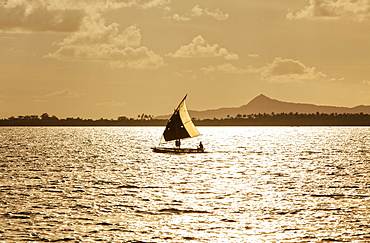
149-6666 - Fisherman heading out to sea at sunrise in a sailing dhow near Ushongo, Pangani, Tanzania, East Africa, Africa
797-13026 - England, Cumbria, Lake District, Glenridding, Yacht moored at a jetty on Lake Ullswater.
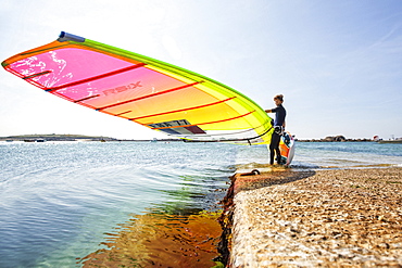
857-94863 - Pierre Le Coq preparing his windsurfing gear on a jetty near his van at Plouguerneau, Brittany, France.
857-94867 - Pink Granite CoastPierre Le Coq riding his windsurf board during a sunset session on the "Cote de Granit Rose" ( Pink Granite Coast ), Trégastel, Brittany, France.
857-94715 - Nimoa Island - here the island mission will impress. The five-sided church features murals of island life and all mission buildings are surrounded by well maintained paths and gardens filled with flowering plants. Edged by jungle-covered mountains, postcard beaches and crystal clear waters - an island paradise indeed! The Louisiade Archipelago is a string of ten larger volcanic islands frequently fringed by coral reefs, and 90 smaller coral islands located 200 km southeast of New Guinea, stretching over more than 160 km and spread over an ocean area of 26,000 km? between the Solomon Sea to the north and the Coral Sea to the south. The aggregate land area of the islands is about 1,790 km? (690 square miles), with Vanatinai (formerly Sudest or Tagula as named by European claimants on Western maps) being the largest. Sideia Island and Basilaki Island lie closest to New Guinea, while Misima, Vanatinai, and Rossel islands lie further east.
857-94864 - Pierre Le Coq carries his windsurfing board over his head on a jetty at Plouguerneau, Brittany, France.
857-94865 - Pierre Le Coq carries his windsurfing board on a jetty at Plouguerneau, Brittany, France.
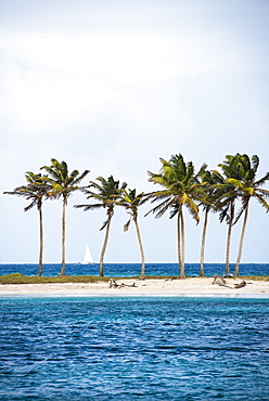
857-94828 - Rainbow over a sail boat in Prickly Pear Island, British Virgin Islands
857-94866 - Pierre Le Coq performing a jibe with his windsurf board at Plouguerneau, Brittany, France.
857-94714 - The Louisiade Archipelago is a string of ten larger volcanic islands frequently fringed by coral reefs, and 90 smaller coral islands located 200 km southeast of New Guinea, stretching over more than 160 km and spread over an ocean area of 26,000 km? between the Solomon Sea to the north and the Coral Sea to the south. The aggregate land area of the islands is about 1,790 km? (690 square miles), with Vanatinai (formerly Sudest or Tagula as named by European claimants on Western maps) being the largest. Sideia Island and Basilaki Island lie closest to New Guinea, while Misima, Vanatinai, and Rossel islands lie further east. The archipelago is divided into the Local Level Government (LLG) areas Louisiade Rural (western part, with Misima), and Yaleyamba (western part, with Rossell and Tagula islands. The LLG areas are part of Samarai-Murua District district of Milne Bay. The seat of the Louisiade Rural LLG is Bwagaoia on Misima Island, the population center of the archipelago.
857-94712 - The Louisiade Archipelago is a string of ten larger volcanic islands frequently fringed by coral reefs, and 90 smaller coral islands located 200 km southeast of New Guinea, stretching over more than 160 km and spread over an ocean area of 26,000 km? between the Solomon Sea to the north and the Coral Sea to the south. The aggregate land area of the islands is about 1,790 km? (690 square miles), with Vanatinai (formerly Sudest or Tagula as named by European claimants on Western maps) being the largest.Sideia Island and Basilaki Island lie closest to New Guinea, while Misima, Vanatinai, and Rossel islands lie further east. The archipelago is divided into the Local Level Government (LLG) areas Louisiade Rural (western part, with Misima), and Yaleyamba (western part, with Rossell and Tagula islands. The LLG areas are part of Samarai-Murua District district of Milne Bay. The seat of the Louisiade Rural LLG is Bwagaoia on Misima Island, the population center of the archipelago.
1174-4466 - Nyhavn, the 17th century waterfront with row of colourful historic buildings, promenade and moored sailing ships in Copenhagen, Denmark, Copenhagen, Denmark
846-2771 - Fishing boat sailing past The Cobb at sunrise with Golden Cap and Jurassic Coast, UNESCO World Heritage Site, Lyme Regis, Dorset, England, United Kingdom, Europe
844-14355 - Sailing boat and sunset over Elliott Bay with Bainbridge Island visible on the horizon viewed from Bell Harbour Marina, Seattle, Washington State, United States of America, North America
844-14354 - Sailing boat and sunset over Elliott Bay with Bainbridge Island visible on the horizon viewed from Bell Harbour Marina. Seattle, Washington State, United States of America, North America
1104-782 - View of River Nile and the Botanical Gardens on Kitchener Island, Aswan, Upper Egypt, Egypt, North Africa, Africa
857-94344 - Sailing cruise through the Windward Islands of the Lesser Antilles of the Caribbean
857-94358 - Classic wooden catboats sailing on Narragansett Bay during a summer afternoon
857-94345 - Sailing cruise through the Windward Islands of the Lesser Antilles of the Caribbean
857-94349 - Sailing cruise through the Windward Islands of the Lesser Antilles of the Caribbean
857-94290 - aerial view on a sailing boat and rescue boat crossing the Geneva Lake, with mountains in the background, trees on the lake's banks and a marina in Villeneuve, Vaud Canton, Switzerland
857-94346 - Sailing cruise through the Windward Islands of the Lesser Antilles of the Caribbean
857-94343 - Sailing cruise through the Windward Islands of the Lesser Antilles of the Caribbean
857-94360 - Young kids sailing a dinghy in Newport Harbor
857-94351 - Junior sailors practicing in Rhode Island
857-94342 - Sailing cruise through the Windward Islands of the Lesser Antilles of the Caribbean
857-94341 - Sailing cruise through the Windward Islands of the Lesser Antilles of the Caribbean
857-94352 - Sailing cruise through the Windward Islands of the Lesser Antilles of the Caribbean
857-94347 - Sailing cruise through the Windward Islands of the Lesser Antilles of the Caribbean
1243-170 - Yacht sails on Lake Como, Lombardy, Italian Lakes, Italy, Europe


