Recent searches
Loading...
1350-2315 - Porco's bay and Dois Irmaos islands, Fernando de Noronha national marine sanctuary, Pernambuco, Brazil (S. Atlantic)
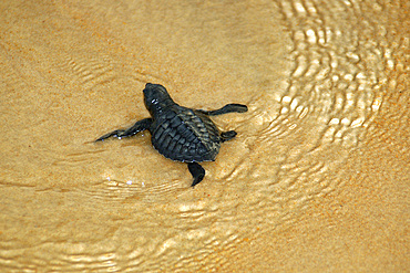
1350-2317 - Olive ridley turtle hatchling, Lepidochelys olivacea, Costa do Sauipe, Bahia, Brazil (South Atlantic)
1350-2314 - Green sea turtles hatching, Chelonia mydas, Fernando de Noronha, Pernambuco, Brazil.
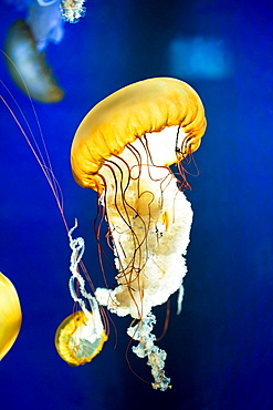
1237-404 - Loch Lomond Sea Life Aquarium, Balloch, West Dumbartonshire, Scotland, United Kingdom, Europe
1350-2094 - Tahitian man with her daughter carrying baguettes while riding a bicycle on the island of Tahiti, French Polynesia, Tahiti Nui, Society Islands, French Polynesia, South Pacific.
1350-2074 - Yagim Mask at the Metropolitan Museum of Art, New York, USA. Yagim Mask, 1920-25 Vancouver Island, British Columbia. Wood, paint. George Walkus (kwakwaka'wakw, ca 1875-1968). A furtive aggressive sea creature known as Yagim was part of the dramatic Tseyka performance cycle, which took place during the dark winter when life on the North West coast moves largely indoors
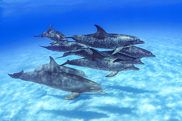
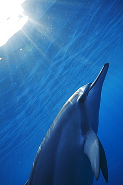
1116-49706 - Mr. Fleetham spent an afternoon photographing these Atlantic Spotted Dolphin (Stenella plagiodon). During the several hours in the water a group of Atlantic Bottlenose Dolphin (Tursiops truncates) joined the company for nearly an hour of inter-species exchange, Bahamas
1113-103634 - life buoy, life belt, ferry, indonesia
1113-103378 - Promenade deck with clock, life buoy and deck chair, sunset, Cruise liner Queen Mary 2, Transatlantic, Atlantic ocean
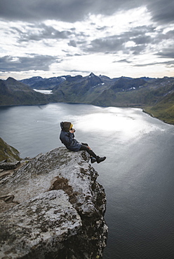
1178-28766 - Norway, Senja, Man taking photo sitting on edge of steep cliff on top of mountain Segla
746-89349 - Oasis Biderrosa, Orosei, Sardinia, Italy, Europe
746-89511 - Istanbul at night. Beautiful sunset city skyline.
1116-47088 - A Red Live Finger Starfish, Also Known As Linckia Sea Star, Found Along A Sandy Beach With White Ocean Tide Washing Up, Honolulu, Oahu, Hawaii, United States Of America
1116-47200 - Detail View Of A Sea Star In A Tidal Pool, Hesketh Island, Homer, Southcentral Alaska, USA
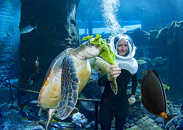
1116-46823 - A diver feeds a green sea turtle (Chelonia mydas), an endangered species, at Sea Life Park's Underwater Sea Trek Adventure in their big tank, Oahu, Hawaii, United States of America
860-287561 - Life is abundant in the Sada pass of the Mayotte lagoon.
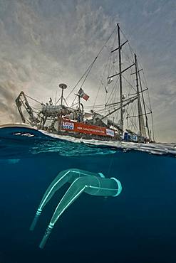
860-287450 - Tara Oceans Expeditions - May 2011. Tara with deployed plancton nets. On "station", the boat is drifting without engine or sails. Tara Oceans, a unique expedition: Tara Oceans is the very first attempt to make a global study of marine plankton, a form of sea life that includes organisms as small as viruses and bacterias, and as big as medusas. Our goal is to better understand planktonic ecosystems by exploring the countless species, learning about interactions among them and with their environment. Marine plankton is the only ecosystem that is almost continuous over the surface of the Earth. Studying plankton is like taking the pulse of our planet. Recently, scientists have discovered the great importance of plankton for the climate: populations of plankton are affected very rapidly by variations in climate. But in turn they can influence the climate by modifying the absorption of carbon. In a context of rapid physico-chemical changes, for example the acidification observed today in the world's oceans, it is urgent to understand and predict the evolution of these particular ecosystems. Finally, plankton is an astonishing way of going back in time ? a prime source of fossils. Over the eons, plankton has created several hundred meters of sediment on the ocean floors. This allows us to go back in time, to the first oceans on Earth, and better understand the history of our biosphere. More than 12 fields of research are involved in the project, which will bring together an international team of oceanographers, ecologists, biologists, geneticists, and physicists from prestigious laboratories headed by Eric Karsenti of the European Molecular Biology Laboratory. Galapagos
1116-42600 - A Lifeboat Sitting On The Beach At The Water's Edge, Rimini, Emilia-Romagna, Italy
1116-42681 - Whale Watching From A Scenic Spot, Makapuu, Oahu, Hawaii, United States Of America
857-96003 - Side view of single man snorkeling in coral reef in Puerto Morelos, Quintana Roo, Mexico
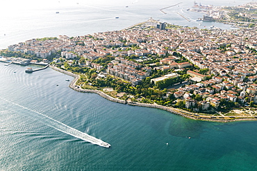
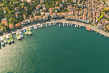
857-95817 - Aerial view of seaside built-up area and harbor, Istanbul, Turkey
857-95816 - Aerial view of Golden Horn and Besektas area, Istanbul, Turkey
857-95815 - Aerial view of Golden Horn and Besektas area, Istanbul, Turkey
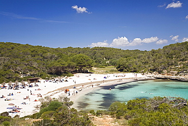
832-381507 - Beach life in the bay of s'Amarador, Cala Mondragó, natural park of Mondragó, Mallorca, Majorca, Balearic Islands, Mediterranean Sea, Spain, Europe
832-380583 - Rescue tower and rescue boat on the beach, Adriatic Sea, Italy, Europe
832-380584 - Rescue tower and rescue boat on the beach, evening mood, Adriatic Sea, Italy, Europe
857-95443 - A woman subsistence farmer cooking on a traditional clay oven, using rice stalks as biofuel in the Sundarbans, Ganges, Delta, India. the area is very low lying and vulnerable to sea level rise. All parts of the rice crop are used, and the villagers life is very self sufficient, with a tiny carbon footprint.
1116-39940 - A close look at the eggs of a common anemonefish (Amphiprion perideraion) that is most often found associated with the anemone, Heteractis magnifica, Philippines.
1116-39947 - A close look at the eggs of a common anemonefish (Amphiprion perideraion) that is most often found associated with the anemone, Heteractis magnifica, Philippines.
1116-39954 - This pink anemonefish (Amphiprion perideraion), is in an anemone (Heteractis magnifica) that is bleaching from high ocean temperatures and heat stress, Yap, Micronesia
857-94717 - Nimoa Island - here the island mission will impress. The five-sided church features murals of island life and all mission buildings are surrounded by well maintained paths and gardens filled with flowering plants. Edged by jungle-covered mountains, postcard beaches and crystal clear waters - an island paradise indeed! The Louisiade Archipelago is a string of ten larger volcanic islands frequently fringed by coral reefs, and 90 smaller coral islands located 200 km southeast of New Guinea, stretching over more than 160 km and spread over an ocean area of 26,000 km? between the Solomon Sea to the north and the Coral Sea to the south. The aggregate land area of the islands is about 1,790 km? (690 square miles), with Vanatinai (formerly Sudest or Tagula as named by European claimants on Western maps) being the largest. Sideia Island and Basilaki Island lie closest to New Guinea, while Misima, Vanatinai, and Rossel islands lie further east. The archipelago is divided into the Local Level Government (LLG) areas Loui!
857-94720 - Nimoa Island - here the island mission will impress. The five-sided church features murals of island life and all mission buildings are surrounded by well maintained paths and gardens filled with flowering plants. Edged by jungle-covered mountains, postcard beaches and crystal clear waters - an island paradise indeed! The Louisiade Archipelago is a string of ten larger volcanic islands frequently fringed by coral reefs, and 90 smaller coral islands located 200 km southeast of New Guinea, stretching over more than 160 km and spread over an ocean area of 26,000 km? between the Solomon Sea to the north and the Coral Sea to the south. The aggregate land area of the islands is about 1,790 km? (690 square miles), with Vanatinai (formerly Sudest or Tagula as named by European claimants on Western maps) being the largest. Sideia Island and Basilaki Island lie closest to New Guinea, while Misima, Vanatinai, and Rossel islands lie further east. The archipelago is divided into the Local Level Government (LLG) areas Louisiade Rural (western part, with Misima), and Yaleyamba (western part, with Rossell and Tagula islands. The LLG areas are part of Samarai-Murua District district of Milne Bay. The seat of the Louisiade Rural LLG is Bwagaoia on Misima Island, the population center of the archipelago.
857-94718 - Nimoa Island - here the island mission will impress. The five-sided church features murals of island life and all mission buildings are surrounded by well maintained paths and gardens filled with flowering plants. Edged by jungle-covered mountains, postcard beaches and crystal clear waters - an island paradise indeed! The Louisiade Archipelago is a string of ten larger volcanic islands frequently fringed by coral reefs, and 90 smaller coral islands located 200 km southeast of New Guinea, stretching over more than 160 km and spread over an ocean area of 26,000 km? between the Solomon Sea to the north and the Coral Sea to the south. The aggregate land area of the islands is about 1,790 km? (690 square miles), with Vanatinai (formerly Sudest or Tagula as named by European claimants on Western maps) being the largest. Sideia Island and Basilaki Island lie closest to New Guinea, while Misima, Vanatinai, and Rossel islands lie further east. The archipelago is divided into the Local Level Government (LLG) areas Louisiade Rural (western part, with Misima), and Yaleyamba (western part, with Rossell and Tagula islands. The LLG areas are part of Samarai-Murua District district of Milne Bay. The seat of the Louisiade Rural LLG is Bwagaoia on Misima Island, the population center of the archipelago.
857-94715 - Nimoa Island - here the island mission will impress. The five-sided church features murals of island life and all mission buildings are surrounded by well maintained paths and gardens filled with flowering plants. Edged by jungle-covered mountains, postcard beaches and crystal clear waters - an island paradise indeed! The Louisiade Archipelago is a string of ten larger volcanic islands frequently fringed by coral reefs, and 90 smaller coral islands located 200 km southeast of New Guinea, stretching over more than 160 km and spread over an ocean area of 26,000 km? between the Solomon Sea to the north and the Coral Sea to the south. The aggregate land area of the islands is about 1,790 km? (690 square miles), with Vanatinai (formerly Sudest or Tagula as named by European claimants on Western maps) being the largest. Sideia Island and Basilaki Island lie closest to New Guinea, while Misima, Vanatinai, and Rossel islands lie further east.
857-94719 - Nimoa Island - here the island mission will impress. The five-sided church features murals of island life and all mission buildings are surrounded by well maintained paths and gardens filled with flowering plants. Edged by jungle-covered mountains, postcard beaches and crystal clear waters - an island paradise indeed! The Louisiade Archipelago is a string of ten larger volcanic islands frequently fringed by coral reefs, and 90 smaller coral islands located 200 km southeast of New Guinea, stretching over more than 160 km and spread over an ocean area of 26,000 km? between the Solomon Sea to the north and the Coral Sea to the south. The aggregate land area of the islands is about 1,790 km? (690 square miles), with Vanatinai (formerly Sudest or Tagula as named by European claimants on Western maps) being the largest. Sideia Island and Basilaki Island lie closest to New Guinea, while Misima, Vanatinai, and Rossel islands lie further east. The archipelago is divided into the Local Level Government (LLG) areas Louisiade Rural (western part, with Misima), and Yaleyamba (western part, with Rossell and Tagula islands. The LLG areas are part of Samarai-Murua District district of Milne Bay. The seat of the Louisiade Rural LLG is Bwagaoia on Misima Island, the population center of the archipelago.
857-94721 - Nimoa Island - here the island mission will impress. The five-sided church features murals of island life and all mission buildings are surrounded by well maintained paths and gardens filled with flowering plants. Edged by jungle-covered mountains, postcard beaches and crystal clear waters - an island paradise indeed! The Louisiade Archipelago is a string of ten larger volcanic islands frequently fringed by coral reefs, and 90 smaller coral islands located 200 km southeast of New Guinea, stretching over more than 160 km and spread over an ocean area of 26,000 km? between the Solomon Sea to the north and the Coral Sea to the south. The aggregate land area of the islands is about 1,790 km? (690 square miles), with Vanatinai (formerly Sudest or Tagula as named by European claimants on Western maps) being the largest. Sideia Island and Basilaki Island lie closest to New Guinea, while Misima, Vanatinai, and Rossel islands lie further east. The archipelago is divided into the Local Level Government (LLG) areas Loui!
857-94716 - Nimoa Island - here the island mission will impress. The five-sided church features murals of island life and all mission buildings are surrounded by well maintained paths and gardens filled with flowering plants. Edged by jungle-covered mountains, postcard beaches and crystal clear waters - an island paradise indeed! The Louisiade Archipelago is a string of ten larger volcanic islands frequently fringed by coral reefs, and 90 smaller coral islands located 200 km southeast of New Guinea, stretching over more than 160 km and spread over an ocean area of 26,000 km? between the Solomon Sea to the north and the Coral Sea to the south. The aggregate land area of the islands is about 1,790 km? (690 square miles), with Vanatinai (formerly Sudest or Tagula as named by European claimants on Western maps) being the largest. Sideia Island and Basilaki Island lie closest to New Guinea, while Misima, Vanatinai, and Rossel islands lie further east. The archipelago is divided into the Local Level Government (LLG) areas Loui!
746-88151 - Fountain Brunnen der Lebensfreude ( lust for life ) at the Kroepeliner Strasse. The hanseatic city of Rostock at the coast of the german baltic sea. Europe,Germany, Mecklenburg-Western Pomerania, June
746-53786 - Daily life, Joal-Fadiouth, Republic of Senegal, Africa
746-54327 - Gardaland Sea Life Aquarium, Castelnuovo del Garda, Veneto, Italy
1172-2500 - Arothron Hispidus, Kerama Islands, Okinawa, Japan
1172-2126 - Dolphins jumping at Sea Life Park in Oahu, Hawaii
1172-2501 - Arothron Hispidus, Kerama Islands, Okinawa, Japan
1104-465 - Life guard beach hut, South Beach, Miami Beach, Florida, United States of America, North America
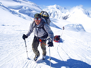
857-88779 - Mountain ranger Brian Scheele on this way to Windy Corner on Mount McKinley, also know as Denali, in Alaska. He is pulling a sled, that together with his heavy backpack is containing all the gear like tents, clothing and food. Every climbing season High Mountain Rangers of the Denali National Park Service are called to help climbers in need. If possible the patient is brought down to Basecamp on foot, only in life threatening conditions a helicopter is called to evacuate the patient to a hospital in Anchorage. Mount McKinley, native name Denali, is the highest mountain peak in North America, with a summit elevation of 20,321 feet (6,194 m) above sea level. At some 18,000 feet (5,500 m), the base-to-peak rise is considered the largest of any mountain situated entirely above sea level. Measured by topographic prominence, it is the third most prominent peak after Mount Everest and Aconcagua. Located in the Alaska Range in the interior of the U.S. state of Alaska, McKinley is the centerpiece of Denali National Park and Preserve.
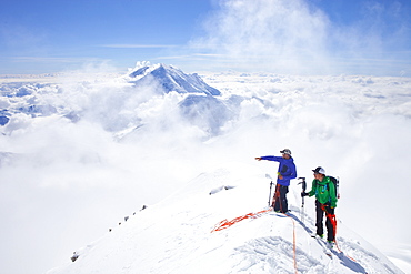
857-88775 - High Mountain Rangers Tom Ditola and David Weber are taking a rest on the West Rib on Mount McKinley, Alaska. Mount Hunter in the background. They are above the clouds in blue sky and the sun is shining. Mount McKinley, native name Denali, is the highest mountain peak in North America, with a summit elevation of 20,321 feet (6,194 m) above sea level. At some 18,000 feet (5,500 m), the base-to-peak rise is considered the largest of any mountain situated entirely above sea level. Measured by topographic prominence, it is the third most prominent peak after Mount Everest and Aconcagua. Located in the Alaska Range in the interior of the U.S. state of Alaska, McKinley is the centerpiece of Denali National Park and Preserve. Every climbing season High Mountain Rangers of the Denali National Park Service are called to help climbers in need. If possible the patient is brought down to base camp on foot, only in life threatening conditions a helicopter is called to evacuate the patient to a hospital in Anchorage.
911-10455 - A woman subsistence farmer cooking on a traditional clay oven, using rice stalks as biofuel in the Sunderbans, Ganges, Delta, India. the area is very low lying and vulnerable to sea level rise. All parts of the rice crop are used, and the villagers life is very self sufficient, with a tiny carbon footprint.
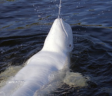
832-375007 - Beluga whale (Delphinapterus leucas), Kareliya, Russia, White Sea, Arctic
832-372294 - Pacific seahorse (Hippocampus ingens) and a small sponge, Ponta de Sao Vicente, Isabella Island, Albemarle, Galapagos Islands, a UNESCO World Natural Heritage Site, Ecuador, Pacific Ocean
832-372288 - Shoal of golden cownose rays (Rhinoptera steindachneri), swimming in the open sea, Gardner Bay, Española Island also known as Hood Island, Galápagos Islands, a World Heritage - natural site, Ecuador, South America, Pacific Ocean
832-372297 - Pygmy seahorse (Bargibanti hippocampus) on a branch of coral, Great Barrier Reef, a UNESCO World Heritage Site, Queensland, Cairns, Australia, Pacific Ocean
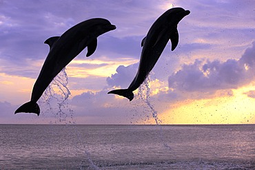
832-373802 - Three Common Bottlenose Dolphins (Tursiops truncatus), adult, leaping at sunset, Roatan, Honduras, Caribbean, Central America, Latin America
832-368342 - Rescue boat, Siglufjoerdur, Iceland, Northern Europe, Europe
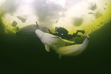
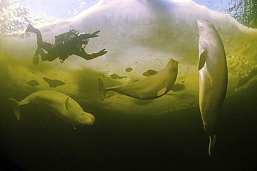
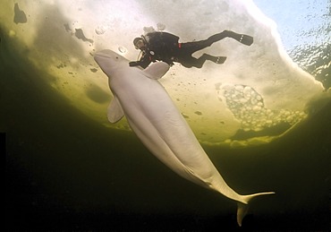
832-367281 - Diver and Belugas, White whales (Delphinapterus leucas), ice-diving in White Sea, Karelia, north Russia, Arctic
832-367923 - Steller sea lion (Eumetopias jubatus), bull, swimming, California, USA
832-373800 - Two Common Bottlenose Dolphins (Tursiops truncatus), adult, leaping at sunset, Roatan, Honduras, Caribbean, Central America, Latin America
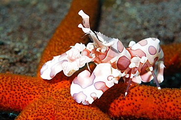
832-372296 - Harlequin shrimp (Hymenocera picta) on a red starfish, Great Barrier Reef, a UNESCO World Heritage Site, Queensland, Cairns, Australia, Pacific Ocean
832-375581 - Woman with cocktail enjoys holidays at sea
832-367282 - Diver and Belugas, White whales (Delphinapterus leucas), ice-diving in White Sea, Karelia, north Russia, Arctic
832-371974 - Tourist playing with a common bottlenose dolphin (Tursiops truncatus), dolphin show, Hawks Cay Resort, Florida Keys, USA
832-373806 - Two Common Bottlenose Dolphins (Tursiops truncatus), adult, leaping at sunset, Roatan, Honduras, Caribbean, Central America, Latin America
832-375924 - Beach life on Copacabana beach, Rio de Janeiro, Brazil
832-369335 - King penguin (Aptenodytes patagonicus) walking in front of a mating Southern Elephant Seal (Mirounga leonina), St. Andrews Bay, South Georgia Island
832-367922 - Steller sea lion (Eumetopias jubatus), bull, swimming, California, USA
832-373804 - Two Common Bottlenose Dolphins (Tursiops truncatus), adult, leaping at sunset, Roatan, Honduras, Caribbean, Central America, Latin America
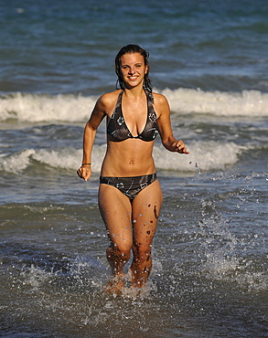
832-369885 - Young woman by the sea, Four Mile Beach, Port Douglas, Daintree National Park, Queensland, Australia
832-367271 - Diver and Common Starfish (Asterias rubens), ice-diving, White Sea, Karelia, north Russia, Arctic
832-375009 - Beluga whale (Delphinapterus leucas), Kareliya, Russia, White Sea, Arctic
832-367283 - Diver and Belugas, White whales (Delphinapterus leucas), ice-diving in White Sea, Karelia, north Russia, Arctic
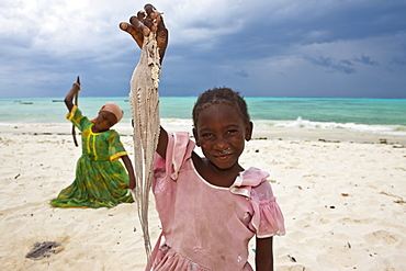
832-371383 - Children beating an octopus with sticks in order to make it edible, Jambiani, Zanzibar, Tanzania, Africa
832-372287 - Shoal of golden cownose rays (Rhinoptera steindachneri), swimming in the open sea, Gardner Bay, Española Island also known as Hood Island, Galápagos Islands, a World Heritage - natural site, Ecuador, South America, Pacific Ocean

