Recent searches
Loading...
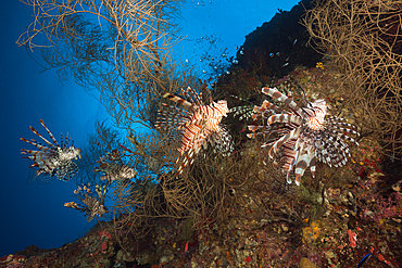
759-12058 - Red Lionfish, Pterois volitans, Marovo Lagoon, Solomon Islands
759-12057 - Red Lionfish, Pterois volitans, Marovo Lagoon, Solomon Islands
759-12056 - Red Lionfish, Pterois volitans, Marovo Lagoon, Solomon Islands
759-12055 - Red Lionfish, Pterois volitans, Marovo Lagoon, Solomon Islands
759-12054 - Armed Bomb at Dauntless Dive Bomber Wreck, Marovo Lagoon, Solomon Islands
759-12052 - Radial Engine of Dauntless Dive Bomber Wreck, Marovo Lagoon, Solomon Islands
759-12053 - Armed Bomb at Dauntless Dive Bomber Wreck, Marovo Lagoon, Solomon Islands
759-12051 - Radial Engine of Dauntless Dive Bomber Wreck, Marovo Lagoon, Solomon Islands
759-12050 - Anemonefish on Lockheed P-388 Lightning Fighter Aircraft Wreck, Marovo Lagoon, Solomon Islands
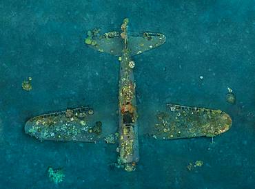
759-12049 - Lockheed P-388 Lightning Fighter Aircraft Wreck, Marovo Lagoon, Solomon Islands
759-12048 - Lockheed P-388 Lightning Fighter Aircraft Wreck, Marovo Lagoon, Solomon Islands
759-12047 - Lockheed P-388 Lightning Fighter Aircraft Wreck, Marovo Lagoon, Solomon Islands
759-12046 - Lockheed P-388 Lightning Fighter Aircraft Wreck, Marovo Lagoon, Solomon Islands
759-12045 - Upright Tuna Boat Wreck, Marovo Lagoon, Solomon Islands
759-12044 - Upright Tuna Boat Wreck, Marovo Lagoon, Solomon Islands
759-12043 - Upright Tuna Boat Wreck, Marovo Lagoon, Solomon Islands
759-12042 - Upright Tuna Boat Wreck, Marovo Lagoon, Solomon Islands
759-12041 - Upright Tuna Boat Wreck, Marovo Lagoon, Solomon Islands
759-12069 - Scuba Diving in Mbuco Caves, Marovo Lagoon, Solomon Islands
759-12067 - Scuba Diving in Mbuco Caves, Marovo Lagoon, Solomon Islands
1112-6920 - Adult bull Steller sea lion (Eumetopias jubatus), catching salmon at the Solomon Gulch Hatchery, Valdez, Alaska, United States of America, North America
1112-6922 - Adult bull Steller sea lions (Eumetopias jubatus), territorial display at the Solomon Gulch Hatchery, Valdez, Alaska, United States of America, North America
1112-6921 - Adult bull Steller sea lion (Eumetopias jubatus), territorial display at the Solomon Gulch Hatchery, Valdez, Alaska, United States of America, North America
1112-6923 - Adult bull Steller sea lions (Eumetopias jubatus), territorial display at the Solomon Gulch Hatchery, Valdez, Alaska, United States of America, North America
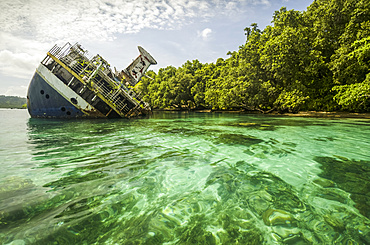
1116-51041 - Shipwrecked World Discoverer cruise in tropical waters of the Solomon Islands, Roderick Bay; Nggela Islands, Solomon Islands
860-287442 - Tara Pacific expedition - november 2017 Kimbe Bay, papua New Guinea, Zero wreck: Coral growth on this wreck is from a period of 74 years ! D: 15 m The ZERO, is a Japanese WW2 fighter plane wreck. This Zero wreck was discovered in January 2000 by local William Nuli while he was freediving for sea cucumbers. He asked the Walindi Plantation Resort dive team if they might know what it was, and when they investigated they uncovered the intact wreck of a Zero fighter, resting on a sedimented bottom in 15 m depth. This World War II Japanese fighter is almost completely intact. The plane is believed to have been ditched, the pilot is believed to have survived, but was never found on the island. He never returned home. Maybe he disappeared in the jungle? On 26th December 1943, during the battle of Cape Gloucester, the Japanese pilot made an emergency landing, ditching his Mitsubishi A6M Zero plane into the sea approximately 100m off West New Britain Province. The plane was piloted by PO1 Tomiharu Honda of the 204st K?k?tai. His fate is unknown but it is believed the he made a controlled water landing after running out of fuel and survived. Although he failed to return to his unit, the plane was found with the throttle and trim controls both set for landing and the canopy was open. There are no visible bullet holes or other shrapnel damage and the plane is still virtually intact after over 70 years underwater. It is a A6M2 Model 21 Zero, made famous for its use in Kamikaze attacks by the Japanese Imperial Navy. The wreck has the Manufacture Number 8224 and was built by Nakajima in late August 1942.
860-287440 - Tara Pacific expedition - november 2017 Zero wreck, vertical view Orthomosaic from 3D photogrammetry (13500 x 10000 px). D: 15 m Kimbe Bay, papua New Guinea, Coral growth on this wreck is from a period of 74 years ! The ZERO, is a Japanese WW2 fighter plane wreck. This Zero wreck was discovered in January 2000 by local William Nuli while he was freediving for sea cucumbers. He asked the Walindi Plantation Resort dive team if they might know what it was, and when they investigated they uncovered the intact wreck of a Zero fighter, resting on a sedimented bottom in 15 m depth. This World War II Japanese fighter is almost completely intact. The plane is believed to have been ditched, the pilot is believed to have survived, but was never found on the island. He never returned home. Maybe he disappeared in the jungle? On 26th December 1943, during the battle of Cape Gloucester, the Japanese pilot made an emergency landing, ditching his Mitsubishi A6M Zero plane into the sea approximately 100m off West New Britain Province. The plane was piloted by PO1 Tomiharu Honda of the 204st K?k?tai. His fate is unknown but it is believed the he made a controlled water landing after running out of fuel and survived. Although he failed to return to his unit, the plane was found with the throttle and trim controls both set for landing and the canopy was open. There are no visible bullet holes or other shrapnel damage and the plane is still virtually intact after over 70 years underwater. It is a A6M2 Model 21 Zero, made famous for its use in Kamikaze attacks by the Japanese Imperial Navy. The wreck has the Manufacture Number 8224 and was built by Nakajima in late August 1942.
860-287441 - Tara Pacific expedition - november 2017 Yanaba Island, Egum Atoll, Papua New Guinea, Old man of Yanaba.
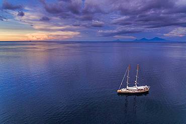
860-287439 - Tara Pacific expedition - november 2017 Tara in Kimbe Bay, papua New Guinea, H: 103,6 m, mandatory credit line: Photo: Christoph Gerigk, drone pilot: Guillaume Bourdin - Tara Expeditions Foundation
860-287437 - Tara Pacific expedition - november 2017 Small coral island and adjacent reef, near Yanaba Island, Papua New Guinea, H: 536,6 m, mandatory credit line: Photo: Christoph Gerigk, drone pilot: Guillaume Bourdin - Tara Expeditions Foundation
860-287438 - Tara Pacific expedition - november 2017 Small coral island and adjacent reef, near Yanaba Island, Papua New Guinea, H: 452.3 m, mandatory credit line: Photo: Christoph Gerigk, drone pilot: Guillaume Bourdin - Tara Expeditions Foundation
857-94717 - Nimoa Island - here the island mission will impress. The five-sided church features murals of island life and all mission buildings are surrounded by well maintained paths and gardens filled with flowering plants. Edged by jungle-covered mountains, postcard beaches and crystal clear waters - an island paradise indeed! The Louisiade Archipelago is a string of ten larger volcanic islands frequently fringed by coral reefs, and 90 smaller coral islands located 200 km southeast of New Guinea, stretching over more than 160 km and spread over an ocean area of 26,000 km? between the Solomon Sea to the north and the Coral Sea to the south. The aggregate land area of the islands is about 1,790 km? (690 square miles), with Vanatinai (formerly Sudest or Tagula as named by European claimants on Western maps) being the largest. Sideia Island and Basilaki Island lie closest to New Guinea, while Misima, Vanatinai, and Rossel islands lie further east. The archipelago is divided into the Local Level Government (LLG) areas Loui!
857-94720 - Nimoa Island - here the island mission will impress. The five-sided church features murals of island life and all mission buildings are surrounded by well maintained paths and gardens filled with flowering plants. Edged by jungle-covered mountains, postcard beaches and crystal clear waters - an island paradise indeed! The Louisiade Archipelago is a string of ten larger volcanic islands frequently fringed by coral reefs, and 90 smaller coral islands located 200 km southeast of New Guinea, stretching over more than 160 km and spread over an ocean area of 26,000 km? between the Solomon Sea to the north and the Coral Sea to the south. The aggregate land area of the islands is about 1,790 km? (690 square miles), with Vanatinai (formerly Sudest or Tagula as named by European claimants on Western maps) being the largest. Sideia Island and Basilaki Island lie closest to New Guinea, while Misima, Vanatinai, and Rossel islands lie further east. The archipelago is divided into the Local Level Government (LLG) areas Louisiade Rural (western part, with Misima), and Yaleyamba (western part, with Rossell and Tagula islands. The LLG areas are part of Samarai-Murua District district of Milne Bay. The seat of the Louisiade Rural LLG is Bwagaoia on Misima Island, the population center of the archipelago.
857-94718 - Nimoa Island - here the island mission will impress. The five-sided church features murals of island life and all mission buildings are surrounded by well maintained paths and gardens filled with flowering plants. Edged by jungle-covered mountains, postcard beaches and crystal clear waters - an island paradise indeed! The Louisiade Archipelago is a string of ten larger volcanic islands frequently fringed by coral reefs, and 90 smaller coral islands located 200 km southeast of New Guinea, stretching over more than 160 km and spread over an ocean area of 26,000 km? between the Solomon Sea to the north and the Coral Sea to the south. The aggregate land area of the islands is about 1,790 km? (690 square miles), with Vanatinai (formerly Sudest or Tagula as named by European claimants on Western maps) being the largest. Sideia Island and Basilaki Island lie closest to New Guinea, while Misima, Vanatinai, and Rossel islands lie further east. The archipelago is divided into the Local Level Government (LLG) areas Louisiade Rural (western part, with Misima), and Yaleyamba (western part, with Rossell and Tagula islands. The LLG areas are part of Samarai-Murua District district of Milne Bay. The seat of the Louisiade Rural LLG is Bwagaoia on Misima Island, the population center of the archipelago.
857-94722 - Children playing with a outrigger canoe in the village of Hessessai Bay at PanaTinai (Panatinane)island in the Louisiade Archipelago in Milne Bay Province, Papua New Guinea. The island has an area of 78 km2. The Louisiade Archipelago is a string of ten larger volcanic islands frequently fringed by coral reefs, and 90 smaller coral islands located 200 km southeast of New Guinea, stretching over more than 160 km and spread over an ocean area of 26,000 km? between the Solomon Sea to the north and the Coral Sea to the south. The aggregate land area of the islands is about 1,790 km? (690 square miles), with Vanatinai (formerly Sudest or Tagula as named by European claimants on Western maps) being the largest. Sideia Island and Basilaki Island lie closest to New Guinea, while Misima, Vanatinai, and Rossel islands lie further east. The archipelago is divided into the Local Level Government (LLG) areas Louisiade Rural (western part, with Misima), and Yaleyamba (western part, with Rossell and Tagula islands. The LLG areas are part of Samarai-Murua District district of Milne Bay. The seat of the Louisiade Rural LLG is Bwagaoia on Misima Island, the population center of the archipelago.PanaTinai (Panatinane) is an island in the Louisiade Archipelago in Milne Bay Province, Papua New Guinea.
857-94715 - Nimoa Island - here the island mission will impress. The five-sided church features murals of island life and all mission buildings are surrounded by well maintained paths and gardens filled with flowering plants. Edged by jungle-covered mountains, postcard beaches and crystal clear waters - an island paradise indeed! The Louisiade Archipelago is a string of ten larger volcanic islands frequently fringed by coral reefs, and 90 smaller coral islands located 200 km southeast of New Guinea, stretching over more than 160 km and spread over an ocean area of 26,000 km? between the Solomon Sea to the north and the Coral Sea to the south. The aggregate land area of the islands is about 1,790 km? (690 square miles), with Vanatinai (formerly Sudest or Tagula as named by European claimants on Western maps) being the largest. Sideia Island and Basilaki Island lie closest to New Guinea, while Misima, Vanatinai, and Rossel islands lie further east.
857-94719 - Nimoa Island - here the island mission will impress. The five-sided church features murals of island life and all mission buildings are surrounded by well maintained paths and gardens filled with flowering plants. Edged by jungle-covered mountains, postcard beaches and crystal clear waters - an island paradise indeed! The Louisiade Archipelago is a string of ten larger volcanic islands frequently fringed by coral reefs, and 90 smaller coral islands located 200 km southeast of New Guinea, stretching over more than 160 km and spread over an ocean area of 26,000 km? between the Solomon Sea to the north and the Coral Sea to the south. The aggregate land area of the islands is about 1,790 km? (690 square miles), with Vanatinai (formerly Sudest or Tagula as named by European claimants on Western maps) being the largest. Sideia Island and Basilaki Island lie closest to New Guinea, while Misima, Vanatinai, and Rossel islands lie further east. The archipelago is divided into the Local Level Government (LLG) areas Louisiade Rural (western part, with Misima), and Yaleyamba (western part, with Rossell and Tagula islands. The LLG areas are part of Samarai-Murua District district of Milne Bay. The seat of the Louisiade Rural LLG is Bwagaoia on Misima Island, the population center of the archipelago.
857-94721 - Nimoa Island - here the island mission will impress. The five-sided church features murals of island life and all mission buildings are surrounded by well maintained paths and gardens filled with flowering plants. Edged by jungle-covered mountains, postcard beaches and crystal clear waters - an island paradise indeed! The Louisiade Archipelago is a string of ten larger volcanic islands frequently fringed by coral reefs, and 90 smaller coral islands located 200 km southeast of New Guinea, stretching over more than 160 km and spread over an ocean area of 26,000 km? between the Solomon Sea to the north and the Coral Sea to the south. The aggregate land area of the islands is about 1,790 km? (690 square miles), with Vanatinai (formerly Sudest or Tagula as named by European claimants on Western maps) being the largest. Sideia Island and Basilaki Island lie closest to New Guinea, while Misima, Vanatinai, and Rossel islands lie further east. The archipelago is divided into the Local Level Government (LLG) areas Loui!
857-94716 - Nimoa Island - here the island mission will impress. The five-sided church features murals of island life and all mission buildings are surrounded by well maintained paths and gardens filled with flowering plants. Edged by jungle-covered mountains, postcard beaches and crystal clear waters - an island paradise indeed! The Louisiade Archipelago is a string of ten larger volcanic islands frequently fringed by coral reefs, and 90 smaller coral islands located 200 km southeast of New Guinea, stretching over more than 160 km and spread over an ocean area of 26,000 km? between the Solomon Sea to the north and the Coral Sea to the south. The aggregate land area of the islands is about 1,790 km? (690 square miles), with Vanatinai (formerly Sudest or Tagula as named by European claimants on Western maps) being the largest. Sideia Island and Basilaki Island lie closest to New Guinea, while Misima, Vanatinai, and Rossel islands lie further east. The archipelago is divided into the Local Level Government (LLG) areas Loui!
857-94714 - The Louisiade Archipelago is a string of ten larger volcanic islands frequently fringed by coral reefs, and 90 smaller coral islands located 200 km southeast of New Guinea, stretching over more than 160 km and spread over an ocean area of 26,000 km? between the Solomon Sea to the north and the Coral Sea to the south. The aggregate land area of the islands is about 1,790 km? (690 square miles), with Vanatinai (formerly Sudest or Tagula as named by European claimants on Western maps) being the largest. Sideia Island and Basilaki Island lie closest to New Guinea, while Misima, Vanatinai, and Rossel islands lie further east. The archipelago is divided into the Local Level Government (LLG) areas Louisiade Rural (western part, with Misima), and Yaleyamba (western part, with Rossell and Tagula islands. The LLG areas are part of Samarai-Murua District district of Milne Bay. The seat of the Louisiade Rural LLG is Bwagaoia on Misima Island, the population center of the archipelago.
857-94712 - The Louisiade Archipelago is a string of ten larger volcanic islands frequently fringed by coral reefs, and 90 smaller coral islands located 200 km southeast of New Guinea, stretching over more than 160 km and spread over an ocean area of 26,000 km? between the Solomon Sea to the north and the Coral Sea to the south. The aggregate land area of the islands is about 1,790 km? (690 square miles), with Vanatinai (formerly Sudest or Tagula as named by European claimants on Western maps) being the largest.Sideia Island and Basilaki Island lie closest to New Guinea, while Misima, Vanatinai, and Rossel islands lie further east. The archipelago is divided into the Local Level Government (LLG) areas Louisiade Rural (western part, with Misima), and Yaleyamba (western part, with Rossell and Tagula islands. The LLG areas are part of Samarai-Murua District district of Milne Bay. The seat of the Louisiade Rural LLG is Bwagaoia on Misima Island, the population center of the archipelago.
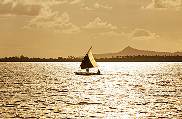
824-181 - A man in a dug out canoe at sunset, Solomon Islands, Pacific
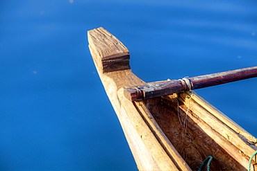
824-180 - A man in a dug out canoe, Solomon Islands, Pacific
832-256330 - Palm trees on a beach, Solomon Bay, St. John Island, United States Virgin Islands, Caribbean
832-256323 - Palm trees on a beach, Solomon Bay, St. John Island, United States Virgin Islands, Caribbean
832-256320 - Palm trees on a beach, Solomon Bay, St. John Island, United States Virgin Islands, Caribbean
832-256316 - Palm tree on a beach, Solomon Bay, St. John Island, United States Virgin Islands, Caribbean
832-256317 - Palm tree on a beach, Solomon Bay, St. John Island, United States Virgin Islands, Caribbean
832-256321 - Palm trees on a beach, Solomon Bay, St. John Island, United States Virgin Islands, Caribbean
832-256329 - Palm trees on a beach, Solomon Bay, St. John Island, United States Virgin Islands, Caribbean
1116-37838 - Solomon Islands, serpent sea star on leather coral, close-up detail A90E
857-7802 - Various classroom situations at several different schools. Every other Friday is culture day when the students come to school in tradional dress.
857-7803 - Various classroom situations at several different schools. Every other Friday is culture day when the students come to school in tradional dress.
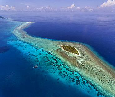
816-3389 - Aerial of the Marovo Lagoon, Solomon Islands, Pacific
816-3416 - Young boys fishing in the Marovo Lagoon, Solomon Islands, Pacific
816-3412 - Huge cloud formations over the Marovo Lagoon, Solomon Islands, Pacific
816-3421 - Beach at Savo Island, Savo, Solomon Islands, Pacific
816-3422 - Beach on Savo Island, Solomon Islands, Pacific
816-3427 - Beach on Savo Island, Solomon Islands, Pacific
816-3415 - Boys in a canoe in backlit in the Marovo Lagoon, Solomon Islands, Pacific
816-3413 - Young boys fishing in the Marovo Lagoon below dramatic clouds, Solomon Islands, Pacific
816-3417 - Young boys fishing in the Marovo Lagoon, Solomon Islands, Pacific
816-3424 - Beach on Savo Island, Savo, Solomon Islands, Pacific
816-3428 - Beach on Savo Island, Solomon Islands, Pacific
816-3395 - View over Honiara, capital of the Solomon Islands, Pacific
816-3388 - Aerial of the Marovo Lagoon, Solomon Islands, Pacific
816-3405 - Giant clams in the clear waters of the Marovo Lagoon, Solomon Islands, Pacific
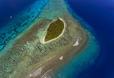
816-3393 - Aerial of the Russell Islands, Solomon Islands, Pacific
816-3399 - View over Honiara, capital of the Solomon Islands, Pacific
920-1318 - Hooded carpet shark (Hemiscyllium strahani). Madang, Papua New Guinea, Solomon Sea, Pacific
920-1317 - Reef cuttlefish (Sepia sp.) at night, Madang, Papua New Guinea, Solomon Sea, Pacific
465-2455 - Mother and child in water, Munda, Solomon Islands, Pacific Islands, Pacific
465-2173 - Crowd of tropical reef fish including scissortail sergeants and grunts, Solomon Islands, Pacific Ocean
465-3076 - Aerial view of the Solomon Islands, Melanesia, South Pacific, Pacific
You reached the end of search results


