Recent searches
Loading...
844-30860 - View of Section of the Berlin Wall at the Topography of Terrors Museum, Berlin, Germany, Europe
844-30852 - View of Section of the Berlin Wall at the Topography of Terrors Museum, Berlin, Germany, Europe
844-30833 - View of Section of the Berlin Wall at the Topography of Terrors Museum, Berlin, Germany, Europe
844-30831 - View of Section of the Berlin Wall at the Topography of Terrors Museum, Berlin, Germany, Europe
844-30826 - View of Section of the Berlin Wall at the Topography of Terrors Museum, Berlin, Germany, Europe
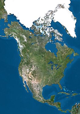
1348-3391 - Satellite view of North America. This image was compiled from data acquired by Landsat 7 & 8 satellites.
1348-5238 - Trinidad and Tobago, Satellite Image With Bump Effect, With Border
1348-3360 - Satellite view of Svalbard, Norway. It is a Norwegian archipelago in the Arctic Ocean. This image was compiled from data acquired by Landsat satellites.
1348-3398 - Satellite view of Mauna Kea Volcano, Island of Hawaii. This image was compiled from data acquired by Landsat 8 satellite in 2014.
1348-3418 - Satellite view of Easter Island. This image was compiled from data acquired by Landsat 8 satellite in 2014.
1348-3356 - Satellite view of Tenerife, Canary Islands, Spain. It is the largest and most populous island of the seven Canary Islands. Volcano Mount Teide at center is the highest point of Spain, at 3718 m. This image was compiled from data acquired by Landsat 8 satellite in 2014.
1348-3363 - Satellite view of Sri Lanka. This image was compiled from data acquired by Landsat 8 satellite in 2014.
1348-3348 - Satellite view of British and US Virgin Islands. This image was compiled from data acquired by Landsat satellites.
1348-3390 - Satellite view of North America that shows Arctic ice cap. This image was compiled from data acquired by Landsat 7 & 8 satellites.
1348-3404 - Satellite view of the State of Hawaii, USA. The main islands are Kauai, Oahu, Maui and the Island of Hawaii. This image was compiled from data acquired by Landsat 8 satellite in 2014.
1348-3405 - Satellite view of the Island of Hawaii, USA. The island is formed of five volcanoes, Mauna Loa being the largest. This image was compiled from data acquired by Landsat 8 satellite in 2014.
1348-3406 - Satellite view of the Great Barrier Reef, Australia, off Mackay's coast. This image was compiled from data acquired in 2014 by Landsat 8 satellite.
1348-3420 - Satellite view of Crete, Greece. Crete is the largest and most populous of the Greek islands. This image was compiled from data acquired by Landsat 8 satellite in 2014.
1348-3371 - Satellite view of Northern Europe showing Scandinavia and the Baltic States. This image was compiled from data acquired by LANDSAT 7 & 8 satellites.
1348-3355 - Satellite view of Tongatapu, the largest island of Tonga archipelago. This image was compiled from data acquired by Landsat 8 satellite in 2014.
1348-3387 - Satellite view of Northern South America. This image was compiled from data acquired by Landsat 7 & 8 satellites.
1348-3372 - Satellite view of Najran University, Saudi Arabia. This image was taken in 2014 by Landsat 8 satellite.
1348-3396 - Satellite view of Moorea, French Polynesia. This image was compiled from data acquired by Landsat 8 satellite in 2014.
1348-3392 - Satellite view of Mount Kilimanjaro, Tanzania. This dormant volcano is the highest mountain in Africa. It is part of the Kilimanjaro National Park. This image was compiled from data acquired by Landsat satellites.
1348-3386 - Satellite view of Nuku Hiva, the largest of the Marquesas Islands in French Polynesia. This image was compiled from data acquired by Landsat 8 satellite in 2014.
1348-3362 - Satellite view of Sulawesi, Indonesia. This image was compiled from data acquired by Landsat satellites.
1348-3440 - Satellite view of Syr Daria River, Kazakhstan. This image was compiled from data acquired in 2014 by Landsat 8 satellite.
1348-3374 - Satellite view of Sao Tome. This image was compiled from data acquired by Landsat satellites.
1348-3394 - Satellite view of Eruption at Mount Etna, Sicily. This image was taken on December 3, 2015 by Landsat 8 satellite.
1348-3429 - Satellite view of the Abaco Islands that lie in the northern Bahamas
1348-3365 - Satellite view of the Southern Great Barrier Reef and Fraser Island along Queensland's coastline in north-east Australia. This image was compiled from data acquired in 2014 by Landsat 8 satellite.
1348-3375 - Satellite view of Sao Miguel Island, Azores, Portugal. It is the largest and most populous island in the Azores archipelago. This image was compiled from data acquired by Landsat satellites.
1348-3397 - Satellite view of the Middle East. This image was compiled from data acquired in 2014 by Landsat 8 satellite.
1348-3383 - Satellite view of Pico Island, Azores, Portugal. Volcano Mount Pico, to the West, is the highest point in Portugal, at 2351 m, and the most famous landmark in the Azores. This image was compiled from data acquired by Landsat satellites.
1348-3347 - Satellite view of Viti Levu Island, Fiji. This is the largest island in the Republic of Fiji and the site of the nation's capital, Suva. This image was compiled from data acquired by Landsat 8 satellite in 2014.
1348-3368 - Satellite view of South America. This image was compiled from data acquired by Landsat 7 & 8 satellites.
1348-3413 - Satellite view of the Fiji Islands. This image was compiled from data acquired by Landsat 8 satellite in 2014.
1348-3410 - Satellite view of Funafuti, an atoll on which the capital of the island nation of Tuvalu is located. This image was compiled from data acquired by Landsat 8 satellite in 2014.
1348-3359 - Satellite view of Tahiti, French Polynesia. This image was compiled from data acquired by Landsat 8 satellite in 2014.
1348-3367 - Satellite view of Southeast Asia. This image was compiled from data acquired by Landsat 7 & 8 satellites.
1348-3381 - Satellite view of Rarotonga, Cook Islands. This is the most populous island of the Cook Islands. This image was compiled from data acquired by Landsat 8 satellite in 2014.
1348-3409 - Satellite view of Futuna and Alofi Islands, part of Wallis and Futuna islands. This image was compiled from data acquired by Landsat 8 satellite in 2014.
1348-3425 - Satellite view of New Providence and Eleuthera Island, Bahamas. New Providence is the most populous island in the Bahamas and it houses the capital city of Nassau
1348-3402 - Satellite view of Isabela and Fernandina Islands, Galapagos Islands. This image was compiled from data acquired by Landsat satellites.
1348-3358 - Satellite view of Taiwan. This image was compiled from data acquired by Landsat satellites.
1348-3349 - Satellite view of Saint Thomas and Saint John, US Virgin Islands. This image was compiled from data acquired by Landsat satellites.
1348-3421 - Satellite view of the Comoros Archipelago. This image was compiled from data acquired by Landsat satellites.
1348-3400 - Satellite view of Komodo Island, Indonesia. The image shows the whole Komodo National Park that includes the three islands Komodo, Padar and Rinca. This image was compiled from data acquired by Landsat satellites.
1348-3384 - Satellite view of the Persian Gulf. This image was compiled from data acquired in 2014 by Landsat 8 satellite.
1348-3424 - Satellite view of Andros Islands and New Providence, Bahamas. New Providence is the most populous island in the Bahamas and it houses the capital city of Nassau
1348-3423 - Satellite view of Barbados. This image was compiled from data acquired by Landsat satellites.
1348-3432 - Satellite view of the Arabian Peninsula. This image was compiled from data acquired in 2014 by Landsat 8 satellite.
1348-3345 - Satellite view of the Central Great Barrier Reef along Queensland's coastline in north-east Australia
1348-3411 - Satellite view of Fuerteventura and Lanzarote, Canary Islands, Spain. This image was compiled from data acquired by Landsat 8 satellite in 2014.
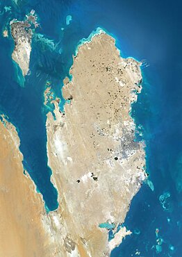
1348-3382 - Satellite view of Qatar and Bahrain. This image was compiled from data acquired by Landsat 8 satellite in 2014.
1348-3388 - Satellite view of North America in winter, with partial snow cover and Arctic ice cap. This image was compiled from data acquired by Landsat 7 & 8 satellites.
1348-3366 - Satellite view of Southern Africa. It shows the African Great Lakes region. This image was compiled from data acquired by Landsat 7 & 8 satellites.
1348-3354 - Satellite view of Trinidad and Tobago. This image was compiled from data acquired by Landsat satellites.
1348-3378 - Satellite view of Saint Vincent. This image was compiled from data acquired by Landsat satellites.
1348-3434 - Satellite view of Ambrym, a volcanic island in the archipelago of Vanuatu. This image was compiled from data acquired by Landsat 8 satellite in 2014.
1348-3393 - Satellite view of Mount Erebus, the tallest volcano in Antarctica. Situated on Ross Island, just off the coast of West Antarctica, Erebus is the southernmost active volcano on Earth. This image was taken on December 31, 2013 by Landsat 8 satellite.
1348-3417 - Satellite view of Efate, Vanuatu. It is the most populous island of Vanuatu archipelago. This image was compiled from data acquired by Landsat 8 satellite in 2014.
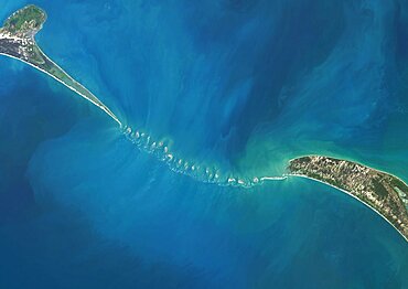
1348-3438 - Satellite view of Adam's Bridge. This chain of limestone shoals connects Sri Lanka to India. This image was taken in 2014 by Landsat 8 satellite.
1348-3357 - Satellite view of Tasmania, Australia. This image was compiled from data acquired by Landsat 8 satellite in 2014.
1348-3427 - Satellite view of Eleuthera Island, Bahamas. This image was compiled from data acquired by Landsat satellites.
1348-3436 - Satellite view of Africa. This image was compiled from data acquired by Landsat 7 & 8 satellites.
1348-3442 - Satellite view of Turkmenbashi Gulf on the Caspian Sea in Turkmenistan. This image was compiled from data acquired in 2014 by Landsat 8 satellite.
1348-3373 - Satellite view of the King Fahd Causeway, a series of bridges and causeways connecting Saudi Arabia and Bahrain. This image was compiled from data acquired in 2014 by Landsat 8 satellite.
1348-3437 - Satellite view of part of the Aeolian Islands, Italy. The image shows the islands of Salina, Lipari, Vulcano, Panarea and Basiluzzo. This image was compiled from data acquired by Landsat satellites.
1348-3350 - Satellite view of Saint Croix, US Virgin Islands. This image was compiled from data acquired by Landsat satellites.
1348-3389 - Satellite view of North America in winter, with partial snow cover. This image was compiled from data acquired by Landsat 7 & 8 satellites.
1348-3395 - Satellite view of Mount Raung, one of the most active volcanoes on the island of Java in Indonesia. This image was taken on July 27, 2015 by Landsat 8 satellite.
1348-3380 - Satellite view of Russia and Central Asia in winter, with partial snow cover. This image was compiled from data acquired by Landsat 7 & 8 satellites.
1348-3403 - Satellite view of Hiva Oa, the second largest island in the Marquesas Islands, in French Polynesia. This image was compiled from data acquired by Landsat 8 satellite in 2014.
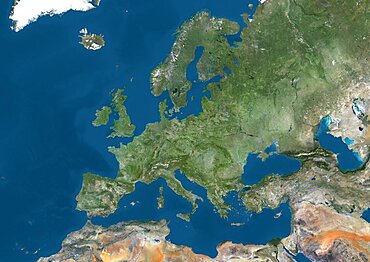
1348-3415 - Satellite view of Europe. This image was compiled from data acquired by Landsat 7 & 8 satellites.
1348-3399 - Satellite view of La Palma, Tenerife and Gran Canaria, Canary Islands, Spain. The smallest islands of La Gomera and El Hierro are also shown. This image was compiled from data acquired by Landsat 8 satellite in 2014.
1348-3370 - Satellite view of Northern Europe showing Scandinavia and the Baltic States in winter, with partial snow cover. This image was compiled from data acquired by Landsat 7 & 8 satellites.
1348-3364 - Satellite view of the South Island, New Zealand. This image was compiled from data acquired by Landsat 8 satellite in 2014.
1348-3369 - Satellite view of Sicily, Italy. Mount Etna, on the East coast of Sicily, is the largest active volcano in Europe. This image was compiled from data acquired by Landsat satellites.
1348-3445 - Satellite view of Senegal River that forms the border between Senegal and Mauritania in West Africa.This image was taken in 2014 by Landsat 8 satellite.
1348-5237 - Trinidad and Tobago, True Colour Satellite Image With Border
1348-3408 - Satellite view of Grand Cayman. It is the largest of the three Cayman Islands. This image was compiled from data acquired by Landsat satellites.
1348-3430 - Satellite view of Uluru Ayers Rock, Northern Territory, Australia. This image was compiled from data acquired by Landsat satellites.
1348-3377 - Satellite view of Saint Vincent and the Grenadines. This image was compiled from data acquired by Landsat satellites.
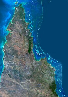
1348-3353 - Satellite view of the Northern Great Barrier Reef along the east coast of Cape York Peninsula in north Australia. This image was compiled from data acquired in 2014 by Landsat 8 satellite.
1348-3379 - Satellite view of Saint Lucia. This image was compiled from data acquired by Landsat satellites.
1348-3433 - Satellite view of Antigua And Barbuda. This image was compiled from data acquired by Landsat satellites.
1348-3385 - Satellite view of Oceania. This image was compiled from data acquired by Landsat 7 & 8 satellites.
1348-3444 - Satellite view of Moreton Bay, Queensland, Australia. This image was compiled from data acquired in 2014 by Landsat 8 satellite.
1348-3412 - Satellite view of Mayotte. This image was compiled from data acquired by Landsat satellites.
1348-3416 - Satellite view of Chikurachki Volcano that erupted on February 17, 2015. The volcano is located in the Kuril Islands in Russia. This image was taken by Landsat 8 satellite.
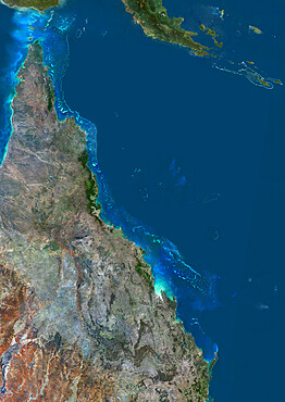
1348-3407 - Satellite view of the Great Barrier Reef. It extends along most of Queensland's coastline in north-east Australia, from Torres Strait and Cape York peninsula down to Fraser Island
1348-3376 - Satellite view of Samoa that consists of two large islands, Upolu and Savaii. This image was compiled from data acquired by Landsat 8 satellite in 2014.
1348-3422 - Satellite view of Christmas Island, Kiribati. This image was compiled from data acquired by Landsat 8 satellite in 2014.
1348-3431 - Satellite view of Australia. This image was compiled from data acquired by Landsat 8 satellite in 2014.
1348-3428 - Satellite view of Andros, New Providence and Eleuthera Islands, Bahamas. New Providence is the most populous island in the Bahamas and it houses the capital city of Nassau. This image was compiled from data acquired by Landsat satellites.
1348-3352 - Satellite view of Turks and Caicos Islands. This image was compiled from data acquired by Landsat satellites.


