Recent searches
Loading...
832-397328 - Long exposure of a water level gauge in the Venice Lagoon, Italy, Europe
1311-440 - Reflective lagoon along East Bay Trail of Willow Lake, gray line on rock is where the water level used to be, Prescott, Arizona, United States of America, North America
832-395408 - Natural thermal bath Termas da Ferraria at high tide with high waves, Ponta da Ferraria, Sao Miguel Island, Azores, Portugal, Europe
832-395409 - Lava arch on the volcanic coast at high tide with high waves, Ponta da Ferraria, Sao Miguel Island, Azores, Portugal, Europe
1178-41860 - Surface level view of backyard sprinkler spraying
1178-41861 - Surface level view of backyard sprinkler spraying
1178-41959 - Surface level view of faces of girls in swimming pool
1178-41961 - Surface level view of Hispanic girl floating in swimming pool
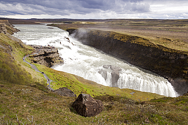
1350-4828 - Gullfoss Waterfall and Gullfoss Gorge, on the Hvita River, Southwest Iceland
832-393621 - Water level tower, Grosser Goitzschesee, Goitzsche near Bitterfeld, Saxony-Anhalt, Germany, Europe
832-390413 - Snowy gauge house at Cape Arkona, Ruegen, Germany, Europe
1113-103811 - Maritius split level , feet unr water, palm trees
1116-47172 - Colourful Fireworks Display Reflected In Water On Canada Day, Edmonton, Alberta, Canada
1116-47171 - Colourful Fireworks Display Reflected In Water On Canada Day, Edmonton, Alberta, Canada
1116-42867 - Pedestrian Crossing Sign In An Area Flooded By A River, Connecticut, United States Of America
1116-42025 - A Kitesurfer Walks Along The Beach At Sunset, Tarifa, Cadiz, Andalusia, Spain
1116-42090 - A woman in a yellow bikini sits with her paddle and board basking in the sunlight on the ocean, Tarifa cadiz andalusia spain
1116-41957 - Upward underwater view from swimming pool arue resort near papeete, Tahiti nui south pacific
857-95712 - A Subsistence farmer watering her vegetable garden by hand, in the Sunderbans, Ganges, Delta, India, the area is very low lying and vulnerable to sea level rise.
1116-41596 - A Woman Paddling On A Surfboard At Sunset, Tarifa, Cadiz, Andalusia, Spain
1116-41597 - A Woman Laying On A Surfboard Watching The Sunset, Tarifa, Cadiz, Andalusia, Spain
1116-41595 - A Woman Paddling On A Surfboard At Sunset, Tarifa, Cadiz, Andalusia, Spain
832-382387 - Barrage de Bimont reservoir with lowered water level, Beaurecueil, Provence-Alpes-Côte d'Azur, France, Europe
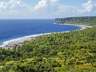
1112-3991 - Rising to 260 feet above sea level, Makatea is a raised coral atoll with fresh water, Tuamotus, French Polynesia, South Pacific, Pacific
1112-3989 - Rising to 260 feet above sea level, Makatea is a raised coral atoll with fresh water, Tuamotus, French Polynesia, South Pacific, Pacific
1112-3990 - Rising to 260 feet above sea level, Makatea is a raised coral atoll with fresh water, Tuamotus, French Polynesia, South Pacific, Pacific
1167-1811 - Blue icebergs in snowy weather, from sea level, Waterboat Point, Paradise Bay, Graham Land, Antarctic Peninsula, Antarctica, Polar Regions
1167-1812 - Blue icebergs in snowy weather, from sea level, Waterboat Point, Paradise Bay, Graham Land, Antarctic Peninsula, Antarctica, Polar Regions
1167-1814 - Blue iceberg arch in snowy weather, from sea level, Waterboat Point, Paradise Bay, Graham Land, Antarctic Peninsula, Antarctica, Polar Regions
857-94720 - Nimoa Island - here the island mission will impress. The five-sided church features murals of island life and all mission buildings are surrounded by well maintained paths and gardens filled with flowering plants. Edged by jungle-covered mountains, postcard beaches and crystal clear waters - an island paradise indeed! The Louisiade Archipelago is a string of ten larger volcanic islands frequently fringed by coral reefs, and 90 smaller coral islands located 200 km southeast of New Guinea, stretching over more than 160 km and spread over an ocean area of 26,000 km? between the Solomon Sea to the north and the Coral Sea to the south. The aggregate land area of the islands is about 1,790 km? (690 square miles), with Vanatinai (formerly Sudest or Tagula as named by European claimants on Western maps) being the largest. Sideia Island and Basilaki Island lie closest to New Guinea, while Misima, Vanatinai, and Rossel islands lie further east. The archipelago is divided into the Local Level Government (LLG) areas Louisiade Rural (western part, with Misima), and Yaleyamba (western part, with Rossell and Tagula islands. The LLG areas are part of Samarai-Murua District district of Milne Bay. The seat of the Louisiade Rural LLG is Bwagaoia on Misima Island, the population center of the archipelago.
857-94718 - Nimoa Island - here the island mission will impress. The five-sided church features murals of island life and all mission buildings are surrounded by well maintained paths and gardens filled with flowering plants. Edged by jungle-covered mountains, postcard beaches and crystal clear waters - an island paradise indeed! The Louisiade Archipelago is a string of ten larger volcanic islands frequently fringed by coral reefs, and 90 smaller coral islands located 200 km southeast of New Guinea, stretching over more than 160 km and spread over an ocean area of 26,000 km? between the Solomon Sea to the north and the Coral Sea to the south. The aggregate land area of the islands is about 1,790 km? (690 square miles), with Vanatinai (formerly Sudest or Tagula as named by European claimants on Western maps) being the largest. Sideia Island and Basilaki Island lie closest to New Guinea, while Misima, Vanatinai, and Rossel islands lie further east. The archipelago is divided into the Local Level Government (LLG) areas Louisiade Rural (western part, with Misima), and Yaleyamba (western part, with Rossell and Tagula islands. The LLG areas are part of Samarai-Murua District district of Milne Bay. The seat of the Louisiade Rural LLG is Bwagaoia on Misima Island, the population center of the archipelago.
857-94719 - Nimoa Island - here the island mission will impress. The five-sided church features murals of island life and all mission buildings are surrounded by well maintained paths and gardens filled with flowering plants. Edged by jungle-covered mountains, postcard beaches and crystal clear waters - an island paradise indeed! The Louisiade Archipelago is a string of ten larger volcanic islands frequently fringed by coral reefs, and 90 smaller coral islands located 200 km southeast of New Guinea, stretching over more than 160 km and spread over an ocean area of 26,000 km? between the Solomon Sea to the north and the Coral Sea to the south. The aggregate land area of the islands is about 1,790 km? (690 square miles), with Vanatinai (formerly Sudest or Tagula as named by European claimants on Western maps) being the largest. Sideia Island and Basilaki Island lie closest to New Guinea, while Misima, Vanatinai, and Rossel islands lie further east. The archipelago is divided into the Local Level Government (LLG) areas Louisiade Rural (western part, with Misima), and Yaleyamba (western part, with Rossell and Tagula islands. The LLG areas are part of Samarai-Murua District district of Milne Bay. The seat of the Louisiade Rural LLG is Bwagaoia on Misima Island, the population center of the archipelago.
857-94714 - The Louisiade Archipelago is a string of ten larger volcanic islands frequently fringed by coral reefs, and 90 smaller coral islands located 200 km southeast of New Guinea, stretching over more than 160 km and spread over an ocean area of 26,000 km? between the Solomon Sea to the north and the Coral Sea to the south. The aggregate land area of the islands is about 1,790 km? (690 square miles), with Vanatinai (formerly Sudest or Tagula as named by European claimants on Western maps) being the largest. Sideia Island and Basilaki Island lie closest to New Guinea, while Misima, Vanatinai, and Rossel islands lie further east. The archipelago is divided into the Local Level Government (LLG) areas Louisiade Rural (western part, with Misima), and Yaleyamba (western part, with Rossell and Tagula islands. The LLG areas are part of Samarai-Murua District district of Milne Bay. The seat of the Louisiade Rural LLG is Bwagaoia on Misima Island, the population center of the archipelago.
857-94712 - The Louisiade Archipelago is a string of ten larger volcanic islands frequently fringed by coral reefs, and 90 smaller coral islands located 200 km southeast of New Guinea, stretching over more than 160 km and spread over an ocean area of 26,000 km? between the Solomon Sea to the north and the Coral Sea to the south. The aggregate land area of the islands is about 1,790 km? (690 square miles), with Vanatinai (formerly Sudest or Tagula as named by European claimants on Western maps) being the largest.Sideia Island and Basilaki Island lie closest to New Guinea, while Misima, Vanatinai, and Rossel islands lie further east. The archipelago is divided into the Local Level Government (LLG) areas Louisiade Rural (western part, with Misima), and Yaleyamba (western part, with Rossell and Tagula islands. The LLG areas are part of Samarai-Murua District district of Milne Bay. The seat of the Louisiade Rural LLG is Bwagaoia on Misima Island, the population center of the archipelago.
1113-102244 - Skyline Berlin with the river Spree, View from Oberbaum bridge towards Media Spree, Skyscraper Living Levels, Mercedes, Berlin, Germany
1113-102245 - Skyline Berlin and river Spree, View from the Oberbaum bridge towards Media Spree, Skyscraper Living Levels, Mercedes, Berlin, Germany
746-70092 - Middle East, Jordan, Dead Sea, 400 metres below sea level
746-47484 - Water at flood level, Venice, Veneto, Italy
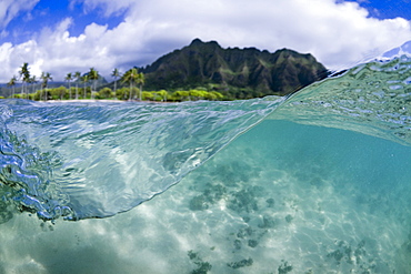
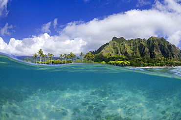
857-93510 - A Split Level Water View Of Kualoa Ridge On Oahu's East Side
857-93512 - A Split Level Water View Of Kualoa Ridge On Oahu's East Side
857-92053 - Aerial view Summersville Lake, WV at low water levels
857-89709 - Hikers setup camp on a beach along the Colorado River near the plumeting 180-foot Deer Creek Falls in the Grand Canyon outside of Fredonia, Arizona November 2011. The 21.4-mile loop starts at the Bill Hall trailhead on the North Rim and descends 2000-feet in 2.5-miles through Coconino Sandstone to the level Esplanada then descends further into the lower canyon through a break in the 400-foot-tall Redwall to access Surprise Valley. Hikers connect Thunder River and Tapeats Creek to a route along the Colorado River and climb out Deer Creek.
857-89713 - Female hiker cooks dinner on a cliff-pinched patio above camp and the Colorado River near Deer Creek Falls in the Grand Canyon outside of Fredonia, Arizona November 2011. The 21.4-mile loop starts at the Bill Hall trailhead on the North Rim and descends 2000-feet in 2.5-miles through Coconino Sandstone to the level Esplanada then descends further into the lower canyon through a break in the 400-foot-tall Redwall to access Surprise Valley. Hikers connect Thunder River and Tapeats Creek to a route along the Colorado River and climb out Deer Creek.
857-89710 - Hikers cook dinner on a cliff-pinched patio above camp and the Colorado River near Deer Creek Falls in the Grand Canyon outside of Fredonia, Arizona November 2011. The 21.4-mile loop starts at the Bill Hall trailhead on the North Rim and descends 2000-feet in 2.5-miles through Coconino Sandstone to the level Esplanada then descends further into the lower canyon through a break in the 400-foot-tall Redwall to access Surprise Valley. Hikers connect Thunder River and Tapeats Creek to a route along the Colorado River and climb out Deer Creek.
857-89708 - Hikers swim in the pool below 180-foot Deer Creek Falls in the Grand Canyon outside of Fredonia, Arizona November 2011. The 21.4-mile loop starts at the Bill Hall trailhead on the North Rim and descends 2000-feet in 2.5-miles through Coconino Sandstone to the level Esplanada then descends further into the lower canyon through a break in the 400-foot-tall Redwall to access Surprise Valley. Hikers connect Thunder River and Tapeats Creek to a route along the Colorado River and climb out Deer Creek.
857-89712 - Male hiker filters water on a cliff-pinched patio near Deer Creek Falls in the Grand Canyon outside of Fredonia, Arizona November 2011. The 21.4-mile loop starts at the Bill Hall trailhead on the North Rim and descends 2000-feet in 2.5-miles through Coconino Sandstone to the level Esplanada then descends further into the lower canyon through a break in the 400-foot-tall Redwall to access Surprise Valley. Hikers connect Thunder River and Tapeats Creek to a route along the Colorado River and climb out Deer Creek.
857-89703 - Hikers past small waterfalls along Deer Creek Narrows in the Grand Canyon outside of Fredonia, Arizona November 2011. The 21.4-mile loop starts at the Bill Hall trailhead on the North Rim and descends 2000-feet in 2.5-miles through Coconino Sandstone to the level Esplanada then descends further into the lower canyon through a break in the 400-foot-tall Redwall to access Surprise Valley. Hikers connect Thunder River and Tapeats Creek to a route along the Colorado River and climb out Deer Creek.
857-89711 - Male hiker filters water on a cliff-pinched patio near Deer Creek Falls in the Grand Canyon outside of Fredonia, Arizona November 2011. The 21.4-mile loop starts at the Bill Hall trailhead on the North Rim and descends 2000-feet in 2.5-miles through Coconino Sandstone to the level Esplanada then descends further into the lower canyon through a break in the 400-foot-tall Redwall to access Surprise Valley. Hikers connect Thunder River and Tapeats Creek to a route along the Colorado River and climb out Deer Creek.
857-89702 - Hikers walk along Deer Creek Narrows in the Grand Canyon outside of Fredonia, Arizona November 2011. The 21.4-mile loop starts at the Bill Hall trailhead on the North Rim and descends 2000-feet in 2.5-miles through Coconino Sandstone to the level Esplanada then descends further into the lower canyon through a break in the 400-foot-tall Redwall to access Surprise Valley. Hikers connect Thunder River and Tapeats Creek to a route along the Colorado River and climb out Deer Creek.
1178-24867 - Scenic view of lake, Lake Placid, New York,USA
1178-24506 - Scenic view of lake on cloudy day, Lake Placid, New York
1178-24498 - Scenic view of lake and mountain, Lake Placid, New York USA
860-286404 - Hippo walking in the water, Okavango Delta Botswana
860-286405 - Hippo walking in the water, Okavango Delta Botswana
1161-8633 - Tranquil atmospheric scene with mute swan (Cygnus olor), in reeds of reedbed marshes, The Somerset Levels Nature Reserve, Somerset, England, United Kingdom, Europe
1161-8634 - Reeds in reedbed and marshes in The Somerset Levels Nature Reserve, Somerset, England, United Kingdom, Europe
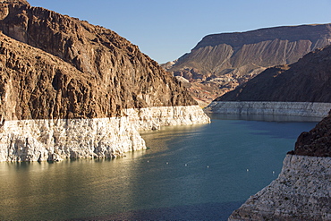
911-10465 - Lake Mead, Nevada, USA. The lake is at a very low level due to the four year long drought, with the boundary of where the water used to reach, clearly visible.
911-10464 - Lake Mead, Nevada, USA. The lake is at a very low level due to the four year long drought, with the boundary of where the water used to reach, clearly visible.
911-10423 - A wild fire near Hawkins Peak above coleville in California, USA. Following an unprecedented four year long drought, wild fires are much more common. Most of California is in exceptional drought, the highest level of drought classification. 428,000 acres of agricultural land have been taken out of production due to lack of water, thousands of agricultural workers have lost their jobs and one third of all children in California go to bed hungry.
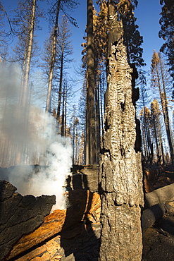
911-10417 - The King Fire that burned 97,717 acres of the El Dorado National Forest in California, USA. Following an unprecedented four year long drought, wild fires are much more common. Most of California is in exceptional drought, the highest level of drought classification. 428,000 acres of agricultural land have been taken out of production due to lack of water, thousands of agricultural workers have lost their jobs and one third of all children in California go to bed hungry.
911-10419 - The King Fire that burned 97,717 acres of the El Dorado National Forest in California, USA. Following an unprecedented four year long drought, wild fires are much more common. Most of California is in exceptional drought, the highest level of drought classification. 428,000 acres of agricultural land have been taken out of production due to lack of water, thousands of agricultural workers have lost their jobs and one third of all children in California go to bed hungry.
911-10424 - Foscheck fire retardent dropped on a wild fire near Hawkins Peak above coleville in California, USA. Following an unprecedented four year long drought, wild fires are much more common. Most of California is in exceptional drought, the highest level of drought classification. 428,000 acres of agricultural land have been taken out of production due to lack of water, thousands of agricultural workers have lost their jobs and one third of all children in California go to bed hungry.
911-10414 - The King Fire that burned 97,717 acres of the El Dorado National Forest in California, USA. Following an unprecedented four year long drought, wild fires are much more common. Most of California is in exceptional drought, the highest level of drought classification. 428,000 acres of agricultural land have been taken out of production due to lack of water, thousands of agricultural workers have lost their jobs and one third of all children in California go to bed hungry.
911-10418 - The King Fire that burned 97,717 acres of the El Dorado National Forest in California, USA. Following an unprecedented four year long drought, wild fires are much more common. Most of California is in exceptional drought, the highest level of drought classification. 428,000 acres of agricultural land have been taken out of production due to lack of water, thousands of agricultural workers have lost their jobs and one third of all children in California go to bed hungry.
911-10425 - Foscheck fire retardent dropped on a wild fire near Hawkins Peak above coleville in California, USA. Following an unprecedented four year long drought, wild fires are much more common. Most of California is in exceptional drought, the highest level of drought classification. 428,000 acres of agricultural land have been taken out of production due to lack of water, thousands of agricultural workers have lost their jobs and one third of all children in California go to bed hungry.
911-10422 - The King Fire that burned 97,717 acres of the El Dorado National Forest in California, USA. Following an unprecedented four year long drought, wild fires are much more common. Most of California is in exceptional drought, the highest level of drought classification. 428,000 acres of agricultural land have been taken out of production due to lack of water, thousands of agricultural workers have lost their jobs and one third of all children in California go to bed hungry.
911-10416 - The King Fire that burned 97,717 acres of the El Dorado National Forest in California, USA. Following an unprecedented four year long drought, wild fires are much more common. Most of California is in exceptional drought, the highest level of drought classification. 428,000 acres of agricultural land have been taken out of production due to lack of water, thousands of agricultural workers have lost their jobs and one third of all children in California go to bed hungry.
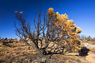
911-10413 - Burnt ground from a wildfire near Bakersfield, California, USA. Following an unprecedented four year long drought, Bakersfield is now the driest city in the USA. Most of California is in exceptional drought, the highest level of drought classification. Wild fires are much more common due to the drought. 428,000 acres of agricultural land have been taken out of production due to lack of water, thousands of agricultural workers have lost their jobs and one third of all children in California go to bed hungry.
911-10420 - The King Fire that burned 97,717 acres of the El Dorado National Forest in California, USA. Following an unprecedented four year long drought, wild fires are much more common. Most of California is in exceptional drought, the highest level of drought classification. 428,000 acres of agricultural land have been taken out of production due to lack of water, thousands of agricultural workers have lost their jobs and one third of all children in California go to bed hungry.
911-10421 - The King Fire that burned 97,717 acres of the El Dorado National Forest in California, USA. Following an unprecedented four year long drought, wild fires are much more common. Most of California is in exceptional drought, the highest level of drought classification. 428,000 acres of agricultural land have been taken out of production due to lack of water, thousands of agricultural workers have lost their jobs and one third of all children in California go to bed hungry.
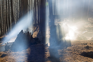
911-10415 - Shafts of sunlight highlight the smoke from the King Fire that burned 97,717 acres of the El Dorado National Forest in California, USA. Following an unprecedented four year long drought, wild fires are much more common. Most of California is in exceptional drought, the highest level of drought classification. 428,000 acres of agricultural land have been taken out of production due to lack of water, thousands of agricultural workers have lost their jobs and one third of all children in California go to bed hungry.
911-10360 - Abandoned dead and dying Orange trees that no longer have water to irrigate them near Bakersfield, California, USA. Following an unprecedented four year long drought, Bakersfield is now the driest city in the USA. Most of California is in exceptional drought, the highest level of drought classification. 428,000 acres of agricultural land have been taken out of production due to lack of water, thousands of agricultural workers have lost their jobs and one third of all children in California go to bed hungry.
911-10363 - A water charity in Porterville supplying bottled water to houses who have had no running water for over five months, near Bakersfield, California, USA. Hoses in the East of Porterville, many of which are on private wells, have run completely out of water as the water table has dropped catastrophically. Following an unprecedented four year long drought, Bakersfield is now the driest city in the USA. Most of California is in exceptional drought, the highest level of drought classification. 428,000 acres of agricultural land have been taken out of production due to lack of water, thousands of agricultural workers have lost their jobs and one third of all children in California go to bed hungry.
911-10362 - A water charity in Porterville supplying bottled water to houses who have had no running water for over five months, near Bakersfield, California, USA. Hoses in the East of Porterville, many of which are on private wells, have run completely out of water as the water table has dropped catastrophically. Following an unprecedented four year long drought, Bakersfield is now the driest city in the USA. Most of California is in exceptional drought, the highest level of drought classification. 428,000 acres of agricultural land have been taken out of production due to lack of water, thousands of agricultural workers have lost their jobs and one third of all children in California go to bed hungry.
911-10364 - A water charity in Porterville supplying bottled water to houses who have had no running water for over five months, near Bakersfield, California, USA. Hoses in the East of Porterville, many of which are on private wells, have run completely out of water as the water table has dropped catastrophically. Following an unprecedented four year long drought, Bakersfield is now the driest city in the USA. Most of California is in exceptional drought, the highest level of drought classification. 428,000 acres of agricultural land have been taken out of production due to lack of water, thousands of agricultural workers have lost their jobs and one third of all children in California go to bed hungry.
911-10350 - Lake Isabella near Bakersfield, East of California's Central valley is at less than 13% capacity following the four year long devastating drought. The reservoir has dropped so low, that the water level is below the outflow pipe.
911-10357 - Dead and dying grape vines in Bakersfield, California, USA. Following an unprecedented four year long drought, Bakersfield is now the driest city in the USA. Most of California is in exceptional drought, the highest level of drought classification. 428,000 acres of agricultural land have been taken out of production due to lack of water, thousands of agricultural workers have lost their jobs and one third of all children in California go to bed hungry.
911-10347 - An RV that until recently would be 40 feet underwater on the lake bed of Lake Isabella near Bakersfield, East of California's Central valley which is at less than 13% capacity following the four year long devastating drought. The reservoir has dropped so low, that the water level is below the outflow pipe.
911-10359 - Abandoned dead and dying Orange trees that no longer have water to irrigate them near Bakersfield, California, USA. Following an unprecedented four year long drought, Bakersfield is now the driest city in the USA. Most of California is in exceptional drought, the highest level of drought classification. 428,000 acres of agricultural land have been taken out of production due to lack of water, thousands of agricultural workers have lost their jobs and one third of all children in California go to bed hungry.
911-10356 - A water charity in Porterville supplying bottled water to houses who have had no running water for over five months, near Bakersfield, California, USA. Hoses in the East of Porterville, many of which are on private wells, have run completely out of water as the water table has dropped catastrophically. Following an unprecedented four year long drought, Bakersfield is now the driest city in the USA. Most of California is in exceptional drought, the highest level of drought classification. 428,000 acres of agricultural land have been taken out of production due to lack of water, thousands of agricultural workers have lost their jobs and one third of all children in California go to bed hungry.
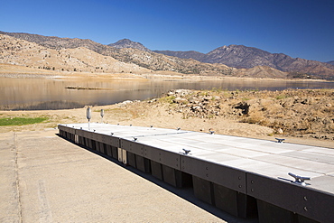
911-10353 - Lake Isabella near Bakersfield, East of California's Central valley is at less than 13% capacity following the four year long devastating drought. The reservoir has dropped so low, that the water level is below the outflow pipe. This shot shows the boat launching jetty, that has been taken as far down the ramp as possible, and is still nowhere near the water level.
911-10354 - Lake Isabella near Bakersfield, East of California's Central valley is at less than 13% capacity following the four year long devastating drought. The reservoir has dropped so low, that the water level is below the outflow pipe, shown here.
911-10367 - Dying Olive trees that no longer have water to irrigate them near Bakersfield, California, USA. Following an unprecedented four year long drought, Bakersfield is now the driest city in the USA. Most of California is in exceptional drought, the highest level of drought classification. 428,000 acres of agricultural land have been taken out of production due to lack of water, thousands of agricultural workers have lost their jobs and one third of all children in California go to bed hungry.
911-10361 - A water charity in Porterville supplying bottled water to houses who have had no running water for over five months, near Bakersfield, California, USA. Hoses in the East of Porterville, many of which are on private wells, have run completely out of water as the water table has dropped catastrophically. Following an unprecedented four year long drought, Bakersfield is now the driest city in the USA. Most of California is in exceptional drought, the highest level of drought classification. 428,000 acres of agricultural land have been taken out of production due to lack of water, thousands of agricultural workers have lost their jobs and one third of all children in California go to bed hungry.
911-10352 - Lake Isabella near Bakersfield, East of California's Central valley is at less than 13% capacity following the four year long devastating drought. The reservoir has dropped so low, that the water level is below the outflow pipe.
911-10349 - Lake Isabella near Bakersfield, East of California's Central valley is at less than 13% capacity following the four year long devastating drought. The reservoir has dropped so low, that the water level is below the outflow pipe.
911-10366 - Grubbed out Olive trees that no longer have water to irrigate them near Bakersfield, California, USA. Following an unprecedented four year long drought, Bakersfield is now the driest city in the USA. Most of California is in exceptional drought, the highest level of drought classification. 428,000 acres of agricultural land have been taken out of production due to lack of water, thousands of agricultural workers have lost their jobs and one third of all children in California go to bed hungry.
911-10351 - Lake Isabella near Bakersfield, East of California's Central valley is at less than 13% capacity following the four year long devastating drought. The reservoir has dropped so low, that the water level is below the outflow pipe.
911-10358 - The dried up river bed of the Kern River in Bakersfield, California, USA. Following an unprecedented four year long drought, Bakersfield is now the driest city in the USA. Most of California is in exceptional drought, the highest level of drought classification. 428,000 acres of agricultural land have been taken out of production due to lack of water, thousands of agricultural workers have lost their jobs and one third of all children in California go to bed hungry.
911-10348 - Lake Isabella near Bakersfield, East of California's Central valley is at less than 13% capacity following the four year long devastating drought. The reservoir has dropped so low, that the water level is below the outflow pipe.
911-10355 - Lake Isabella near Bakersfield, East of California's Central valley is at less than 13% capacity following the four year long devastating drought. The reservoir has dropped so low, that the water level is below the outflow pipe.
911-10368 - Lake Success near Porterville, Bakersfield is at 7% capacity. Bakersfield is now the driest city in the USA. Most of California is in exceptional drought, the highest level of drought classification. 428,000 acres of agricultural land have been taken out of production due to lack of water, thousands of agricultural workers have lost their jobs and one third of all children in California go to bed hungry.
911-10369 - Lake Success near Porterville, Bakersfield is at 7% capacity. Ten years ago the water was so high you couldnt get a boat under the bridge. Bakersfield is now the driest city in the USA. Most of California is in exceptional drought, the highest level of drought classification. 428,000 acres of agricultural land have been taken out of production due to lack of water, thousands of agricultural workers have lost their jobs and one third of all children in California go to bed hungry.
911-10365 - Poor air quality caused by dust from the ongoing drought near Bakersfield, California, USA. Following an unprecedented four year long drought, Bakersfield is now the driest city in the USA. Most of California is in exceptional drought, the highest level of drought classification. 428,000 acres of agricultural land have been taken out of production due to lack of water, thousands of agricultural workers have lost their jobs and one third of all children in California go to bed hungry.
911-10297 - A dried up creek that when it contains water, supports Pup fish, a highly adapted fish that can tolerate high levels of salt. Death Valley is the lowest, hottest, driest place in the USA, with an average annual rainfall of around 2 inches, some years it does not receive any rain at all.
857-86023 - Male hiker filters water on a cliff-pinched patio near Deer Creek Falls in the Grand Canyon outside of Fredonia, Arizona November 2011. The 21.4-mile loop starts at the Bill Hall trailhead on the North Rim and descends 2000-feet in 2.5-miles through Coconino Sandstone to the level Esplanada then descends further into the lower canyon through a break in the 400-foot-tall Redwall to access Surprise Valley. Hikers connect Thunder River and Tapeats Creek to a route along the Colorado River and climb out Deer Creek.
832-376908 - Water shortage in April 2007, Lake Sylvenstein, Upper Bavaria, Germany
1167-350 - Lake-level view of blue ice at the glacier face, Grey Glacier, Torres del Paine National Park, Patagonia, Chile, South America
1167-351 - Lake-level view of blue ice at the glacier face and iceberg, Grey Glacier, Torres del Paine National Park, Patagonia, Chile, South America


