Recent searches
Loading...
802-705 - Traditional door, Fann Mountains, part of the western Pamir-Alay, Tajikistan, Central Asia, Asia
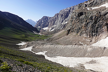
802-703 - The remote and spectacular Fann Mountains, part of the western Pamir-Alay, Tajikistan, Central Asia, Asia
802-700 - The remote and spectacular Fann Mountains, part of the western Pamir-Alay, Tajikistan, Central Asia, Asia
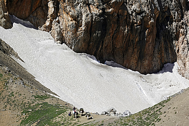
802-701 - The remote and spectacular Fann Mountains, part of the western Pamir-Alay, Tajikistan, Central Asia, Asia
802-698 - The remote and spectacular Fann Mountains, part of the western Pamir-Alay, Tajikistan, Central Asia, Asia
802-694 - The remote and spectacular Fann Mountains, part of the western Pamir-Alay, Tajikistan, Central Asia, Asia
802-695 - The remote and spectacular Fann Mountains, part of the western Pamir-Alay, Tajikistan, Central Asia, Asia
802-693 - The remote and spectacular Fann Mountains, part of the western Pamir-Alay, Tajikistan, Central Asia, Asia
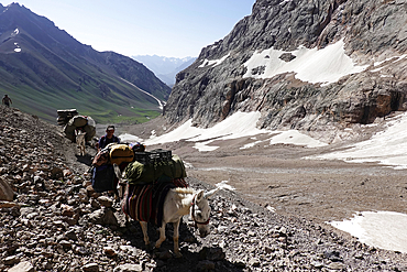
802-692 - Pack animals in the remote and spectacular Fann Mountains, part of the western Pamir-Alay, Tajikistan, Central Asia, Asia
802-690 - Trekker's tent lit inside at night in the remote and spectacular Fann Mountains, part of the western Pamir-Alay, Tajikistan, Central Asia, Asia
802-689 - The remote and spectacular Fann Mountains, part of the western Pamir-Alay, Tajikistan, Central Asia, Asia
802-688 - Village in the remote and spectacular Fann Mountains, part of the western Pamir-Alay, Tajikistan, Central Asia, Asia
802-686 - The remote and spectacular Fann Mountains, part of the western Pamir-Alay, Tajikistan, Central Asia, Asia
802-685 - The remote and spectacular Fann Mountains, part of the western Pamir-Alay, Tajikistan, Central Asia, Asia
802-684 - The remote and spectacular Fann Mountains, part of the western Pamir-Alay, Tajikistan, Central Asia, Asia
802-682 - Wooden bridge over a river in the remote and spectacular Fann Mountains, part of the western Pamir-Alay, Tajikistan, Central Asia, Asia
802-681 - Reflections in a lake in the remote and spectacular Fann Mountains, part of the western Pamir-Alay, Tajikistan, Central Asia, Asia
802-680 - Tents in the remote and spectacular Fann Mountains, part of the western Pamir-Alay, Tajikistan, Central Asia, Asia
802-678 - The remote and spectacular Fann Mountains, part of the western Pamir-Alay, Tajikistan, Central Asia, Asia
802-679 - Turquoise water in lake in the remote and spectacular Fann Mountains, part of the western Pamir-Alay, Tajikistan, Central Asia, Asia
802-675 - Pack animals in the remote and spectacular Fann Mountains, part of the western Pamir-Alay, Tajikistan, Central Asia, Asia
802-674 - The remote and spectacular Fann Mountains, part of the western Pamir-Alay, Tajikistan, Central Asia, Asia
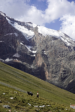
802-673 - Trekking in the Fann Mountains, part of the western Pamir-Alay, Tajikistan, Central Asia, Asia
802-672 - The remote and spectacular Fann Mountains, part of the western Pamir-Alay, Tajikistan, Central Asia, Asia
802-671 - Iskanderkul Lake, Fann Mountains, part of the western Pamir-Alay, Tajikistan, Central Asia, Asia
802-670 - The remote and spectacular Fann Mountains, part of the western Pamir-Alay, Tajikistan, Central Asia, Asia
802-668 - Big avalanche in the remote and spectacular Fann Mountains, part of the western Pamir-Alay, Tajikistan, Central Asia, Asia
746-91541 - Local tourists prepare barbecue. Nature reserve Sary-Chelek (Sary-Tschelek), part of the UNESCO world heritage Western Tien Shan. Tien Shan mountains or heavenly mountains in Kirghizia. Asia, central Asia, Kyrgyzstan
1348-4587 - Pine Island Bay, Amundsen Sea, Antarctica, True Colour Satellite Image. True colour satellite of Pine Island Bay in the Amundsen Sea.The blakek mark crossing the image shows the limit between the indlansis of the Wallgreen coast and Pine Island Bay in Amundsen Sea, in the Western part of Antarctica. Image taken on 13 January 2001 using LANDSAT data.
1116-51291 - Wooden structure at the edge of Steingrimsfjorour, in Drangsnes, a small town in the Western part of Iceland; Iceland
1113-106859 - Angola; western part of the province of Cunene; young woman from the Mucohona ethnic group; with typical head and neck jewelry
1113-106866 - Angola; in the western part of the province of Cunene; Mucohona woman with elaborate head and neck jewelry; small ethnic group in the southwest of Angola
1113-107270 - Angola; western part of the province of Cunene; Woman with luggage on her head; on the road
1113-107267 - Angola; western part of the province of Cunene; young girl from the Mucohona ethnic group; with typical head and neck jewelry
1113-107145 - Angola; western part of the province of Cunene; two women by the roadside; carrying her luggage on her head
1113-106991 - Angola; western part of the province of Cunene; Woman from the ethnic group of the Mucohona; rear view of the head; eye-catching hairstyle with pearls, shells and a long feather; in addition finely incorporated colored sticks, made from tin cans
1113-107165 - Angola; in the western part of the province of Cunene; Woman on the street; with luggage on his head
1113-107064 - Angola; in the western part of the province of Cunene; typical village of the Mucohona; small ethnic group in the southwest of Angola
1113-106980 - Angola; in the western part of the province of Cunene; Mucohona women; small ethnic group in the southwest of Angola
1113-107144 - Angola; in the western part of the province of Cunene; two young Mucohona men; Cattle herders; small ethnic group in the southwest of Angola
1113-107059 - Angola; western part of the province of Cunene; young man from the Mucohona ethnic group; with mohawk hairstyle
832-382472 - Aerial view, town of Norderney, western part of the island, Wadden Sea, Norderney, island in the North Sea, East Frisian Islands, Lower Saxony, Germany, Europe
832-381920 - Old town of Jaffa with St. Peter church and mosque, old port, today part of Tel Aviv, Tel Aviv-Jaffa, Israel, Asia
1116-40765 - Cowboy Boot Heel And Spur In Saddle Stirrup
857-94720 - Nimoa Island - here the island mission will impress. The five-sided church features murals of island life and all mission buildings are surrounded by well maintained paths and gardens filled with flowering plants. Edged by jungle-covered mountains, postcard beaches and crystal clear waters - an island paradise indeed! The Louisiade Archipelago is a string of ten larger volcanic islands frequently fringed by coral reefs, and 90 smaller coral islands located 200 km southeast of New Guinea, stretching over more than 160 km and spread over an ocean area of 26,000 km? between the Solomon Sea to the north and the Coral Sea to the south. The aggregate land area of the islands is about 1,790 km? (690 square miles), with Vanatinai (formerly Sudest or Tagula as named by European claimants on Western maps) being the largest. Sideia Island and Basilaki Island lie closest to New Guinea, while Misima, Vanatinai, and Rossel islands lie further east. The archipelago is divided into the Local Level Government (LLG) areas Louisiade Rural (western part, with Misima), and Yaleyamba (western part, with Rossell and Tagula islands. The LLG areas are part of Samarai-Murua District district of Milne Bay. The seat of the Louisiade Rural LLG is Bwagaoia on Misima Island, the population center of the archipelago.
857-94718 - Nimoa Island - here the island mission will impress. The five-sided church features murals of island life and all mission buildings are surrounded by well maintained paths and gardens filled with flowering plants. Edged by jungle-covered mountains, postcard beaches and crystal clear waters - an island paradise indeed! The Louisiade Archipelago is a string of ten larger volcanic islands frequently fringed by coral reefs, and 90 smaller coral islands located 200 km southeast of New Guinea, stretching over more than 160 km and spread over an ocean area of 26,000 km? between the Solomon Sea to the north and the Coral Sea to the south. The aggregate land area of the islands is about 1,790 km? (690 square miles), with Vanatinai (formerly Sudest or Tagula as named by European claimants on Western maps) being the largest. Sideia Island and Basilaki Island lie closest to New Guinea, while Misima, Vanatinai, and Rossel islands lie further east. The archipelago is divided into the Local Level Government (LLG) areas Louisiade Rural (western part, with Misima), and Yaleyamba (western part, with Rossell and Tagula islands. The LLG areas are part of Samarai-Murua District district of Milne Bay. The seat of the Louisiade Rural LLG is Bwagaoia on Misima Island, the population center of the archipelago.
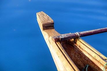
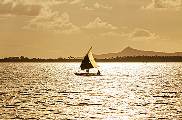
857-94722 - Children playing with a outrigger canoe in the village of Hessessai Bay at PanaTinai (Panatinane)island in the Louisiade Archipelago in Milne Bay Province, Papua New Guinea. The island has an area of 78 km2. The Louisiade Archipelago is a string of ten larger volcanic islands frequently fringed by coral reefs, and 90 smaller coral islands located 200 km southeast of New Guinea, stretching over more than 160 km and spread over an ocean area of 26,000 km? between the Solomon Sea to the north and the Coral Sea to the south. The aggregate land area of the islands is about 1,790 km? (690 square miles), with Vanatinai (formerly Sudest or Tagula as named by European claimants on Western maps) being the largest. Sideia Island and Basilaki Island lie closest to New Guinea, while Misima, Vanatinai, and Rossel islands lie further east. The archipelago is divided into the Local Level Government (LLG) areas Louisiade Rural (western part, with Misima), and Yaleyamba (western part, with Rossell and Tagula islands. The LLG areas are part of Samarai-Murua District district of Milne Bay. The seat of the Louisiade Rural LLG is Bwagaoia on Misima Island, the population center of the archipelago.PanaTinai (Panatinane) is an island in the Louisiade Archipelago in Milne Bay Province, Papua New Guinea.
857-94719 - Nimoa Island - here the island mission will impress. The five-sided church features murals of island life and all mission buildings are surrounded by well maintained paths and gardens filled with flowering plants. Edged by jungle-covered mountains, postcard beaches and crystal clear waters - an island paradise indeed! The Louisiade Archipelago is a string of ten larger volcanic islands frequently fringed by coral reefs, and 90 smaller coral islands located 200 km southeast of New Guinea, stretching over more than 160 km and spread over an ocean area of 26,000 km? between the Solomon Sea to the north and the Coral Sea to the south. The aggregate land area of the islands is about 1,790 km? (690 square miles), with Vanatinai (formerly Sudest or Tagula as named by European claimants on Western maps) being the largest. Sideia Island and Basilaki Island lie closest to New Guinea, while Misima, Vanatinai, and Rossel islands lie further east. The archipelago is divided into the Local Level Government (LLG) areas Louisiade Rural (western part, with Misima), and Yaleyamba (western part, with Rossell and Tagula islands. The LLG areas are part of Samarai-Murua District district of Milne Bay. The seat of the Louisiade Rural LLG is Bwagaoia on Misima Island, the population center of the archipelago.
857-94714 - The Louisiade Archipelago is a string of ten larger volcanic islands frequently fringed by coral reefs, and 90 smaller coral islands located 200 km southeast of New Guinea, stretching over more than 160 km and spread over an ocean area of 26,000 km? between the Solomon Sea to the north and the Coral Sea to the south. The aggregate land area of the islands is about 1,790 km? (690 square miles), with Vanatinai (formerly Sudest or Tagula as named by European claimants on Western maps) being the largest. Sideia Island and Basilaki Island lie closest to New Guinea, while Misima, Vanatinai, and Rossel islands lie further east. The archipelago is divided into the Local Level Government (LLG) areas Louisiade Rural (western part, with Misima), and Yaleyamba (western part, with Rossell and Tagula islands. The LLG areas are part of Samarai-Murua District district of Milne Bay. The seat of the Louisiade Rural LLG is Bwagaoia on Misima Island, the population center of the archipelago.
857-94712 - The Louisiade Archipelago is a string of ten larger volcanic islands frequently fringed by coral reefs, and 90 smaller coral islands located 200 km southeast of New Guinea, stretching over more than 160 km and spread over an ocean area of 26,000 km? between the Solomon Sea to the north and the Coral Sea to the south. The aggregate land area of the islands is about 1,790 km? (690 square miles), with Vanatinai (formerly Sudest or Tagula as named by European claimants on Western maps) being the largest.Sideia Island and Basilaki Island lie closest to New Guinea, while Misima, Vanatinai, and Rossel islands lie further east. The archipelago is divided into the Local Level Government (LLG) areas Louisiade Rural (western part, with Misima), and Yaleyamba (western part, with Rossell and Tagula islands. The LLG areas are part of Samarai-Murua District district of Milne Bay. The seat of the Louisiade Rural LLG is Bwagaoia on Misima Island, the population center of the archipelago.
1171-247 - Illuminated pagoda and view towards the western part of Beijing city at nightfall, Beijing, China, Asia
819-629 - Tepla Abbey is a Premonstratensian monastery in the western part of Bohemia, Czech Republic, Europe
1161-8539 - Copper stills for whisky process in traditional Still House part of Visitor Centre visitors tour at Tobermory Distillery, Isle of Mull, Inner Hebrides and Western Isles, Scotland, United Kingdom, Europe
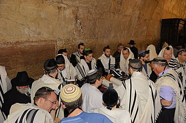
832-370845 - Bar Mitzvah, Jewish coming of age ritual, public reading from the Books of the Prophets, Haftarah, underground part of the Western Wall or Wailing Wall, Old City of Jerusalem, Arab Quarter, Israel, Middle East
832-370841 - Bar Mitzvah, Jewish coming of age ritual, decorated Torah scroll on table with young man celebrating his Bar Mitzvah, Haftarah, underground part of the Western Wall or Wailing Wall, Old City of Jerusalem, Arab Quarter, Israel, Middle East
832-370842 - Bar Mitzvah, Jewish coming of age ritual, public reading from the Books of the Prophets, Haftarah, underground part of the Western Wall or Wailing Wall, Old City of Jerusalem, Arab Quarter, Israel, Middle East
832-370850 - Praying Jew in the underground part of the Western Wall or Wailing Wall, Old City of Jerusalem, Arab Quarter, Jerusalem, Israel, Middle East
832-370844 - Bar Mitzvah, Jewish coming of age ritual, public reading from the Books of the Prophets, Haftarah, underground part of the Western Wall or Wailing Wall, Old City of Jerusalem, Arab Quarter, Israel, Middle East
832-370840 - Bar Mitzvah, Jewish coming of age ritual, Torah scroll is taken back to the cabinet, Western Wall or Wailing Wall, Old City of Jerusalem, Arab Quarter, Israel, Middle East
832-370837 - Bar Mitzvah, Jewish coming of age ritual, public reading from the Books of the Prophets, Haftarah, underground part of the Western Wall or Wailing Wall, Old City of Jerusalem, Arab Quarter, Israel, Middle East
832-370839 - Bar Mitzvah, Jewish coming of age ritual, men holding up Torah scroll, Western Wall or Wailing Wall, Old City of Jerusalem, Arab Quarter, Israel, Middle East
832-370838 - Bar Mitzvah, Jewish coming of age ritual, Western Wall or Wailing Wall, Old City of Jerusalem, Arab Quarter, Israel, Middle East
832-331500 - Market square of Bergen, Ruegen, Rugia, Mecklenburg-Western Pomerania, Germany
832-331499 - Market square of Bergen, Ruegen, Rugia, Mecklenburg-Western Pomerania, Germany
832-304314 - View of pharmacy and St. Nicholas Church in background, Badenstrasse, Stralsund, Mecklenburg-Western Pomerania, Germany, Europe
832-284729 - Tourists are waiting at the western part of the village for the sunset, Oia, Santorini, Greece
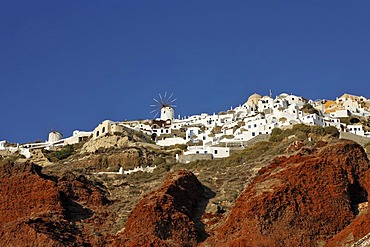
832-284749 - The western part of the village of Oia viewed from the harbour of Ammoudi, Oia, Santorini, Greece
832-361001 - Mineral mix yellow ochre as basic material for colour Dales Gorge Karijini National Park Pilbara region western australia WA
832-186652 - Country road, avenue, part of the Deutsche Alleenstrasse German Avenue Road, between Granitz and Putbus, Ruegen island, Mecklenburg-Western Pomerania, Germany, Europe
832-186653 - Country road, avenue, part of the Deutsche Alleenstrasse German Avenue Road, between Granitz and Putbus, Ruegen island, Mecklenburg-Western Pomerania, Germany, Europe
832-186651 - Country road, avenue, part of the Deutsche Alleenstrasse German Avenue Road, between Granitz and Putbus, Ruegen island, Mecklenburg-Western Pomerania, Germany, Europe
832-186658 - Country road, avenue, part of the Deutsche Alleenstrasse German Avenue Road, between Granitz and Putbus, Ruegen island, Mecklenburg-Western Pomerania, Germany, Europe
832-186656 - Country road, avenue, part of the Deutsche Alleenstrasse German Avenue Road, between Granitz and Putbus, Ruegen island, Mecklenburg-Western Pomerania, Germany, Europe
832-186650 - Country road, avenue, part of the Deutsche Alleenstrasse German Avenue Road, between Granitz and Putbus, Ruegen island, Mecklenburg-Western Pomerania, Germany, Europe
832-186648 - Country road, avenue, part of the Deutsche Alleenstrasse German Avenue Road, between Granitz and Putbus, Ruegen island, Mecklenburg-Western Pomerania, Germany, Europe
832-186661 - Country road, avenue, part of the Deutsche Alleenstrasse German Avenue Road, between Granitz and Putbus, Ruegen island, Mecklenburg-Western Pomerania, Germany, Europe
832-186649 - Country road, avenue, part of the Deutsche Alleenstrasse German Avenue Road, between Granitz and Putbus, Ruegen island, Mecklenburg-Western Pomerania, Germany, Europe
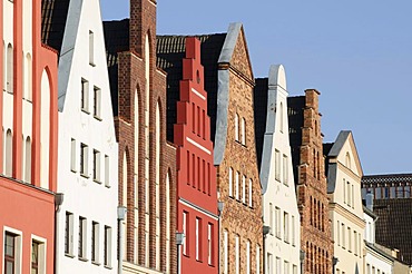
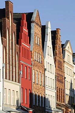
832-158951 - Gables of the old town, Rostock, Mecklenburg-Western Pomerania, Germany, Europe
832-158950 - Gables of the old town and Marienkirche church, Rostock, Mecklenburg-Western Pomerania, Germany, Europe
832-158996 - Shopping street Kroepeliner Strasse, pedestrian area, old town, Hanseatic city of Rostock, Mecklenburg-Western Pomerania, Germany, Europe
832-158998 - Shopping street Kroepeliner Strasse, pedestrian area, old town, Hanseatic city of Rostock, Mecklenburg-Western Pomerania, Germany, Europe
832-158948 - Gables of the old town and Marienkirche church, Rostock, Mecklenburg-Western Pomerania, Germany, Europe
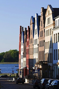
832-158946 - Old town with the Marienkirche church, Warnow river and harbour, Rostock, Mecklenburg-Western Pomerania, Germany, Europe
832-158975 - Neuer Markt square and town hall, sidewalk cafe, old town, Hanseatic city of Rostock, Mecklenburg-Western Pomerania, Germany, Europe
832-158952 - Gables of the old town, Rostock, Mecklenburg-Western Pomerania, Germany, Europe
832-158999 - Shopping street Kroepeliner Strasse, pedestrian area, old town, Hanseatic city of Rostock, Mecklenburg-Western Pomerania, Germany, Europe
832-158954 - Gables of the old town, Rostock, Mecklenburg-Western Pomerania, Germany, Europe
832-158953 - Gables of the old town, Rostock, Mecklenburg-Western Pomerania, Germany, Europe
832-158987 - Neuer Markt square, gables, old town, Hanseatic city of Rostock, Mecklenburg-Western Pomerania, Germany, Europe
832-157501 - Half-timbered house, Wismar, Mecklenburg-Western Pomerania, Germany, Europe
832-158973 - Neuer Markt square and town hall, sidewalk cafe, old town, Hanseatic city of Rostock, Mecklenburg-Western Pomerania, Germany, Europe
832-136153 - The Very Large Array radio telescope consists of 27 large dish antennas, the facility is part of the National Radio Astronomy Observatory, on the Plains of San Agustin in Datil, western New Mexico, USA
832-136150 - The Very Large Array radio telescope consists of 27 large dish antennas, the facility is part of the National Radio Astronomy Observatory, on the Plains of San Agustin in Datil, western New Mexico, USA
832-136144 - The Very Large Array radio telescope consists of 27 large dish antennas, the facility is part of the National Radio Astronomy Observatory, the tracks enable astronomers to move the antennas to different locations, on the Plains of San Agustin in Datil, we
832-136152 - The Very Large Array radio telescope consists of 27 large dish antennas, the facility is part of the National Radio Astronomy Observatory, on the Plains of San Agustin in Datil, western New Mexico, USA
832-136147 - The Very Large Array radio telescope consists of 27 large dish antennas, the facility is part of the National Radio Astronomy Observatory, on the Plains of San Agustin in Datil, western New Mexico, USA
832-136145 - The Very Large Array radio telescope consists of 27 large dish antennas, the facility is part of the National Radio Astronomy Observatory, on the Plains of San Agustin in Datil, western New Mexico, USA
832-136149 - The Very Large Array radio telescope consists of 27 large dish antennas, the facility is part of the National Radio Astronomy Observatory, on the Plains of San Agustin in Datil, western New Mexico, USA
832-136151 - The Very Large Array radio telescope consists of 27 large dish antennas, the facility is part of the National Radio Astronomy Observatory, on the Plains of San Agustin in Datil, western New Mexico, USA
832-136142 - The Very Large Array radio telescope consists of 27 large dish antennas, the facility is part of the National Radio Astronomy Observatory, on the Plains of San Agustin in Datil, western New Mexico, USA


