Recent searches
Loading...
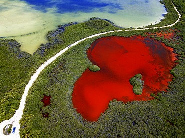
1350-6627 - Aerial view of Punta Allen Sian Ka'an Reserve, Yucatan Peninsula, Mexico. Red lagoon near Boca Paila Bridge.
In the language of the Mayan peoples who once inhabited this region, Sian Ka'an means Origin of the Sky. Located on the east coast of the Yucatán peninsula, this biosphere reserve contains tropical forests, mangroves and marshes, as well as a large marine section intersected by a barrier reef. It provides a habitat for a remarkably rich flora and a fauna comprising more than 300 species of birds, as well as a large number of the region's characteristic terrestrial vertebrates, which cohabit in the diverse environment formed by its complex hydrological system.
Along its roughly 120 kilometres of coastline, the property covers over 400,000 hectares of land ranging from sea level to only ten m.a.s.l. The property boasts diverse tropical forests, palm savannah, one of the most pristine wetlands in the region, lagoons, extensive mangrove stands, as well as sandy beaches and dunes. The 120,000 hectares of marine area protect a valuable part of the Mesoamerican Barrier Reef and seagrass beds in the shallow bays. The lush green of the forests and the many shades of blue of the lagoons and the Caribbean Sea under a wide sky offer fascinating visual impressions.
1350-6623 - Aerial view of Punta Allen Sian Ka'an Reserve, Yucatan Peninsula, Mexico. Red lagoon near Boca Paila Bridge.
In the language of the Mayan peoples who once inhabited this region, Sian Ka'an means Origin of the Sky. Located on the east coast of the Yucatán peninsula, this biosphere reserve contains tropical forests, mangroves and marshes, as well as a large marine section intersected by a barrier reef. It provides a habitat for a remarkably rich flora and a fauna comprising more than 300 species of birds, as well as a large number of the region's characteristic terrestrial vertebrates, which cohabit in the diverse environment formed by its complex hydrological system.
Along its roughly 120 kilometres of coastline, the property covers over 400,000 hectares of land ranging from sea level to only ten m.a.s.l. The property boasts diverse tropical forests, palm savannah, one of the most pristine wetlands in the region, lagoons, extensive mangrove stands, as well as sandy beaches and dunes. The 120,000 hectares of marine area protect a valuable part of the Mesoamerican Barrier Reef and seagrass beds in the shallow bays. The lush green of the forests and the many shades of blue of the lagoons and the Caribbean Sea under a wide sky offer fascinating visual impressions.
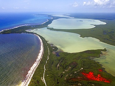
1350-6625 - Aerial view of Punta Allen Sian Ka'an Reserve, Yucatan Peninsula, Mexico. Red lagoon near Boca Paila Bridge.
In the language of the Mayan peoples who once inhabited this region, Sian Ka'an means Origin of the Sky. Located on the east coast of the Yucatán peninsula, this biosphere reserve contains tropical forests, mangroves and marshes, as well as a large marine section intersected by a barrier reef. It provides a habitat for a remarkably rich flora and a fauna comprising more than 300 species of birds, as well as a large number of the region's characteristic terrestrial vertebrates, which cohabit in the diverse environment formed by its complex hydrological system.
Along its roughly 120 kilometres of coastline, the property covers over 400,000 hectares of land ranging from sea level to only ten m.a.s.l. The property boasts diverse tropical forests, palm savannah, one of the most pristine wetlands in the region, lagoons, extensive mangrove stands, as well as sandy beaches and dunes. The 120,000 hectares of marine area protect a valuable part of the Mesoamerican Barrier Reef and seagrass beds in the shallow bays. The lush green of the forests and the many shades of blue of the lagoons and the Caribbean Sea under a wide sky offer fascinating visual impressions.
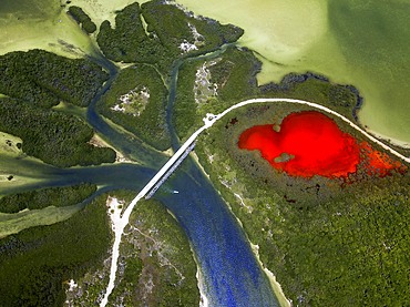
1350-6620 - Aerial view of Punta Allen Sian Ka'an Reserve, Yucatan Peninsula, Mexico. Red lagoon near Boca Paila Bridge.
In the language of the Mayan peoples who once inhabited this region, Sian Ka'an means Origin of the Sky. Located on the east coast of the Yucatán peninsula, this biosphere reserve contains tropical forests, mangroves and marshes, as well as a large marine section intersected by a barrier reef. It provides a habitat for a remarkably rich flora and a fauna comprising more than 300 species of birds, as well as a large number of the region's characteristic terrestrial vertebrates, which cohabit in the diverse environment formed by its complex hydrological system.
Along its roughly 120 kilometres of coastline, the property covers over 400,000 hectares of land ranging from sea level to only ten m.a.s.l. The property boasts diverse tropical forests, palm savannah, one of the most pristine wetlands in the region, lagoons, extensive mangrove stands, as well as sandy beaches and dunes. The 120,000 hectares of marine area protect a valuable part of the Mesoamerican Barrier Reef and seagrass beds in the shallow bays. The lush green of the forests and the many shades of blue of the lagoons and the Caribbean Sea under a wide sky offer fascinating visual impressions.
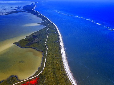
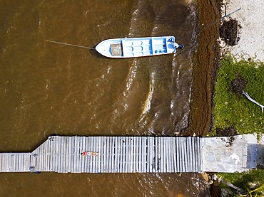
1350-6616 - Aerial view of Punta Allen Sian Ka'an Reserve, Yucatan Peninsula, Mexico.
In the language of the Mayan peoples who once inhabited this region, Sian Ka'an means Origin of the Sky. Located on the east coast of the Yucatán peninsula, this biosphere reserve contains tropical forests, mangroves and marshes, as well as a large marine section intersected by a barrier reef. It provides a habitat for a remarkably rich flora and a fauna comprising more than 300 species of birds, as well as a large number of the region's characteristic terrestrial vertebrates, which cohabit in the diverse environment formed by its complex hydrological system.
Along its roughly 120 kilometres of coastline, the property covers over 400,000 hectares of land ranging from sea level to only ten m.a.s.l. The property boasts diverse tropical forests, palm savannah, one of the most pristine wetlands in the region, lagoons, extensive mangrove stands, as well as sandy beaches and dunes. The 120,000 hectares of marine area protect a valuable part of the Mesoamerican Barrier Reef and seagrass beds in the shallow bays. The lush green of the forests and the many shades of blue of the lagoons and the Caribbean Sea under a wide sky offer fascinating visual impressions.
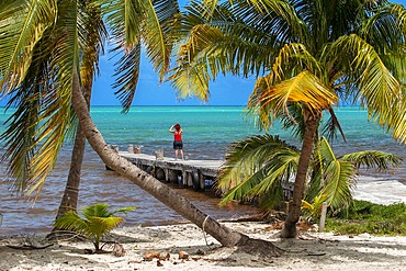
1350-6615 - Palms and old pier in Punta Allen Sian Ka'an Reserve, Yucatan Peninsula, Mexico.
In the language of the Mayan peoples who once inhabited this region, Sian Ka'an means Origin of the Sky. Located on the east coast of the Yucatán peninsula, this biosphere reserve contains tropical forests, mangroves and marshes, as well as a large marine section intersected by a barrier reef. It provides a habitat for a remarkably rich flora and a fauna comprising more than 300 species of birds, as well as a large number of the region's characteristic terrestrial vertebrates, which cohabit in the diverse environment formed by its complex hydrological system.
Along its roughly 120 kilometres of coastline, the property covers over 400,000 hectares of land ranging from sea level to only ten m.a.s.l. The property boasts diverse tropical forests, palm savannah, one of the most pristine wetlands in the region, lagoons, extensive mangrove stands, as well as sandy beaches and dunes. The 120,000 hectares of marine area protect a valuable part of the Mesoamerican Barrier Reef and seagrass beds in the shallow bays. The lush green of the forests and the many shades of blue of the lagoons and the Caribbean Sea under a wide sky offer fascinating visual impressions.
832-397328 - Long exposure of a water level gauge in the Venice Lagoon, Italy, Europe
1350-6279 - An italian crested newt (Triturus carnifex) swimming calm in the placid waters of Lago Nero, 1730 mt above sea level, only reachable walking
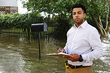
1178-39410 - Black insurance adjuster examining flooding damage to house
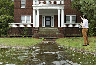
1178-39411 - Black insurance adjuster examining flooding damage to house
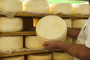
746-90459 - Sant'Antonio Agricultural Cooperative, Dairy company for the production of Strachitunt, typical raw milk cheese, raw paste, possibly blue, produced with whole cow's milk with the two curds technique, milk is obtained about a hundred Brown Alpine cows at 800 meters above sea level, DOP cheese, Val Taleggio valley; Lombardy; Italy; Europe.
746-90471 - Sant'Antonio Agricultural Cooperative, Dairy company for the production of Strachitunt, typical raw milk cheese, raw paste, possibly blue, produced with whole cow's milk with the two curds technique, milk is obtained about a hundred Brown Alpine cows at 800 meters above sea level, DOP cheese, Val Taleggio valley; Lombardy; Italy; Europe.
746-90463 - Sant'Antonio Agricultural Cooperative, Dairy company for the production of Strachitunt, typical raw milk cheese, raw paste, possibly blue, produced with whole cow's milk with the two curds technique, milk is obtained about a hundred Brown Alpine cows at 800 meters above sea level, DOP cheese, Val Taleggio valley; Lombardy; Italy; Europe.
746-90462 - Sant'Antonio Agricultural Cooperative, Dairy company for the production of Strachitunt, typical raw milk cheese, raw paste, possibly blue, produced with whole cow's milk with the two curds technique, milk is obtained about a hundred Brown Alpine cows at 800 meters above sea level, DOP cheese, Val Taleggio valley; Lombardy; Italy; Europe.
746-90467 - Sant'Antonio Agricultural Cooperative, Dairy company for the production of Strachitunt, typical raw milk cheese, raw paste, possibly blue, produced with whole cow's milk with the two curds technique, milk is obtained about a hundred Brown Alpine cows at 800 meters above sea level, DOP cheese, Val Taleggio valley; Lombardy; Italy; Europe.
746-90468 - Sant'Antonio Agricultural Cooperative, Dairy company for the production of Strachitunt, typical raw milk cheese, raw paste, possibly blue, produced with whole cow's milk with the two curds technique, milk is obtained about a hundred Brown Alpine cows at 800 meters above sea level, DOP cheese, Val Taleggio valley; Lombardy; Italy; Europe.
746-90461 - Sant'Antonio Agricultural Cooperative, Dairy company for the production of Strachitunt, typical raw milk cheese, raw paste, possibly blue, produced with whole cow's milk with the two curds technique, milk is obtained about a hundred Brown Alpine cows at 800 meters above sea level, DOP cheese, Val Taleggio valley; Lombardy; Italy; Europe.
746-90465 - Sant'Antonio Agricultural Cooperative, Dairy company for the production of Strachitunt, typical raw milk cheese, raw paste, possibly blue, produced with whole cow's milk with the two curds technique, milk is obtained about a hundred Brown Alpine cows at 800 meters above sea level, DOP cheese, Val Taleggio valley; Lombardy; Italy; Europe.
746-90470 - Sant'Antonio Agricultural Cooperative, Dairy company for the production of Strachitunt, typical raw milk cheese, raw paste, possibly blue, produced with whole cow's milk with the two curds technique, milk is obtained about a hundred Brown Alpine cows at 800 meters above sea level, DOP cheese, Val Taleggio valley; Lombardy; Italy; Europe.
746-90469 - Sant'Antonio Agricultural Cooperative, Dairy company for the production of Strachitunt, typical raw milk cheese, raw paste, possibly blue, produced with whole cow's milk with the two curds technique, milk is obtained about a hundred Brown Alpine cows at 800 meters above sea level, DOP cheese, Val Taleggio valley; Lombardy; Italy; Europe.
746-90472 - Sant'Antonio Agricultural Cooperative, Dairy company for the production of Strachitunt, typical raw milk cheese, raw paste, possibly blue, produced with whole cow's milk with the two curds technique, milk is obtained about a hundred Brown Alpine cows at 800 meters above sea level, DOP cheese, Val Taleggio valley; Lombardy; Italy; Europe.
746-90460 - Sant'Antonio Agricultural Cooperative, Dairy company for the production of Strachitunt, typical raw milk cheese, raw paste, possibly blue, produced with whole cow's milk with the two curds technique, milk is obtained about a hundred Brown Alpine cows at 800 meters above sea level, DOP cheese, Val Taleggio valley; Lombardy; Italy; Europe.
746-90466 - Sant'Antonio Agricultural Cooperative, Dairy company for the production of Strachitunt, typical raw milk cheese, raw paste, possibly blue, produced with whole cow's milk with the two curds technique, milk is obtained about a hundred Brown Alpine cows at 800 meters above sea level, DOP cheese, Val Taleggio valley; Lombardy; Italy; Europe.
746-90458 - Sant'Antonio Agricultural Cooperative, Dairy company for the production of Strachitunt, typical raw milk cheese, raw paste, possibly blue, produced with whole cow's milk with the two curds technique, milk is obtained about a hundred Brown Alpine cows at 800 meters above sea level, DOP cheese, Val Taleggio valley; Lombardy; Italy; Europe.
746-90464 - Sant'Antonio Agricultural Cooperative, Dairy company for the production of Strachitunt, typical raw milk cheese, raw paste, possibly blue, produced with whole cow's milk with the two curds technique, milk is obtained about a hundred Brown Alpine cows at 800 meters above sea level, DOP cheese, Val Taleggio valley; Lombardy; Italy; Europe.
1116-51285 - Viewing dial at Borgarvirki, at 177 meters above sea level it dominates the surrounding region. Made out of basalt strata, it has been used as a fortress for centuries; Hunaping vestra, Northwestern Region, Iceland
1350-2488 - Split image of pristine coral reef and deserted island, Rongelap, Marshall Islands, Micronesia
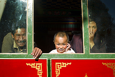
1350-3825 - Local people inside a house in Gyantse village or Gyangze town, Tibet, China. Located in the northeast of Gyantse at 3900 meters above sea level. Pelkor Chode Monastery, or rather Palcho Monastery in Tibetan language means auspicious monastery. It was first built in early 15th century and took 10 years to complete. Because it was built when different religious sectors conflicted neck and neck in Tibet, Sakyapa, Kadampa and Gelukpa of Tibetan Buddhism coexist in it. Each religious sector has five to six Dratsang schools in the monastery.
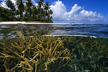
1350-2388 - Split image of staghorn coral, Acropora sp., and island, Truk lagoon, Chuuk, Federated States of Micronesia, Pacific
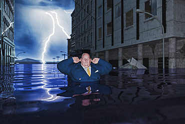
1178-36680 - Overweight businessman with fingers in ears in flooded city
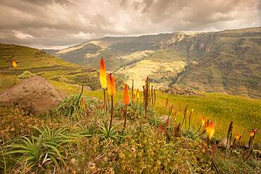
860-288869 - Torch Lily (Kniphofia foliosa), spectacular flowering on the highlands at 3500 meters above sea level, Simien mountains, Ethiopia
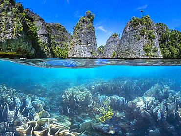
860-288997 - Split level panorama to Raja Ampat, Indonesia
1174-9733 - Polder or re-claimed lands, North Holland, Netherlands
1174-9732 - Polder or re-claimed lands, North Holland, Netherlands
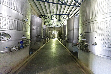
1112-5345 - Bodega Colome, a winery located in high Calchaqui valley at 2300 meters above sea level, Salta Province, Argentina, South America
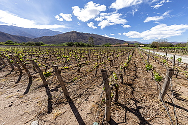
1112-5344 - Estancia Colome, vineyards located in the high Calchaqui valley at 2300 meters above sea level, Salta Province, Argentina, South America
1112-5343 - Bodega Colome, a winery located in high Calchaqui valley at 2300 meters above sea level, Salta Province, Argentina, South America
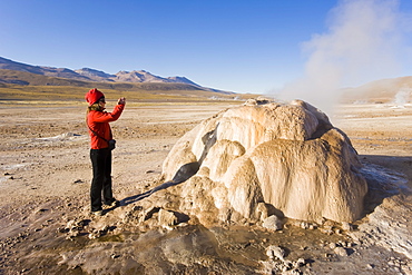
794-520 - El Tatio Geysers, 4300m above sea level, El Tatio is the world's highest geyser field, the area is ringed by volcanoes and fed by 64 geysers, Atacama Desert, Norte Grande, Chile, South America
746-88631 - Chiesa di San Francesco church, built at the end of the thirteenth century (1275), it stands on the highest place in the city (225 m above sea level), where it was certainly a Roman temple, Bevagna, Umbria, Italy, Europe
746-88633 - Chiesa di San Francesco church, built at the end of the thirteenth century (1275), it stands on the highest place in the city (225 m above sea level), where it was certainly a Roman temple, Bevagna, Umbria, Italy, Europe
746-88632 - Christmas crib, Chiesa di San Francesco church, built at the end of the thirteenth century (1275), it stands on the highest place in the city (225 m above sea level), where it was certainly a Roman temple, Bevagna, Umbria, Italy, Europe
746-88630 - Chiesa di San Francesco church, built at the end of the thirteenth century (1275), it stands on the highest place in the city (225 m above sea level), where it was certainly a Roman temple, Bevagna, Umbria, Italy, Europe
857-95713 - Villagers in a remote subsistence farming village on an island in the Sunderbans, the Ganges Delta in Eastern India that is very vulnerable to sea level rise, gather in the rice crop after drying.
857-95727 - A subsistence farmer picking Aubergines from their vegetable garden in the Sunderbans, Ganges, Delta, India, the area is very low lying and vulnerable to sea level rise.
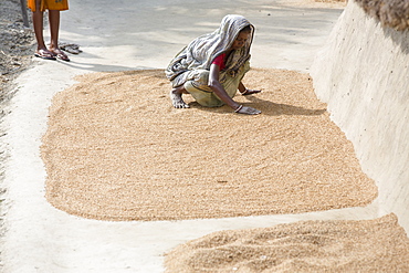
857-95726 - A woman drying her rice crop in the Sunderbans, Ganges, Delta, India, the area is very low lying and vulnerable to sea level rise.
857-95712 - A Subsistence farmer watering her vegetable garden by hand, in the Sunderbans, Ganges, Delta, India, the area is very low lying and vulnerable to sea level rise.
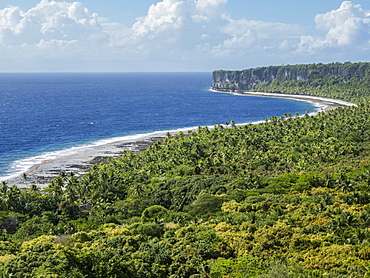
1112-3991 - Rising to 260 feet above sea level, Makatea is a raised coral atoll with fresh water, Tuamotus, French Polynesia, South Pacific, Pacific
1112-3989 - Rising to 260 feet above sea level, Makatea is a raised coral atoll with fresh water, Tuamotus, French Polynesia, South Pacific, Pacific
1112-3990 - Rising to 260 feet above sea level, Makatea is a raised coral atoll with fresh water, Tuamotus, French Polynesia, South Pacific, Pacific
832-380211 - Morning light, sunrise during a balloon ride, view of the Alps, position about 5400 m above sea level, over Neukirchen am Großvenediger, Viewing direction Westendorf and Kitzbühel, Austria, Europe
832-380212 - Morning light, sunrise during a balloon ride, view of the Alps, position about 5400 m above sea level, over Neukirchen am Großvenediger, Viewing direction Westendorf and Kitzbühel, Austria, Europe
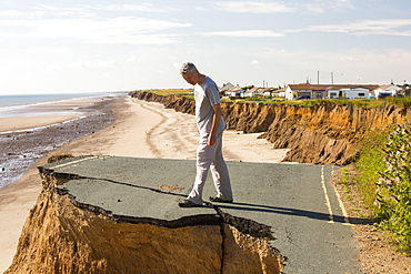
857-95431 - A collapsed coastal road at between Skipsea and Ulrome on Yorkshires East Coast, near Skipsea, UK. The coast is composed of soft boulder clays, very vulnerable to coastal erosion. This section of coast has been eroding since Roman times, with many villages having disappeared into the sea, and is the fastest eroding coast in Europe. Climate change is speeding up the erosion, with sea level rise, increased stormy weather and increased heavy rainfall events, all playing their part.
857-95432 - A collapsed coastal road at between Skipsea and Ulrome on Yorkshires East Coast, near Skipsea, UK. The coast is composed of soft boulder clays, very vulnerable to coastal erosion. This section of coast has been eroding since Roman times, with many villages having disappeared into the sea, and is the fastest eroding coast in Europe. Climate change is speeding up the erosion, with sea level rise, increased stormy weather and increased heavy rainfall events, all playing their part.
857-95443 - A woman subsistence farmer cooking on a traditional clay oven, using rice stalks as biofuel in the Sundarbans, Ganges, Delta, India. the area is very low lying and vulnerable to sea level rise. All parts of the rice crop are used, and the villagers life is very self sufficient, with a tiny carbon footprint.
857-95435 - A collapsed coastal road at near Aldbrough on Yorkshires East Coast, near Skipsea, UK. The coast is composed of soft boulder clays, very vulnerable to coastal erosion. This section of coast has been eroding since Roman times, with many villages having disappeared into the sea, and is the fastest eroding coast in Europe. Climate change is speeding up the erosion, with sea level rise, increased stormy weather and increased heavy rainfall events, all playing their part.
857-95433 - A collapsed coastal road at between Skipsea and Ulrome on Yorkshires East Coast, near Skipsea, UK. The coast is composed of soft boulder clays, very vulnerable to coastal erosion. This section of coast has been eroding since Roman times, with many villages having disappeared into the sea, and is the fastest eroding coast in Europe. Climate change is speeding up the erosion, with sea level rise, increased stormy weather and increased heavy rainfall events, all playing their part.
857-95441 - A villager woman in a remote subsistence farming village on an island in the Sundarbans, the Ganges Delta in Eastern India that is very vulnerable to sea level rise. She is cooking on a traditional clay oven, fueled by biofuel (rice stalks), low carbon cooking.
857-95437 - A collapsed coastal road at between Skipsea and Ulrome on Yorkshires East Coast, near Skipsea, UK. The coast is composed of soft boulder clays, very vulnerable to coastal erosion. This section of coast has been eroding since Roman times, with many villages having disappeared into the sea, and is the fastest eroding coast in Europe. Climate change is speeding up the erosion, with sea level rise, increased stormy weather and increased heavy rainfall events, all playing their part.
857-95442 - Cow dung belonging to subsistence farmers in the Sundarbans, a low lying area of the Ganges Delta in Eastern India, that is very vulnerable to sea level rise. The cow dung is used as biofuel in traditional clay ovens
857-95436 - A collapsed coastal road at between Skipsea and Ulrome on Yorkshires East Coast, near Skipsea, UK. The coast is composed of soft boulder clays, very vulnerable to coastal erosion. This section of coast has been eroding since Roman times, with many villages having disappeared into the sea, and is the fastest eroding coast in Europe. Climate change is speeding up the erosion, with sea level rise, increased stormy weather and increased heavy rainfall events, all playing their part.
857-95434 - A collapsed coastal road at Barmston on Yorkshires East Coast, near Skipsea, UK. The coast is composed of soft boulder clays, very vulnerable to coastal erosion. This section of coast has been eroding since Roman times, with many villages having disappeared into the sea, and is the fastest eroding coast in Europe. Climate change is speeding up the erosion, with sea level rise, increased stormy weather and increased heavy rainfall events, all playing their part.
857-95438 - Smashed concrete sea defenses at Ulrome near Skipsea on Yorkshires East Coast, UK. The sea has eroded past the barriers and left them stranded further down the beach. The coast is composed of soft boulder clays, very vulnerable to coastal erosion. This section of coast has been eroding since Roman times, with many villages having disappeared into the sea, and is the fastest eroding coast in Europe. Climate change is speeding up the erosion, with sea level rise, increased stormy weather and increased heavy rainfall events, all playing their part.
1167-1811 - Blue icebergs in snowy weather, from sea level, Waterboat Point, Paradise Bay, Graham Land, Antarctic Peninsula, Antarctica, Polar Regions
1167-1812 - Blue icebergs in snowy weather, from sea level, Waterboat Point, Paradise Bay, Graham Land, Antarctic Peninsula, Antarctica, Polar Regions
1167-1814 - Blue iceberg arch in snowy weather, from sea level, Waterboat Point, Paradise Bay, Graham Land, Antarctic Peninsula, Antarctica, Polar Regions
857-94717 - Nimoa Island - here the island mission will impress. The five-sided church features murals of island life and all mission buildings are surrounded by well maintained paths and gardens filled with flowering plants. Edged by jungle-covered mountains, postcard beaches and crystal clear waters - an island paradise indeed! The Louisiade Archipelago is a string of ten larger volcanic islands frequently fringed by coral reefs, and 90 smaller coral islands located 200 km southeast of New Guinea, stretching over more than 160 km and spread over an ocean area of 26,000 km? between the Solomon Sea to the north and the Coral Sea to the south. The aggregate land area of the islands is about 1,790 km? (690 square miles), with Vanatinai (formerly Sudest or Tagula as named by European claimants on Western maps) being the largest. Sideia Island and Basilaki Island lie closest to New Guinea, while Misima, Vanatinai, and Rossel islands lie further east. The archipelago is divided into the Local Level Government (LLG) areas Loui!
857-94720 - Nimoa Island - here the island mission will impress. The five-sided church features murals of island life and all mission buildings are surrounded by well maintained paths and gardens filled with flowering plants. Edged by jungle-covered mountains, postcard beaches and crystal clear waters - an island paradise indeed! The Louisiade Archipelago is a string of ten larger volcanic islands frequently fringed by coral reefs, and 90 smaller coral islands located 200 km southeast of New Guinea, stretching over more than 160 km and spread over an ocean area of 26,000 km? between the Solomon Sea to the north and the Coral Sea to the south. The aggregate land area of the islands is about 1,790 km? (690 square miles), with Vanatinai (formerly Sudest or Tagula as named by European claimants on Western maps) being the largest. Sideia Island and Basilaki Island lie closest to New Guinea, while Misima, Vanatinai, and Rossel islands lie further east. The archipelago is divided into the Local Level Government (LLG) areas Louisiade Rural (western part, with Misima), and Yaleyamba (western part, with Rossell and Tagula islands. The LLG areas are part of Samarai-Murua District district of Milne Bay. The seat of the Louisiade Rural LLG is Bwagaoia on Misima Island, the population center of the archipelago.
857-94718 - Nimoa Island - here the island mission will impress. The five-sided church features murals of island life and all mission buildings are surrounded by well maintained paths and gardens filled with flowering plants. Edged by jungle-covered mountains, postcard beaches and crystal clear waters - an island paradise indeed! The Louisiade Archipelago is a string of ten larger volcanic islands frequently fringed by coral reefs, and 90 smaller coral islands located 200 km southeast of New Guinea, stretching over more than 160 km and spread over an ocean area of 26,000 km? between the Solomon Sea to the north and the Coral Sea to the south. The aggregate land area of the islands is about 1,790 km? (690 square miles), with Vanatinai (formerly Sudest or Tagula as named by European claimants on Western maps) being the largest. Sideia Island and Basilaki Island lie closest to New Guinea, while Misima, Vanatinai, and Rossel islands lie further east. The archipelago is divided into the Local Level Government (LLG) areas Louisiade Rural (western part, with Misima), and Yaleyamba (western part, with Rossell and Tagula islands. The LLG areas are part of Samarai-Murua District district of Milne Bay. The seat of the Louisiade Rural LLG is Bwagaoia on Misima Island, the population center of the archipelago.
857-94722 - Children playing with a outrigger canoe in the village of Hessessai Bay at PanaTinai (Panatinane)island in the Louisiade Archipelago in Milne Bay Province, Papua New Guinea. The island has an area of 78 km2. The Louisiade Archipelago is a string of ten larger volcanic islands frequently fringed by coral reefs, and 90 smaller coral islands located 200 km southeast of New Guinea, stretching over more than 160 km and spread over an ocean area of 26,000 km? between the Solomon Sea to the north and the Coral Sea to the south. The aggregate land area of the islands is about 1,790 km? (690 square miles), with Vanatinai (formerly Sudest or Tagula as named by European claimants on Western maps) being the largest. Sideia Island and Basilaki Island lie closest to New Guinea, while Misima, Vanatinai, and Rossel islands lie further east. The archipelago is divided into the Local Level Government (LLG) areas Louisiade Rural (western part, with Misima), and Yaleyamba (western part, with Rossell and Tagula islands. The LLG areas are part of Samarai-Murua District district of Milne Bay. The seat of the Louisiade Rural LLG is Bwagaoia on Misima Island, the population center of the archipelago.PanaTinai (Panatinane) is an island in the Louisiade Archipelago in Milne Bay Province, Papua New Guinea.
857-95014 - Car driving on road in Death Valley National Park at sea level, California, USA
857-94719 - Nimoa Island - here the island mission will impress. The five-sided church features murals of island life and all mission buildings are surrounded by well maintained paths and gardens filled with flowering plants. Edged by jungle-covered mountains, postcard beaches and crystal clear waters - an island paradise indeed! The Louisiade Archipelago is a string of ten larger volcanic islands frequently fringed by coral reefs, and 90 smaller coral islands located 200 km southeast of New Guinea, stretching over more than 160 km and spread over an ocean area of 26,000 km? between the Solomon Sea to the north and the Coral Sea to the south. The aggregate land area of the islands is about 1,790 km? (690 square miles), with Vanatinai (formerly Sudest or Tagula as named by European claimants on Western maps) being the largest. Sideia Island and Basilaki Island lie closest to New Guinea, while Misima, Vanatinai, and Rossel islands lie further east. The archipelago is divided into the Local Level Government (LLG) areas Louisiade Rural (western part, with Misima), and Yaleyamba (western part, with Rossell and Tagula islands. The LLG areas are part of Samarai-Murua District district of Milne Bay. The seat of the Louisiade Rural LLG is Bwagaoia on Misima Island, the population center of the archipelago.
857-94721 - Nimoa Island - here the island mission will impress. The five-sided church features murals of island life and all mission buildings are surrounded by well maintained paths and gardens filled with flowering plants. Edged by jungle-covered mountains, postcard beaches and crystal clear waters - an island paradise indeed! The Louisiade Archipelago is a string of ten larger volcanic islands frequently fringed by coral reefs, and 90 smaller coral islands located 200 km southeast of New Guinea, stretching over more than 160 km and spread over an ocean area of 26,000 km? between the Solomon Sea to the north and the Coral Sea to the south. The aggregate land area of the islands is about 1,790 km? (690 square miles), with Vanatinai (formerly Sudest or Tagula as named by European claimants on Western maps) being the largest. Sideia Island and Basilaki Island lie closest to New Guinea, while Misima, Vanatinai, and Rossel islands lie further east. The archipelago is divided into the Local Level Government (LLG) areas Loui!
857-94716 - Nimoa Island - here the island mission will impress. The five-sided church features murals of island life and all mission buildings are surrounded by well maintained paths and gardens filled with flowering plants. Edged by jungle-covered mountains, postcard beaches and crystal clear waters - an island paradise indeed! The Louisiade Archipelago is a string of ten larger volcanic islands frequently fringed by coral reefs, and 90 smaller coral islands located 200 km southeast of New Guinea, stretching over more than 160 km and spread over an ocean area of 26,000 km? between the Solomon Sea to the north and the Coral Sea to the south. The aggregate land area of the islands is about 1,790 km? (690 square miles), with Vanatinai (formerly Sudest or Tagula as named by European claimants on Western maps) being the largest. Sideia Island and Basilaki Island lie closest to New Guinea, while Misima, Vanatinai, and Rossel islands lie further east. The archipelago is divided into the Local Level Government (LLG) areas Loui!
857-94714 - The Louisiade Archipelago is a string of ten larger volcanic islands frequently fringed by coral reefs, and 90 smaller coral islands located 200 km southeast of New Guinea, stretching over more than 160 km and spread over an ocean area of 26,000 km? between the Solomon Sea to the north and the Coral Sea to the south. The aggregate land area of the islands is about 1,790 km? (690 square miles), with Vanatinai (formerly Sudest or Tagula as named by European claimants on Western maps) being the largest. Sideia Island and Basilaki Island lie closest to New Guinea, while Misima, Vanatinai, and Rossel islands lie further east. The archipelago is divided into the Local Level Government (LLG) areas Louisiade Rural (western part, with Misima), and Yaleyamba (western part, with Rossell and Tagula islands. The LLG areas are part of Samarai-Murua District district of Milne Bay. The seat of the Louisiade Rural LLG is Bwagaoia on Misima Island, the population center of the archipelago.
857-94712 - The Louisiade Archipelago is a string of ten larger volcanic islands frequently fringed by coral reefs, and 90 smaller coral islands located 200 km southeast of New Guinea, stretching over more than 160 km and spread over an ocean area of 26,000 km? between the Solomon Sea to the north and the Coral Sea to the south. The aggregate land area of the islands is about 1,790 km? (690 square miles), with Vanatinai (formerly Sudest or Tagula as named by European claimants on Western maps) being the largest.Sideia Island and Basilaki Island lie closest to New Guinea, while Misima, Vanatinai, and Rossel islands lie further east. The archipelago is divided into the Local Level Government (LLG) areas Louisiade Rural (western part, with Misima), and Yaleyamba (western part, with Rossell and Tagula islands. The LLG areas are part of Samarai-Murua District district of Milne Bay. The seat of the Louisiade Rural LLG is Bwagaoia on Misima Island, the population center of the archipelago.
746-70092 - Middle East, Jordan, Dead Sea, 400 metres below sea level
746-70210 - Middle East, Jordan, Wadi Mujib, a wonderful gorge which enters the Dead Sea at about 400 meters below the sea level
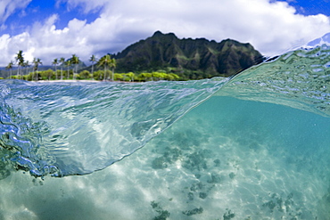
857-93510 - A Split Level Water View Of Kualoa Ridge On Oahu's East Side
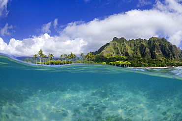
857-93512 - A Split Level Water View Of Kualoa Ridge On Oahu's East Side
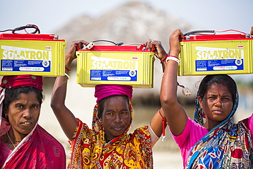
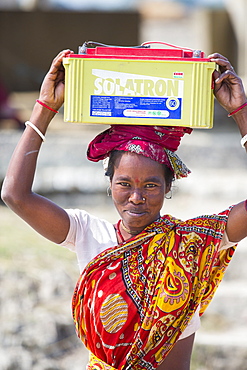
911-10498 - A WWF project to supply electricity to a remote island in the Sunderbans, a low lying area of the Ganges Delta in Eastern India, that is very vulnerable to sea level rise. Prior to this project the subsistence farmers had no access to electricity. The project involves charging large batteries from solar panels. Each villager collects a battery to run household lighting, and returns to the recharging station once a week to recharge their battery. This shot shows women carrying the heavy batteries (20Kg) from the charging station.
911-10497 - A WWF project to supply electricity to a remote island in the Sunderbans, a low lying area of the Ganges Delta in Eastern India, that is very vulnerable to sea level rise. Prior to this project the subsistence farmers had no access to electricity. The project involves charging large batteries from solar panels. Each villager collects a battery to run household lighting, and returns to the recharging station once a week to recharge their battery. This shot shows women carrying the heavy batteries (20Kg) from the charging station.
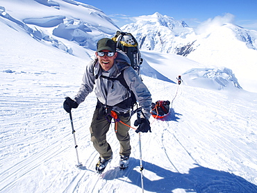
857-88779 - Mountain ranger Brian Scheele on this way to Windy Corner on Mount McKinley, also know as Denali, in Alaska. He is pulling a sled, that together with his heavy backpack is containing all the gear like tents, clothing and food. Every climbing season High Mountain Rangers of the Denali National Park Service are called to help climbers in need. If possible the patient is brought down to Basecamp on foot, only in life threatening conditions a helicopter is called to evacuate the patient to a hospital in Anchorage. Mount McKinley, native name Denali, is the highest mountain peak in North America, with a summit elevation of 20,321 feet (6,194 m) above sea level. At some 18,000 feet (5,500 m), the base-to-peak rise is considered the largest of any mountain situated entirely above sea level. Measured by topographic prominence, it is the third most prominent peak after Mount Everest and Aconcagua. Located in the Alaska Range in the interior of the U.S. state of Alaska, McKinley is the centerpiece of Denali National Park and Preserve.
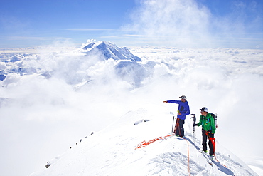
857-88775 - High Mountain Rangers Tom Ditola and David Weber are taking a rest on the West Rib on Mount McKinley, Alaska. Mount Hunter in the background. They are above the clouds in blue sky and the sun is shining. Mount McKinley, native name Denali, is the highest mountain peak in North America, with a summit elevation of 20,321 feet (6,194 m) above sea level. At some 18,000 feet (5,500 m), the base-to-peak rise is considered the largest of any mountain situated entirely above sea level. Measured by topographic prominence, it is the third most prominent peak after Mount Everest and Aconcagua. Located in the Alaska Range in the interior of the U.S. state of Alaska, McKinley is the centerpiece of Denali National Park and Preserve. Every climbing season High Mountain Rangers of the Denali National Park Service are called to help climbers in need. If possible the patient is brought down to base camp on foot, only in life threatening conditions a helicopter is called to evacuate the patient to a hospital in Anchorage.
911-10750 - The Remains of the Godwin battery on the beach at Kilnsea at the head of Spurn point on Yorkshires East Coast, UK. Initially constructed during the First World War, the Godwin Battery was added to during the Second World War. It comprised of gun emplacements, search light, barracks, officers’ mess, and a hospital. This section of coastline is the fastest eroding coastline in Europe. The soft boulder clay cliffs are easily eroded and have been eroding since Roman Times, but recently the climate change impacts of increased stormy weather, increased heavy rainfall events and sea level rise have accelerated the rate of erosion. The average rate of attrition is 1.5metres per year, last year it was 5 metres.
911-10749 - The Remains of the Godwin battery on the beach at Kilnsea at the head of Spurn point on Yorkshires East Coast, UK. Initially constructed during the First World War, the Godwin Battery was added to during the Second World War. It comprised of gun emplacements, search light, barracks, officers’ mess, and a hospital. This section of coastline is the fastest eroding coastline in Europe. The soft boulder clay cliffs are easily eroded and have been eroding since Roman Times, but recently the climate change impacts of increased stormy weather, increased heavy rainfall events and sea level rise have accelerated the rate of erosion. The average rate of attrition is 1.5metres per year, last year it was 5 metres.
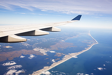
911-10585 - Highly built up beach front areas, just north of Atlantic City that are very vulnerable to sea level rise, USA.
911-10566 - The Thames barrier on the River Thames in London. It was constructed to protect the capital city from storm surge flooding. Recent predictions show it will probably be redundant in around twenty years due to increased stormy weather and sea level rise driven by climate change.
911-10567 - The Thames barrier on the River Thames in London. It was constructed to protect the capital city from storm surge flooding. Recent predictions show it will probably be redundant in around twenty years due to increased stormy weather and sea level rise driven by climate change.
911-10565 - The Thames barrier on the River Thames in London. It was constructed to protect the capital city from storm surge flooding. Recent predictions show it will probably be redundant in around twenty years due to increased stormy weather and sea level rise driven by climate change.
911-10447 - A villager woman in a remote subsistence farming village on an island in the Sunderbans, the Ganges Delta in Eastern India that is very vulnerable to sea level rise. She is cooking on a traditional clay oven, fuelled by biofuel (rice stalks), low carbon cooking.
911-10451 - Boats carrying people and goods in the Sunderbans, a low lying area of the Ganges Delta in Eastern India, that is very vulnerable to sea level rise.
911-10455 - A woman subsistence farmer cooking on a traditional clay oven, using rice stalks as biofuel in the Sunderbans, Ganges, Delta, India. the area is very low lying and vulnerable to sea level rise. All parts of the rice crop are used, and the villagers life is very self sufficient, with a tiny carbon footprint.
911-10448 - Villagers in a remote subsistence farming village on an island in the Sunderbans, the Ganges Delta in Eastern India that is very vulnerable to sea level rise, gather in the rice crop after drying.
911-10456 - A woman drying her rice crop in the Sunderbans, Ganges, Delta, India, the area is very low lying and vulnerable to sea level rise.
911-10453 - Villagers in a remote subsistence farming village on an island in the Sunderbans, the Ganges Delta in Eastern India that is very vulnerable to sea level rise, gather in the rice crop after drying.
911-10449 - Villagers in a remote subsistence farming village on an island in the Sunderbans, the Ganges Delta in Eastern India that is very vulnerable to sea level rise, gather in the rice crop after drying.
911-10450 - Boats carrying people and goods in the Sunderbans, a low lying area of the Ganges Delta in Eastern India, that is very vulnerable to sea level rise.
